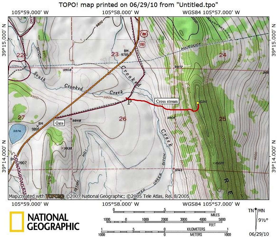
From the “shooting range” parking:
Continue on foot in a primarily eastward direction across mostly level ground. Descend slightly to cross Crooked Creek, then begin gaining elevation up the western slope to the summit ridge. From here, explore the rocky outcrops to find the high point and enjoy the views.
Distance: 1.6 miles roundtrip
Elevation Gain: 600 feet
Map designed June 2010


