
|
|
Mountain/Rock |
|---|---|
|
|
34.02760°N / 112.7037°W |
|
|
Yavapai |
|
|
Spring, Fall, Winter |
|
|
3190 ft / 972 m |
|
|
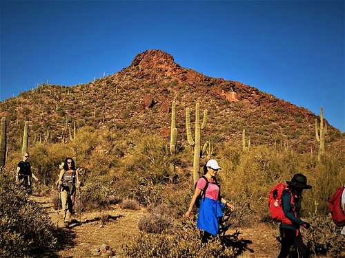
Overview
Red Top is the most prominent summit in the Sophie’s Flat hiking area north of Wickenburg, Arizona. Trails have been built to just 140’ below the summit, with some fun short scrambling required to reach the summit. The rocks at the summit are a reddish color and the peak has been referred to as Red Top in recent years, although no such name was given to it by the USGS.
The Sophie’s Flat area is becoming more popular as the Phoenix metro area expands further west, with neighborhoods in Surprise, AZ just a 30-minute drive of the trailhead.
While the trail system isn’t particularly well marked, it is fairly simple to follow trails up towards the summit.
There are multiple other summits in the area, including Sophie’s Flat Peak 3,191’, which is the highest summit in the area – just one foot higher than Red Top. A trail leads to Red Top Plateau, which is 3,064’ and shares a saddle with Red Top at about 2,800’.
Because these peaks are relatively low elevation, it is best to hike here during the winter months – November through March to avoid the heat. Although since Red Top is a trail hike, it isn’t unreasonable to hike in the morning in October or April. Just be aware that rattlesnakes may be present during those times.
Getting There
From the Phoenix metro area, getting to the Sophie’s Flat Trail is easy. If coming from downtown Phoenix, take US 60 for about 50 miles to Wickenburg. From north Phoenix take the Carefree Highway (74) for from the I-17 and turn right on US 60 to Wickenburg. Once in Wickenburg, turn right on El Recreo Drive, which merges into Constellation Drive and turns to dirt after a couple miles. Once on the dirt, continue up Constellation for a little less than a mile, at which point there is a sign to Sophie’s Flat Trailhead which is to the right on Blue Tank Road less than 1 ½ miles from the turn off.
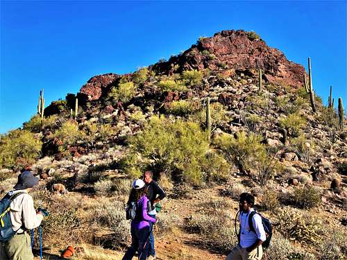
Route
There are a couple options for Red Top from the Sophie’s Flat Trailhead. The shortest option is to take Blue Tank Road from the trailhead for a little under half a mile. You’ll see a small structure for the cattle, and you can take a right onto a smaller road. Continue on that road for about a mile, and then take a left on a road that runs just south of Sophie’s Flat Peak. After about eight-tenths of a mile, the road gets to the western edge of Sophie’s Flat Peak. There is a trail to the right that heads in between the two mountains. Take this trail for about four-tenths of a mile and then look for a trail leading steeply up Red Top. The trail gains over 300’ in about a third of a mile. The trail leads to the base of the summit block before descending. It is less than a tenth of a mile to the summit with 140’ to gain. A small use trail leads up the slope and then some class 2/class 3 rock scrambling is necessary to reach the summit.
All told, this route is 3 ¼ miles to the summit gaining about 950’. You can add Sophie’s Flat Peak along the way (off-trail) and add another 0.6 miles of total distance and 360’ (if leaving from the highest point on the road and then descending the summit ridge and then back to the main trail further west).
Another option is to do a loop over Red Top Plateau 3,064’, and then return via the route described above. For this route, take Blue Tank Road for about 2.15 miles and turn right on a lesser road. Continue up this road for another 9/10ths of a mile to a Y-Junction. Take a right and continue for another 0.3 miles. Look for a trail to the right. This trail leads to the summit of the Red Top Plateau. Once on the summit, take the trail down to the saddle between it and Red Top. Although not obvious, once you get down to the saddle, just continue straight across and you'll find the trail to Red Top. Once at the base, follow instructions above. Via this route, it is 4.4 miles to the summit gaining about 1,230’. If taking the first route down, it is about 7 2/3rds miles round trip gaining about 1,500'. Add Sophie's Flat Peak and you gain about 1,940' and the distance is 8 1/2 miles. You can also add Sophie's Flat Hill 3,060' and get four summits in the area, gaining about 2,300' in 9 1/4 miles round trip.
Red Tape
There is no red tape of note. The trailhead is managed by the BLM. Leave no trace.
External Links
https://www.blm.gov/visit/sophies-flat-trailhead