Toggle navigation
Mountains
Routes
Images
Trip Reports
Forum
What's New
People
Areas & Ranges
Articles
Trailheads
Canyons
Huts & Campgrounds
Albums
Logistical Centers
Fact Sheets
Lists
Custom Objects
Gear
Plans & Partners
WELCOME TO SUMMITPOST
SIGN IN
REGISTER
Loveland-Eisenhower CoonBear Ridge Traverse
Additional Parents
Image
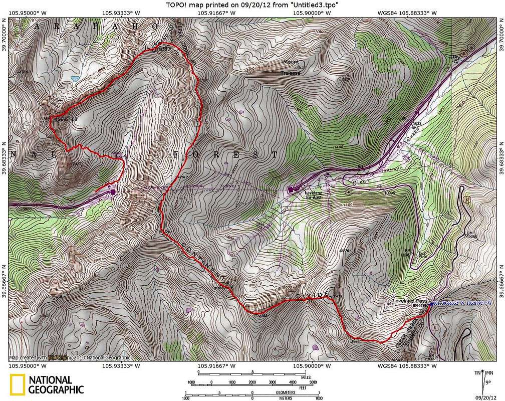
Ridge Run Map
View High-Resolution Image
Ridge Run Map
Roundtrip Distance:
9 miles
Starting Elevation:
11,991 (Loveland Pass)
Low Elevation:
11,143 feet
High Elevation:
13,010 feet
YDS Class:
3 max on ridge to Coon Hill
Map designed July 2012
« PREV
NEXT »
Sarah Simon
on
Sep 23, 2012 11:11 pm
Comments & voting
Other parents
Image Type(s):
Topo/Diagram
Image ID:
815846
2249 Hits
71.06
% Score
1
Votes
Log in to vote
Comments
No comments posted yet.
to post!
Don't have an account?
Loveland-Eisenhower CoonBear Ridge Traverse
(Route)
« PREV
Viewing
#33 of 35
GALLERY
NEXT »
Sarah Simon's Image Gallery
« PREV
Viewing
#4813 of 5480
GALLERY
NEXT »
×
You need to login in order to vote!
User Name
Password
Remember me
Forgot your password?
Log me out when I close my browser.
Keep me logged in all the time.
sign in as a user
Don't have an account?
Register now for FREE
Rating available
Suggested routes for you
People who climb the same things as you
Comments Available
Create Albums
Register Here


