

|
|
Area/Range |
|---|---|
|
|
41.29019°S / 175.08054°E |
|
|
3087 ft / 941 m |
|
|
Overview & History
Disclaimer: I want to start out by saying that the Department of Conservation (DOC) (aka Te Papa Atawhai in Maori) does such a nice job of explaining how to enjoy the Forest Park on their website, that this page is really just a formailty. This page just serves to give this incredible region some exposure on Summitpost. It gives SPer's some familiarity with the area and a general launching point in which to conduct their research.Please see the DOC webpage for more in-depth analysis and maps/charts/etc. Feel free to PM me should you have any questions about organizing a trip to the park (I know it can seem overwhelming when planning a trip if you are not familiar with the area).
From DOC website:
Early Maori used the Rimutaka range as a refuge between tribal wars and a food source. One of their major trails traversed the range between Waiorongomai in the east and Lowry Bay in the west. A rail route established in 1878 between the Hutt Valley and Featherston carried passengers up the steep incline from the Rimutaka summit to Featherston until the opening of the Rimutaka rail tunnel in 1955. The Department of Conservation and the Wellington Regional Council jointly manage the rail formation from Kaitoke to Cross Creek as a recreational and historic area. It provides one of the better mountain biking trips in the Wellington region.
Parts of three large catchments in the Rimutaka Range - the Wainuiomata, Orongorongo and Pakuratahi - were set aside for water supply purposes and are now controlled by the Wellington Regional Council with restricted access. The importance of the remaining area for water supply and flood control as well as recreational use was recognised with its formation as a State Forest Park in 1972.
 Magic everywhere...
Geological, tectonic and climatic forces have shaped the vegetation pattern of the Rimutaka Range. Beech forest dominates much of the range, joined by podocarps at lower altitudes, and kamahi, a predominant canopy tree (with emergent trees like rimu, rata, miro, hinau, rewarewa and maire in some areas). The south end of the range, where most of the original forest has been destroyed by fire, is covered at lower altitudes by shrub woods like manuka, tauhini, rangiora and heketara with some emergent hinau and rewarewa.
Eight species of moa once roamed the area which still contains some native birdlife, including bellbirds, tui, kaka, kereru and ruru. Red deer, goats, pigs and possums are also present. Recreational hunting is encouraged except in the Catchpool Valley, within 200 metres of the Orongorongo River and the Landcare research area where, because of a high level of public use, discharging of firearms is prohibited. The Rimutaka Forest Park Trust began releasing North Island brown kiwi into the park in May 2006. It was the first ever kiwi translocation planned and executed entirely by an independent trust. Volunteers from the trust and local tramping groups spent two years controlling stoats in a 1000 hectacre area to provide a safe habitat for the release of up to 20 kiwi from BNZ Kiwi Recovery.
Getting There
Catchpool Valley, 30 km from Wellington, is the most popular entrance to Rimutaka Forest Park. There are also entry points along the Western Lake Road in the Wairarapa - at Cross Creek (the start of the Rimutaka Rail Trail), Waiorongamai Track, Battery Stream/Papatahi Crossing and Ocean Beach. View of Wellington at night.
Red Tape
Protecting Kiwi From DogsThe long-standing requirement to keep dogs on a lead in the Catchpool Valley will be enforced to protect North Island brown kiwi released into the park by the Rimutaka Forest Park Trust. This includes dogs on the McKerrow, Clay Ridge, Orongorongo, Butcher and Cattle Ridge Tracks. Dogs must also be kept on a lead on the Whakanui Track from Sunny Grove Wainuiomata to about three quarters of the way to the Orongorongo River. A dog exercise area, where dogs may be let off their leads, has been designated in an area between the Catchpool Valley Road and Catchpool Stream opposite the visitor centre.
 Kiwi habitat...
Camping & Huts
Camping is only permitted in the Catchpool Valley or Grace's Stream campsites.On the Wairarapa side of the park you can either stay at the Corner Creek campsite or in two basic DOC huts, which are available on a first come, first served basis. On the Poneke side of the park you can either stay at the Catchpool Valley or Grace's Stream campsites, or in one of the six bookable huts in the Orongorongo Valley. These huts are sole occupancy, and it is essential to book. Booked huts in the Orongorongo Valley are available for exclusive hire. Bookings can be made via the online booking system or by contacting the DOC Wellington Visitor Centre. Backcountry hut passes and hut tickets are not valid for the booked huts.
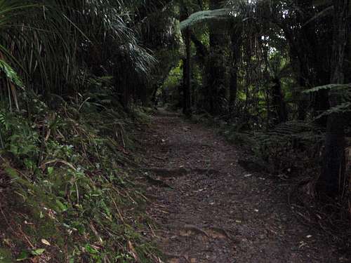 Well groomed trails, easy to follow...
Booked huts fees and booking conditions
• A flat fee is charged for each hut.
• Huts are sole occupancy.
• Full payment is required at the time of booking.
• Cancellations must be made at least 10 days before the original occupancy date and within 48 hours of making the booking, otherwise a cancellation fee applies.
• Transfers may be made online up to 2 days before start date. Transfers after this time must be arranged through the DOC Wellington Visitor Centre, and will incur a $10 administration fee.
• Changes may not be made on or after the start date.
Mountains and Trails
 Summit of Mt McKerrow looking SW across the Cook Straight to the S Island
Mount Matthews (941m) - Highest point in the Park. Accessed via the Mount Matthews Track
Papatahi (902m) - Accessed via the Papatahi Crossing
Mount McKerrow (706m) - Accessed via the Clay Ridge Track or McKerrow Track
 Orongorongo Track
Other Popular Hikes
Orongorongo Track - 5.2km
Butcher/Cattle Ridge Track - 12km
Mukamuka Valley - 15+km
External Links
Rimutaka Forest Park (general info)http://www.doc.govt.nz/parks-and-recreation/places-to-visit/wellington/poneke/rimutaka-forest-park/
Publication and Trail Map
http://www.doc.govt.nz/upload/documents/parks-and-recreation/places-to-visit/wellington/rimutaka-fp-brochure.pdf