Toggle navigation
Mountains
Routes
Images
Trip Reports
Forum
What's New
People
Areas & Ranges
Articles
Trailheads
Canyons
Huts & Campgrounds
Albums
Logistical Centers
Fact Sheets
Lists
Custom Objects
Gear
Plans & Partners
WELCOME TO SUMMITPOST
SIGN IN
REGISTER
Bat
Additional Parents
Image
Road map of the area around...
View High-Resolution Image
Road map of the area around...
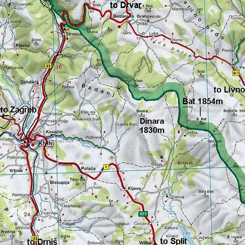
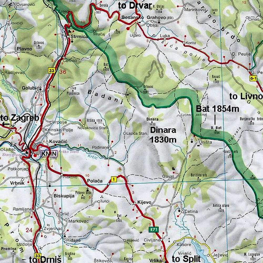
Road map of the area around
Dinara
and
Bat
groups of
Dinara massif
. Access to
Unista
village, trailhead for
Bat (1854m)
, is clearly visible.
Area covered is
33x33km
« PREV
NEXT »
Velebit
on
Jan 13, 2005 12:34 pm
Comments & voting
Other parents
Lat/Lon:
44.05400°N / 16.48750°E
Image ID:
85115
3328 Hits
72.64
% Score
5
Votes
Log in to vote
Comments
No comments posted yet.
to post!
Don't have an account?
Bat
(Mountain/Rock)
« PREV
Viewing
#25 of 25
GALLERY
You are at
the Last
Image
Velebit's Image Gallery
« PREV
Viewing
#1744 of 1984
GALLERY
NEXT »
×
You need to login in order to vote!
User Name
Password
Remember me
Forgot your password?
Log me out when I close my browser.
Keep me logged in all the time.
sign in as a user
Don't have an account?
Register now for FREE
Rating available
Suggested routes for you
People who climb the same things as you
Comments Available
Create Albums
Register Here


