We were going to take a long road trip from home in Florida, no flights involved. We would leave our comfy homes in Jupiter, Florida and road trip north through the state to the panhandle. We'd hit the HP of Florida, and then cross into Alabama, eventually reaching the lower Appalachians. From there, we would drive the spine of the mountain range, hitting every high point until Virginia. After VA's high point, we would turn around and make the long return drive home. 8 state high points in a span of 9 days! Plus, we wanted to catch some extra hiking in Great Smoky Mtn Nat'l Park, and use Asheville, NC as a base of operations. Well, here goes; welcome to our first journey, and one that would propel my wanderlust even further and drag me into the world of hiking/mountaineering for the time to come........
Britton Hill, Florida - State HP #1
The trip started on a Friday afternoon. Travis got out of work in the early afternoon and we said goodbye to sunny South Florida! Pheww, aside from the mission, it felt nice just to get out on the road. It seemed like ages since i had taken an extended road trip! We had a lot of ground to cover on the first afternoon, as Florida is quite a long state. We drove all the way up to a panhandle town of DeFuniak Springs, FL, which lies just south of the Florida State High Point, and the Alabama border. We live so far away from the rest of the country that it took about 7 hours just to get to this small town. It was late by the time we reached our destination, and bed was in order. The next day was going to be long and entail lots more driving, as well as our first 2 state HP's.
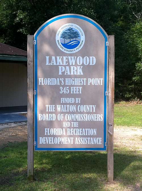
![Britton Hill High Point]() High Point sign inside Lakewood Park
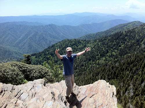
High Point sign inside Lakewood ParkBritton Hill, Florida's State High Point, was just a mere roadside stop-off. It is located in the extreme northern part of Florida's panhandle, amid lots of small rolling hills and farmland. From the hotel, it was a short drive through country roads towards the Alabama border. Unfortunately, there was no hiking involved, as the monument and signage are in Lakewood Park, located alongside Highway 285. We parked and walked towards the monument to take our requisite photos. The day was gorgeous, and we started in good time. It was only about 8:30am, and we had plenty of time. Again, though there was no hiking involved, it felt good to start this whole mission at our home state's high point, and get the first one under our belt.
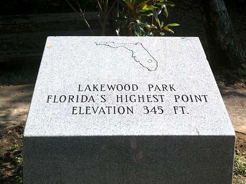
![Britton Hill Monument]() Britton Hill Monument
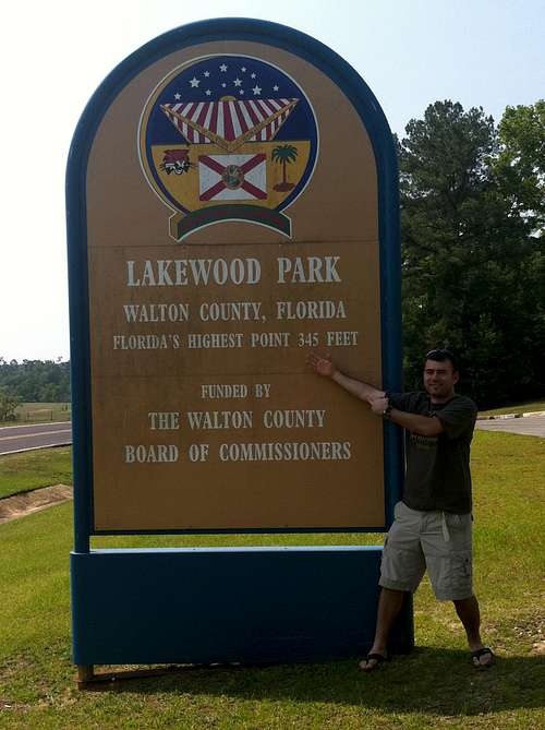
Britton Hill Monument![Britton Hill]() Sign on the road for Florida's High Point
Sign on the road for Florida's High PointAfter our pictures, it was back on the road continuing down Highway 331 into Alabama. We were going to head to our second HP of the day and the trip, Cheaha Mountain! Cheaha was located about 4 hours north, along many of Alabama's local state roads.
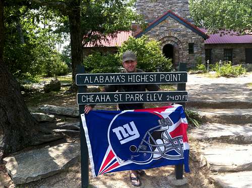
Cheaha Mountain, Alabama - State HP #2
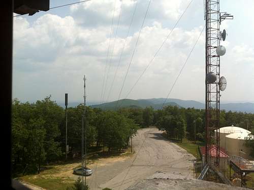
The trip up towards Cheaha Mountain was fairly uneventful. We took a quick stop off in Montgomery, the State's Capitol, for lunch and refueling. Sometimes, it's nice taking the localized state roads as opposed to always travelling on interstates. It gives a different perspective on the country. That is also is recurring theme on many of the state HP's ahead. Anyhow, back to Cheaha, we reached the state park that encompasses the peak in the early afternoon. The landscape was starting to change and the hills were growing steeper. Cheaha State Park had a small entrance fee. The park was a big loop essentially, with motel rooms, cabins and a campground all around the grounds. There were no real hikes up to the actual high point, unless you wanted to walk the road that we drove in. The views were nicer here though, as we climbed some above the surrounding forests.
![Cheaha Tower Views]() View from the tower at Cheaha
View from the tower at CheahaWe headed for the tower area, which held the actual high point survey marker as well. The tower had great views, 360 degrees, of the surround Talladega Nat'l Forest. We parked near the front of the house and tower. There were a few other groups there, and we chatted with other locals. We walked up the stone tower to try to get the best views possible. I loved the sign and design of the house. We stayed for about 30 minutes taking pictures and videos, so we can document our second State HP.
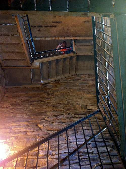
![Inside Cheaha Tower]() Walking up the stairs in Cheaha Tower.
Walking up the stairs in Cheaha Tower.![Cheaha Mountain]() Posing in front of the Cheaha tower.
Posing in front of the Cheaha tower.After we left the tower, we decided to drive around the park for a few and ran into a wedding going on in the Main Lodge. We stopped and watched for a few minutes, on what was a picture perfect late Spring day. We snapped a few more pics and then decided to hit the roads again. It was going to be another nearly 3 hour drive to get to our next destination, northern Georgia.
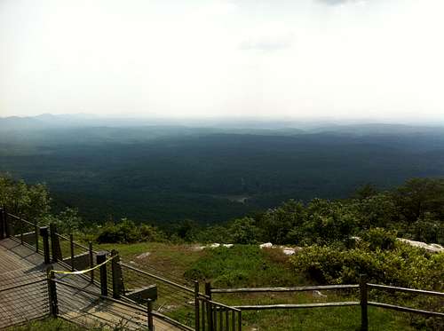
![Cheaha Views]() Cheaha Lodge Views
Cheaha Lodge Views
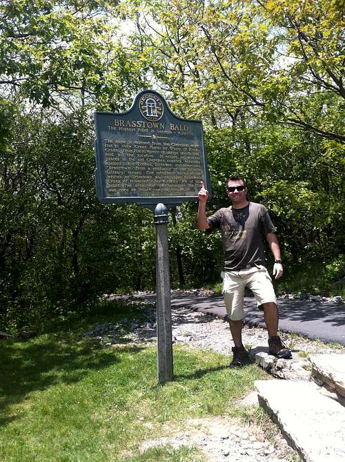
Brasstown Bald, Georgia - State HP #3
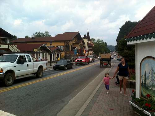
The drive into Georgia took us through the always congested Atlanta. Grrrr, patience, yes patience. Once through Atlanta, we headed north towards actual mountains. It was a welcome site, as the peaks grew taller the further north we drove. The previous day, we had researched this little town to stay in, that was supposedly all German Bavarian themed. Finally, after driving for a while, we found the kitschy town in northern Georgia that they call Helen. It was like a Bavarian oasis in the middle of the mountains of southern Appalachia. Every building was in German style architecture, and many people working there were wearing traditional Bavarian gear. Being German, i found this to be totally bizarre, yet interesting at the same time. Southerners and Germans mixed up, just weird!!
![Helen, Georgia]() Main St, Helen, GA
Main St, Helen, GATo add to it, the town had what they called a traditional Bavarian Fest, at the Festhalle. So after we checked in to the hotel, we decided to go out on the town for a couple drinks and check it out. After all, we were still on vacation! We enjoyed the little town of Helen that night over a several pints of nice German beer! This was another one of those, only on a road trip moment. I mean, who knew, HELEN!!
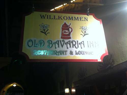
![Old Bavarian Inn]() Bavarian Pub, Helen, GA
Bavarian Pub, Helen, GA![Festhalle, Helen, GA]() Oktoberfest in Georgia!
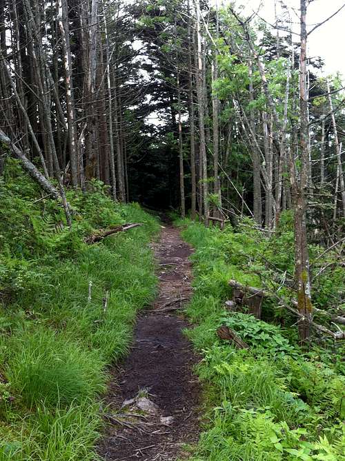
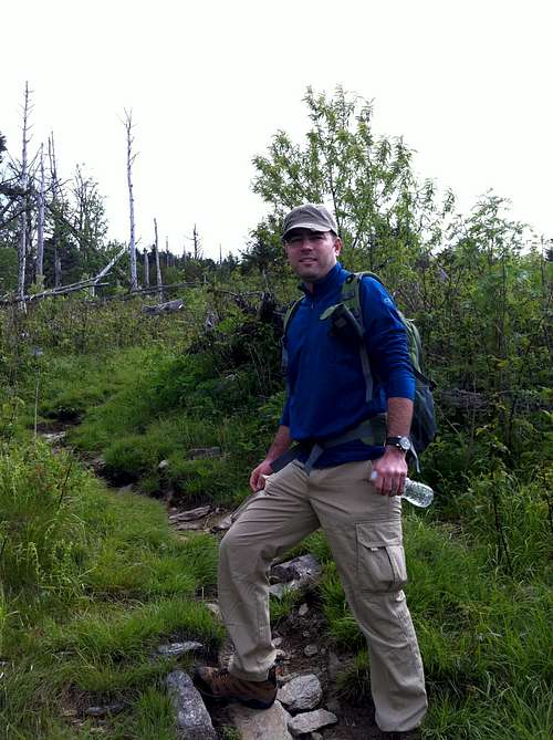
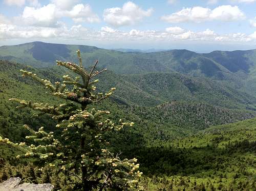
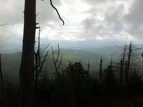
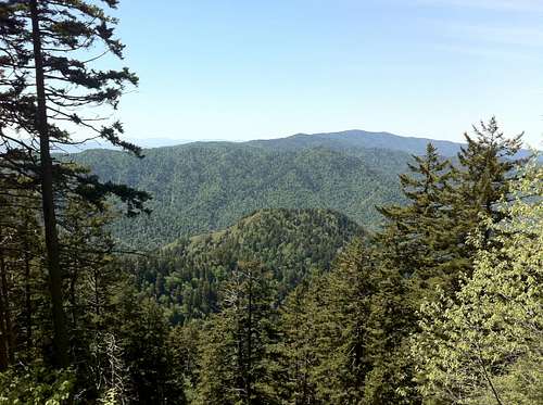
Oktoberfest in Georgia!We woke early the next day, admittedly with a slight hangover. Oh well, you only live once. We had another long day ahead of us, with 2 more state High Points planned, including Brasstown and Sassafras! After a quick stop at a German bakery, it was off to the trail head for our first hike at any state HP. We had planned on taking the 6 mile round trip Jacks Knob trail up to the summit of Brasstown Bald. It turned out to be the perfect intro hike of our trip. The trail head was a little tricky to find, as it crossed over GA 180, and there was only room for a couple people to park just down the road. We strapped on our day packs, and hit the trail finally. It felt good to get out there, and head through the forests. I just remember how good it smelled, on another beautiful late spring day. The trail gained 1,700 feet elevation, and had lots of switchbacks right off the bat. Music playing in my ears, no problems here.
![Jack's Knob Trail, Brasstown]() Views from Jack's Knob Trail
Views from Jack's Knob TrailThe trail was pretty even and maintained as it wound its way through the forest up towards the parking area. It only took us an hour or so to get to the parking lot, just below the summit of Brasstown. If you wanted to, you could drive up to the summit parking area, and then walk the last paved .5 mile trail up to the summit. After hiking through the forest, it was a little odd emerging from the trees and into a parking area with a hundred cars and tons of people. Oh well, if it had to be, it had to be.
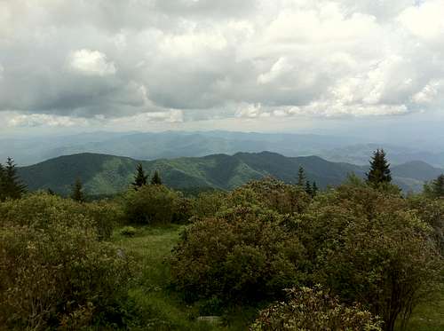
![Summit House, Brasstown]() Views up to the summit, from the parking area.
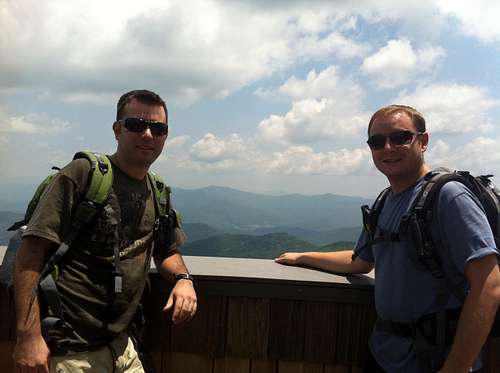
Views up to the summit, from the parking area.We had to cross the huge parking area, and then join the final paved trail up to the summit. The summit trail gained another 500 feet of elevation and was pretty simple. The summit of Georgia is one of the most well kept in the country, from what i've seen. The summit house is very nice, and it contains a mini museum, and film room showing a movie. There was a huge sweeping porch with rocking chairs. There were a lot of people up there, of all ages, and nationalities. We walked around the compound, taking in all the views. We had to ask the ranger where the survey marker was, as it was unclear. She opened a door for us and voila!
![Summit, Brasstown Bald]() Summit views from the patio, Brasstown.
Summit views from the patio, Brasstown.![Brasstown HP sign]() Brasstown HP Sign, Georgia
Brasstown HP Sign, GeorgiaWe had a cheese and bread that we had bought earlier at the German bakery in Helen, as a treat for summiting. I mentioned earlier just how nice the weather was. 70's, with no clouds in the sky. The day couldn't be any better. After rest and snacks, it was time to head back down the Jack's Knob Trail. The walk down was easy and and relaxing. We encountered numerous groups heading up. By the time we got back to the car, it was around noon. We couldn't hang around much longer as the day wasn't finished. Next on the agenda, was to drive up to the edge of South Carolina and hit our second High Point of the day, Sassafras Mountain.
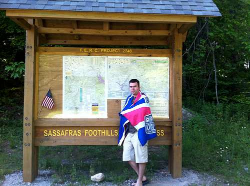
Sassafras Mountain, South Carolina - State HP #4
![Sassafras Foothills Sign]() Sassafras Map/Sign
Sassafras Map/SignThe drive to Sassafras was very scenic. We weaved further through Georgia, and parts of North Carolina. The whole way, we wound into and out of the peaks, and valleys. Sough Carolina's HP sat right near the border with its big brother, literally. The dirt/rocky road (199) off the main road crawled for about 5 miles right along the imaginary state border. The going was slow, and canopy seemed to cave in over us. It ended at the summit parking area. There is a huge sign and map on one side of the parking lot that says Sassafras Foothills Wilderness. Once you see this, you know that you are in the right place. I only say this because that gravel road on the way up, seemed like an eternity, and had me second guessing where we were going.
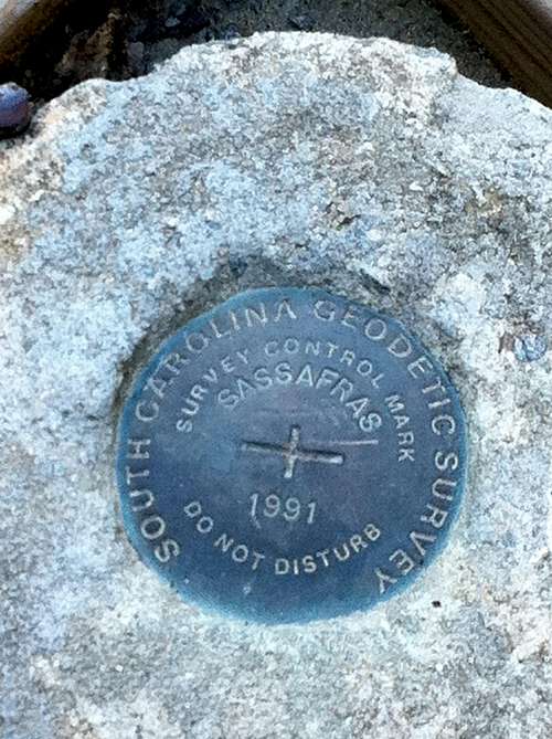
![Sassafras Survey Marker]() Sassafras Survey Marker
Sassafras Survey Marker![Sassafras Tower]() Tower at Sassafras HP area.
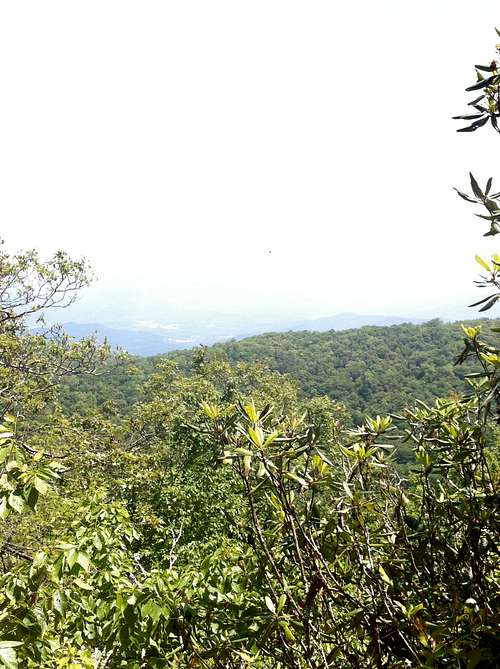
Tower at Sassafras HP area.Go past the gate at the edge of the parking lot and find a little trail that scoots further up the way to the actual summit and high point survey marker. Near the survey marker is an electrical tower of some sort. Once you see that, you are in the right place. The summit is fairly boring with no views of the surrounding landscape. We took our photos and videos fairly quickly and headed back to the parking lot. Off to one side of the parking lot, is a lookout deck. I'd recommend going to this deck so you can actually see the beautiful 6000' Black Mountains of North Carolina in the distance. Also, you can feel like you are actually on top of a mountain this way. We snapped a few more pics here, and then headed back to the car. South Carolina was short and sweet, and notched us another State HP!
![Views from Sassafras]() Views in NC from Sassafras Mountain.
Views in NC from Sassafras Mountain.Back to the car, and we were heading next to the cool city of Asheville, NC for a couple nights. Asheville was a good base for hiking Mt Mitchell and surroundings, as well as being near Great Smoky Mountain National Park. The drive up to Asheville was only a little more than an hour. Again, we passed through beautiful countryside en route. We rolled into Asheville, found the hotel and hit the town looking for a hearty dinner. We saw a city with more breweries than one could imagine. Asheville was also very hip, and artsy. What a cool city i thought! We couldn't stay out that late on this night though, as we had to be up early for Mt Mitchell in the morning. So after a late dinner, it was back to the hotel and bed fairly early.
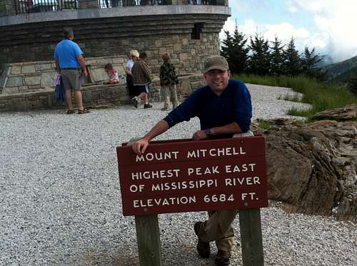
Mt Mitchell, North Carolina - State HP #5
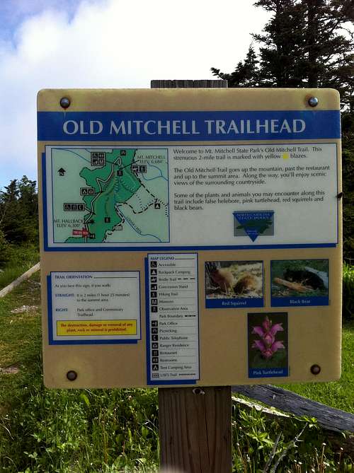
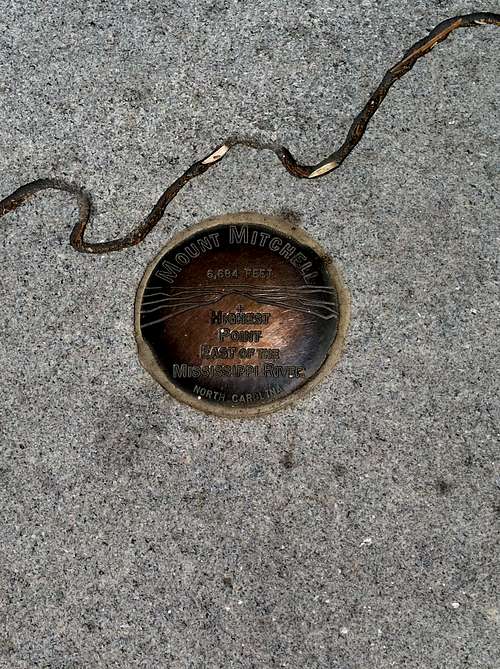
We woke up very early that morning and got our stuff together for the hike up to the tallest peak east of the Mississippi. I was most looking forward to this peak of any on our trip. Mt Mitchell sits at 6,684 ft tall, and is visible far into the distance. There was a cool fog in and around town that morning. The Black Mountains seemed to all be foggy, as we hoped the weather would clear and leave us with a nice hiking day. We drove the 30 minutes out of town and ascended high into the peaks. It was near white-out fog for a short while. We were trying to navigate our way towards the Mitchell State Park office. Once there, we grabbed some hiking maps and brochures. It was about 8am, and the fog didn't seem like it wanted to clear. The Ranger told us to calm down, that the day was supposed to be beautiful and to start on our hike as planned. Sooo, after checking the maps, we decided to hike the Old Mitchell Trail up towards the summit, which was about 2 miles. Once reaching the summit, we wanted to continue along the Crest/Deep Gap trail, and over all four 6000' peaks.
![Foggy Mitchell]() The drive up to foggy Mitchell.
The drive up to foggy Mitchell.The trail started just beyond the office, and at an altitude of nearly 6'000 ft. We first hiked through beautiful forest on the upper reaches of the peaks, near treeline. The weather was still crisp in the morning, although just a few minutes after leaving the trail head, the fog did start to clear and the sun came out. It warmed us up immediately, and turned into another pleasant day.
![Old Mitchell Trail]() Old Mitchell trail
Old Mitchell trailIt wasn't too long before we had some great views of the high peaks. There were breaks in the treeline fairly early on in the trail.
![Near treeline, Mt Mitchell]() Views through the trees
Views through the trees![Along old mitchell trail]() Hiking Old Mitchell trail
Hiking Old Mitchell trailIt wasnt too long before we came out of the woods to the parking area, near the summit of Mt Mitchell. Again, it was weird to see soooo many cars and people after we had just walked a few miles through the woods. Once we hit the parking lot, we just had to walk a paved trail up to the summit lodge/viewing area. Once at the summit, we were standing on the tallest peak east of the Mississippi.
![Famous Mitchell Sign]() Famous Mt Mitchell sign!
Famous Mt Mitchell sign!![Summit views, Mitchel]() Summit Views!
Summit Views!![Survey Marker Mitchell]() Actual Summit of Mitchell
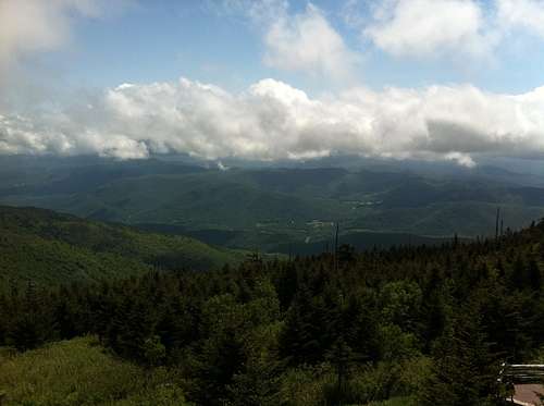
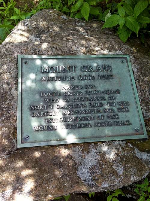
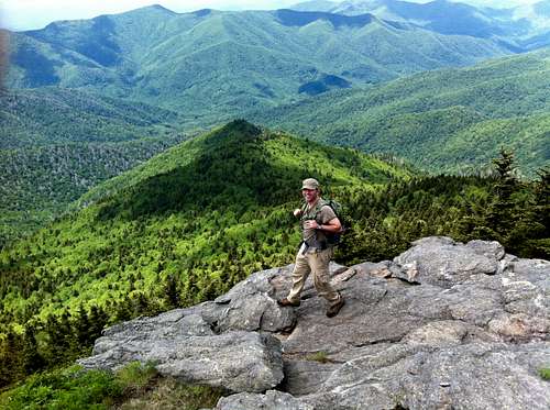
Actual Summit of MitchellThe summit views were spectacular, as the day had cleared up. The weather up top was around 60 degrees, and we shared the peak with many people. The survey marker was very easy to find, as was the the summit monument. People were taking turns with the big sign, and really just hanging out at the summit tower area soaking it all in. You could see as far as the Smokies to the west, and back towards Asheville too. Mitchell's summit was not the end to our hiking day as we decided to continue along the Black Mountain Crest Trail and towards the other 6000 ft peaks on the ridge. This was one of the most stunning hiking trails to date. We left the Mitchell summit, and dipped back below the trees for a few minutes, only to ascend back up to the summit of North Carolina's second tallest peak, Mt Craig. The distance between the two was probably .75 mile.
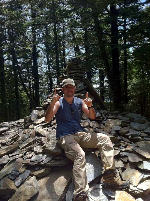
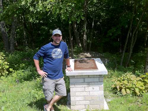
![Mt Craig]() Mt Craig plaque
Mt Craig plaque
![Crest Trail, NC]() Crest Trail from Mitchell to Craig
Crest Trail from Mitchell to CraigOnce we found the summit area of Mt Craig, it was time for lunch. We sat on the edge of the cliff at the most amazing table for two you could imagine. Though lunch wasn't really gourmet (sandwiches packed earlier and berries) it was satisfactory. We relaxed there too and took many pictures for the album.
![Views from Mt Craig]() Summit Mt Craig
Summit Mt Craig![Mt Craig]() Summit views, Mt Craig
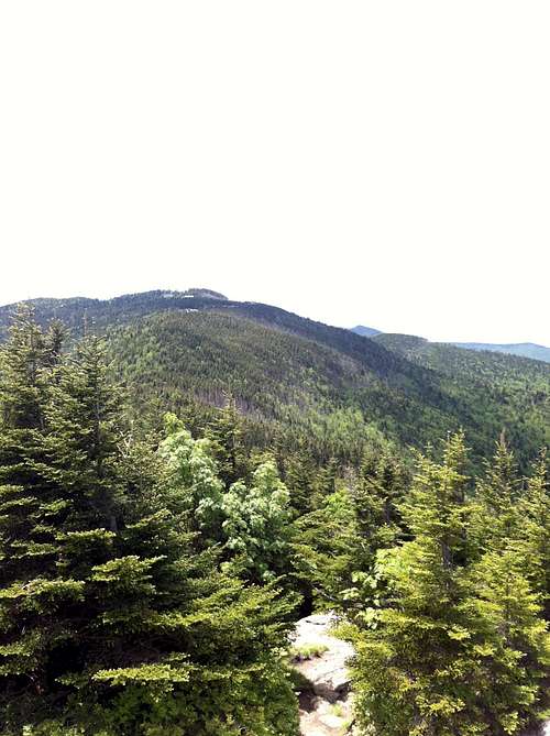
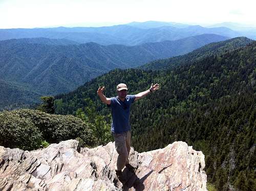
Summit views, Mt CraigAfter a long lunch, we moved on further down the Crest Trail towards Big Tom. This was the third summit along the highest ridge in the eastern USA. It was another .5 mile past Mt Craig. Once we got there, we decided it was far enough and that it was time to turn around. After a few more pics, we headed back towards the Mt Mitchell's summit area. Along the way, i took this pic, maybe my favorite from the whole trip.
![Best Pic Ever]() Black Mtns, best pic ever!
Black Mtns, best pic ever!After returning to the Mitchell summit area, we descended back down the Old Mitchell trail towards the park office and parking lot. The trek back was fairly uneventful. We just marveled at how the weather had changed from early that morning and stayed perfect all day for us. What a great day up in the Black Mountains, one i will never forget.
After a fun night touring the breweries in Asheville, we headed towards the Smoky Mountains and Tennessee the following day. We decided to stay in the kitschy tourist town of Gatlinburg, just outside the western border to Great Smoky Mountains Nat'l Park. I do love Gatlinburg, and it's perfect access to one of my favorite National Parks.
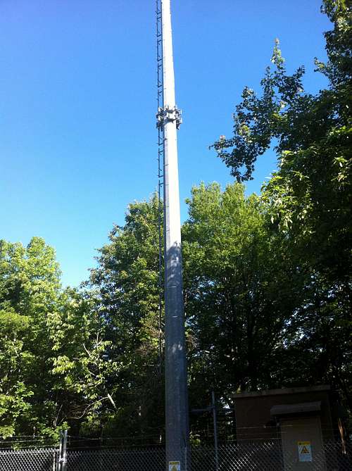
Clingmans Dome, Tennessee - State HP #6
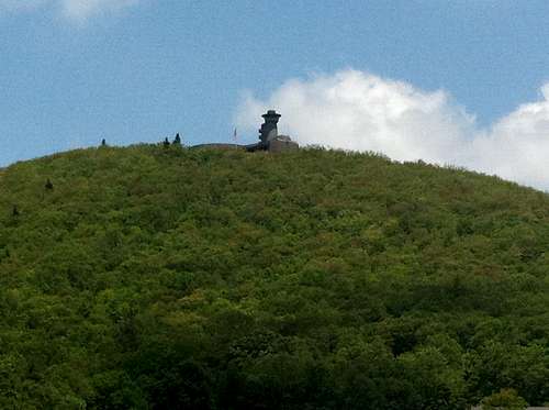
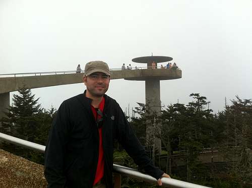
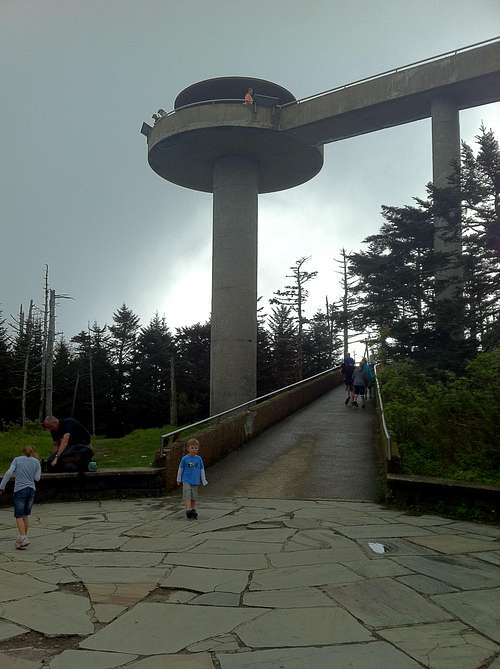
The Smoky Mountains are awesome, plain and simple. There are so many great hiking trails to get into. Clingman's Dome, however is not one of them. It is the high point of the state of TN, but we decided that we were just going to drive up to the the main parking area of Clingman's Dome and walk the .5 mile paved trail to the summit. There were two reasons for this; the only other route to hike to it was the 16 mile round trip on the A.T., which followed the road most of the way towards the flying saucer summit tower. We had heard that it didn't have too many views as is, and the weather on that day was very cloudy and overcast. We figured that we would just drive up to the top, and take our pics, and save for a big hike the next day. What hike are we talking about......of course, the classic Mont Leconte.
![Summit of Clingman's Dome, TN]() Summit of Clingman's Dome
Summit of Clingman's DomeThe paved trail up from the parking area at the summit area was very easy. We ascended into the fog and clouds, and had no views at all from the flying saucer. We still had fun though. Here we were, sitting atop our sixth state High Point, and the second tallest mountain east of the Mississippi! There were many people up there as always in GSM Nat'l Park. There were tour groups hanging out, and people of all ages.
![Flying saucer summit tower]() Flying saucer tower, Clingman's Dome
Flying saucer tower, Clingman's DomeWe decided to hike on the Forney ridge trail, towards Andrews Bald i believe, and a very nice open meadow and viewing area of the surrounding peaks. The trail was a little less than 2 miles. We were hoping to see some breaks in the clouds and nice views. It didn't really give us to many on that day, other than a few openings every once in while. We found Andrews Bald, and went to relax in the meadow for a while.
![Views high atop Tennessee]() Overcast day on Forney Ridge Trail
Overcast day on Forney Ridge Trail![Andrews Bald, TN]() Andrews Bald, near Clingmans Dome, TN
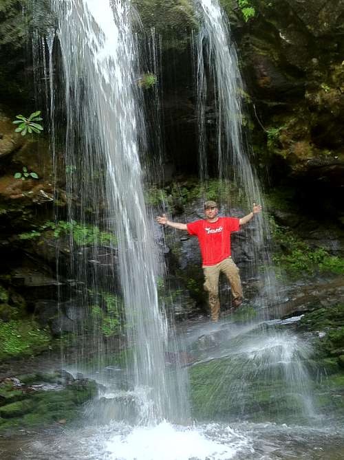
Andrews Bald, near Clingmans Dome, TNThe Bald was the end of the trail, and after our rest stop, we headed back towards Clingmans Dome. We wanted to further explore the park on this day, so we decided to take yet another shorter hike to see one of the park's best waterfalls, Grotto Falls. To get there, we had to exit the park and re-enter through the Roaring Fork Motor Nature Trail. The loop drive itself was very neat, as the trees hugged the road, and we had to drive over several small picturesque bridges. We found the trail head, Trillium Gap Trail, and followed it as it meandered through the forest. It was a pretty well worn path, that crossed over a few small streams. At about 1.2 miles, the waterfalls came into view. Although it was slightly foggy and overcast, it was still very warm. The feeling of the cool rush of the falls was excellent during the mid afternoon hours. We walked right up behind the falls and drenched ourselves.
![Grotto Falls]() Cooling off at Grotto Falls
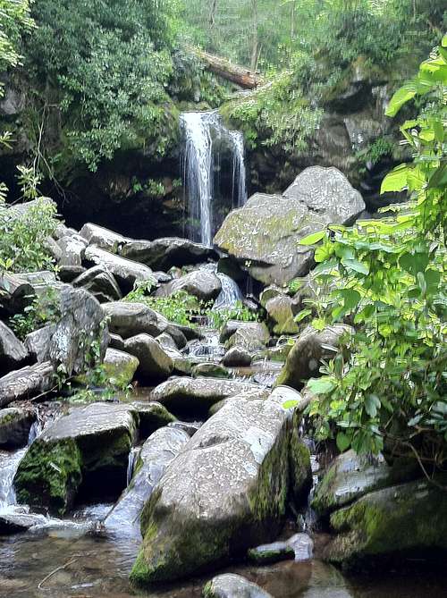
Cooling off at Grotto Falls Then, we found a spot further down the stream to rest on and observe the falls from below. It was such a pleasant place to be in the afternoon. I could have just kicked my feet up and went to sleep for a few hours if i had the time.
![Grotto Falls, TN]() Grotto Falls
Grotto Falls
Eventually we had to leave the falls, and head back towards town. We did need to get to bed relatively early as we planned on hiking up to Mont Leconte the next day. We had heard from everybody that this was one THE classic Smoky Mountain hike.
Mont Leconte, TN - Great Smoky Mtns Nat'l Park
There were five main routes to get up to Mont Leconte. After researching all the options, we settled for the most popular route, Alum Cave. It was the one that had a mix of everything we wanted to see in the Smokies. So, after rising at 5:30am, we had a hearty breakfast in town, and headed back into the park. The trail head was already busy by 7am. Due to the popularity of this hike, I would advise everyone to get there as early as possible. To be honest, there are some people that shouldn't have been attempting it, but oh well. There were all types of people on the trail, young and old, as well as lots of foreign travelers. The morning temp were perfect. There was a crisp chill in the air, which eventually dissipated. There wasn't a cloud in the sky, and it looked like we were going to luck out.
![Streams along Alum Cave Trail]() Streams along the trail, morning light.
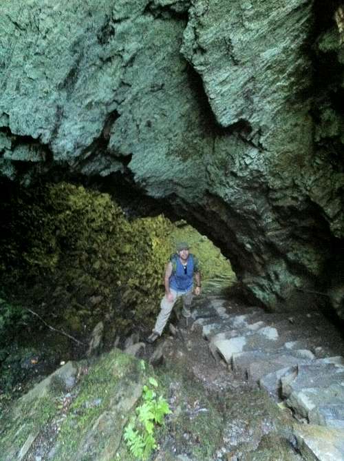
Streams along the trail, morning light.We hit the trail and found ourselves walking along meandering streams in the early goings. The morning light was shining through the trees, and it was just beautiful already. The forests on the lower reaches of the trail were inviting and comfortable. Our first landmark of the hike was about 1.3 miles in, Arch Rock. It is a really neat feature, with steps etched into the stone. You have to climb up these steps, literally through the giant rock.
![Arch Rock, Mont Leconte, TN]() About to climb through Arch Rock.
About to climb through Arch Rock.After making our way through Arch Rock, the trail climbed significantly. This was the steepest of any of our hikes on this Appalachian trip. At about 2 miles in, we found ourselves at Inspiration Point. This point had the first sweeping views of the surrounding peaks. You could look in the distance and see the keyhole in the rock, near the top of Little Duck Hawk Ridge. The trail again continued to ascend higher, until we reached the next prominent landmark, the Alum Cave.
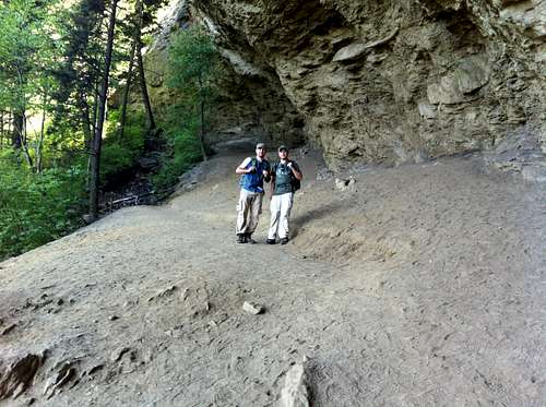
![Alum Cave, Mont Leconte]() Alum Cave
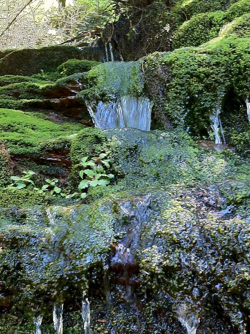
Alum CaveThe Alum Cave really isn't an actual cave, but a huge bluff that juts out and creates a shade for all the hikers trekking through. It was probably about 80 feet tall. We took this opportunity to rest for a while, as did many other hikers. It was a pretty cool feature along the trail. There were many hikers that turned back at this point, though we knew it was just a mere rest stop for us. The "Cave" was about 2.25 miles from the trail head, meaning there were still 3 to go to reach to summit. We trucked on past, and found the trail continually and steadily gaining more elevation. Along the last couple miles, the trail became narrow in some sections and had hand rails built into the cliff for safety. It was never too scary, but did provide great views in some sections. There were some small waterfalls cascading down the trail, which actually provided a cool splash from the otherwise warm day. The sun was beating down on us, but we were in great spirit and shape.
![Cascading water on Leconte]() Cascading water
Cascading water![Views along Alum Cave Trail]() Views on upper reaches of trail
Views on upper reaches of trailEventually, we reached the summit ridge of the Mont Leconte as the trail flattened out. It ran into the Rainbow Falls trail, and the Leconte Lodge came into view. The time was about 11am, and we were pretty much on schedule. We were curious about the Lodge, but decided to find the true summit of the mountain, and catch some views, before returning to it. So, we walked about a half mile beyond the lodge to the the true summit, which was a huge cairn in the middle of a forested area on top of the peak. Well, here we were, standing at 6,593 feet and the summit of Mont Leconte.
![True summit, Leconte]() True summit of Mont Leconte, TN
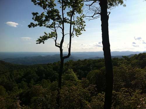
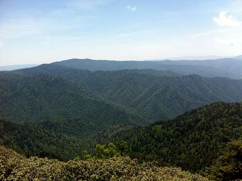
True summit of Mont Leconte, TNAfter snapping our requisite pictures, we actually wanted to see some views from the summit, so we walked over another half mile to Myrtle Point. This was a remarkable place to kick back, and just take in the majestic views of all of the Smoky Mountains. WOW, we made it to yet another huge mountain without any issues. The day was just great and the views breathtaking in all directions!!
![Myrtle Point, Mont Leconte]() Myrtle Point, Mont Leconte
Myrtle Point, Mont Leconte![Sweeping views, Mont Leconte]() Sweeping Smoky Views
Sweeping Smoky ViewsAfter hanging out by the lookout for what seemed like all afternoon, we walked back towards the Leconte Lodge. We walked inside just to check it out, and saw a common room and small gift shop. There were people playing chess, while others were reading books. A guy was playing guitar and another singing. It was actually a relaxing scene, and we talked to some hikers for a little while. We really wished we had booked a room to stay at the Lodge overnight, as it was crystal clear, and we probably would've had some great skies. Unfortunately, we had to finally head back down this large peak before it was too late in the afternoon. The hike down was relaxing and fairly uneventful. We met many hikers still on their way up. It was a great feeling to have completed this peak, though not a state high point, a beautiful mountain and experience.
Once back to the parking area and our car, we made our way back into Gatlinburg for dinner and an early night. It was a tiring day after all. Great Smoky Mountain National Park had been nice to us, and is still to this day one of my favorite places to be!
Black Mountain, Kentucky - State HP #7
The following day, we had to leave Tennessee and drive north towards the the hills of Kentucky. This was my first time in this state. I know we wouldn't have much time there, but i was still excited to see a new state. Black Mountain was interesting place, in that mining companies own the surrounding lands. We had to fill out this waiver to enter the area, in order to drive to the summit area. Actually, there were no gates, or anybody checking to see if we actually had this permit but it was better to be safe than sorry.
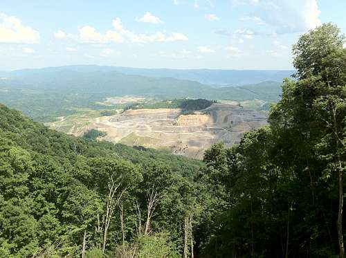
Kentucky is mostly a flat state known for its caves more than its mountains. Although, Black Mountain is fairly high, with an elevation over 4,000ft. You have to drive though very windy, steep mountain roads to reach Black Mountain. As we were driving through the area, we noticed that the area is heavily mined. There were complete mountains near it which were totally stripped down of all trees and reduced to a shell of their former self. It was actually sad to see. There is mining done on the upper reaches of Black Mountain too.
![Mining around Black Mountain]() Mined out mountain near Black Mt.
Mined out mountain near Black Mt.Rt 160, which approaches Black Mountain is actually very steep and fun to drive. It winds around and has very sharp curves. Once near the summit, fork left in the road to take you to the summit. There is a huge tower there, which is visible easily.
![Tower at Black Mountain]() Black Mountain tower
Black Mountain towerSitting right next to the tower, is the monument and plaque dedicated to the high point! It wasn't that spectacular of a high point area, but we found it succesfully. Kentucky's Black Mountain, wohoooo!
![Kentucky summit sign]() Black Mt summit sign!
Black Mt summit sign!
We didn't stay there that long, as we just wanted to continue driving further along and back into Virginia. We had one more mountain to hike on this trip, and it had a considerable trek to get to the summit. So, we drove out of the Kentucky hills and found our way to the town of Abingdon, Va, off I81.
Mount Rogers, Virginia - State HP #8
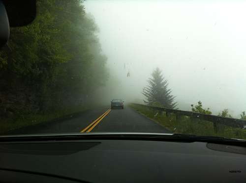
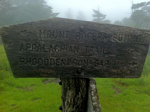
We were monitoring the weather as it was supposed to be very iffy conditions on the next day. When we woke up, it was drizzly, and we could see heavy rain clouds everywhere. Mt Rogers was a 45 minute drive from the town of Abingdon, and after debating it for a while, we decided to forge ahead and see if the weather was any better up near the peak. The drive into Grayson Highlands was a cool, foggy one. There didn't seem to be a break in the weather anywhere, unlike the day on Mt Mitchell. We found the parking area and trail head at Massie Gap, and decided to give it a go.
![Start of Rogers Trail.]() Start of Rogers Trail
Start of Rogers Trail
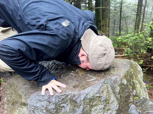
It was rainy ALL day long, and made for a cool unpleasant hike up. We had to cross the road and join the Appalachian Trail route. It first went through a huge open meadow, before entering the forest. The visibility was near zero in the open meadows. Once in the forest, in was like a cold, wet canopy dripping all over us. It was also slightly windy too. I didn't take any pictures on the way up, as we almost ran up to the summit. Most of the trail up wandered through thick forest, and was well worn path. We were very concerned about some thunder we heard in the distance. The trail was a little more than four miles long, and we were basically counting it down as we jogged up most of it. At one point, we reached a junction in the path appeared as if it could have opened into another huge meadow. I thought i saw movement out in the meadow, but then told myself it was nothing as the fog was at almost whiteout conditions. I'll get to that later. Well, back through the forest and on the trail. We made it up to the summit of Mt Rogers in record time. It was about 1.5 hours and we finally found what was the summit area. It consisted of a couple large rocks in the middle of a thick spruce fir forest. We were just relieved to have made it there without any serious thunder or lightening hitting us.
![Mt Rogers summit]() Mt Rogers summit rock!
Mt Rogers summit rock!
![Kiss the summit marker!]() Kissing the survey marker!
Kissing the survey marker!
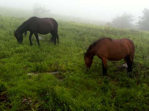
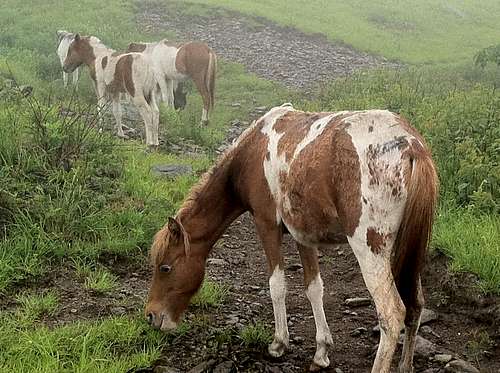
The summit area lacked any views, even if it wasn't such bad weather. It was really just good enough to say we made it. After being there briefly, we headed down quickly. Now, if you remember what i mentioned earlier about another clearing in the trail, in what seemed to open up to a large meadow. Well, on the way down my curiosity took over me. I told my buddy that i wanted to see exactly what i thought might be moving around further down the meadow. He first looked at me and thought i was crazy, but after some convincing we veered off the trail and entered the meadow. As we walked carefully through the damp high grass, there was another trail that started and continued on. We walked it, and could now see more than one figure in the distance moving slowly. They weren't people, and we weren't sure what else could live up here. Closer and closer we got, until finally into views came a huge group of horses! They were baby ponies, and i had remembered reading about them in my research before the trip.
![Rogers ponies]() Friends we met along the way!
Friends we met along the way!As we walked closer, even more horses came into view. Different colors, they were just grazing up here in the open meadows. Pretty cool to see these wild animals just living in the wild. They didn't really seem startled by us as they continued to graze.
![More ponies on Rogers]() More ponies grazing in the open meadows on Mt Rogers
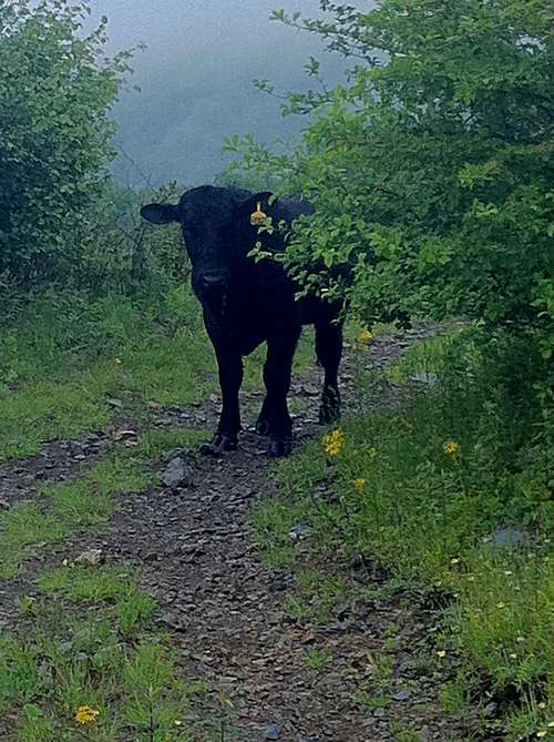
More ponies grazing in the open meadows on Mt RogersThough, near these beautiful horses, were also noticed a bunch of big cattle, also hanging around and making lots of noise. They were pooping everywhere, and also didn't seem to mind our presence much.
![Guarding the trail]() Guarding the trail!
Guarding the trail!This one particular guy was in the path we were walking, but after some negotiation, he granted us clearance. All in all, it was an interesting scene high up in the sub-alpine meadows. We finally said goodbye to all of our new friends, and headed back down the trail. This trail eventually connected with the trail we took up in the first place. It was a rainy and damp end the hiking on our trip. However, it was also another successful day, and gave us our 8th state high point of the trip!
In closing, this trip through the Appalachians was outstanding. We got to see the highest peaks the southeast had to offer. Primarily, we had great weather, and made it through all the goals we laid out for ourselves. As i mentioned in the introduction, i wanted to try this trip first, the one closest to my home. It met my every expectation, and just propelled my motivation to go on further. As soon as we got home, we started planning trip number two. It would be a late summer road trip through New England, that let us see state high points #9 -15. To read more about that trip, please click the link in my profile. I have tons more updated photos and routes we used while climbing all the New England high points!!