|
|
Mountain/Rock |
|---|---|
|
|
48.69029°N / 119.91689°W |
|
|
Okanogan |
|
|
Hiking, Scrambling |
|
|
Spring, Summer, Fall |
|
|
7971 ft / 2430 m |
|
|
Overview
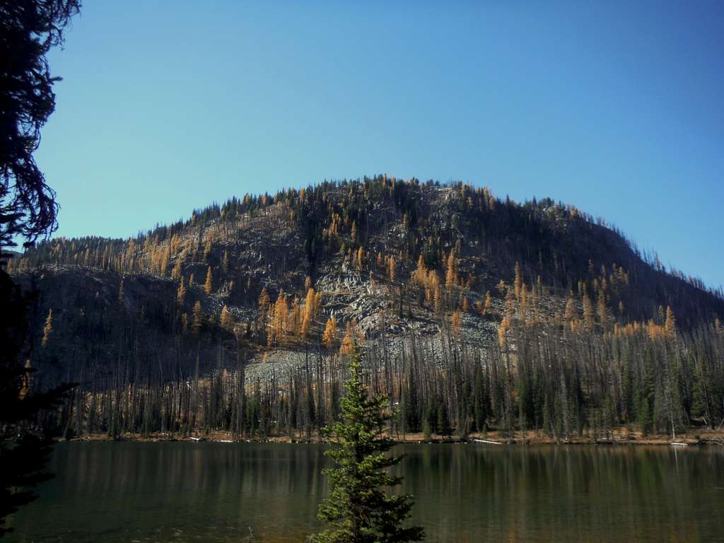
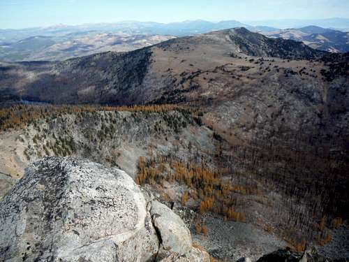
Looking toward the summit
The few hikers who head up this mountain usually combine it with nearby Middle Tiffany Mountain for a good half day hike. Some also combine it with Tiffany Mountain making for a long day hike over three summit. The most scenic time to do Rock Mountain is in the fall. Though the high summit is completely devoid of trees, the larch views towards Middle Tiffany Mountain and Tiffany Mountain more than make up for the lack of trees on Rock Mountain. Though Rock Mountain does require some off-trail travel there is no hand scrambling required to make the summit and most of the area to Rock Mountain is open grasslands and some minor scree.
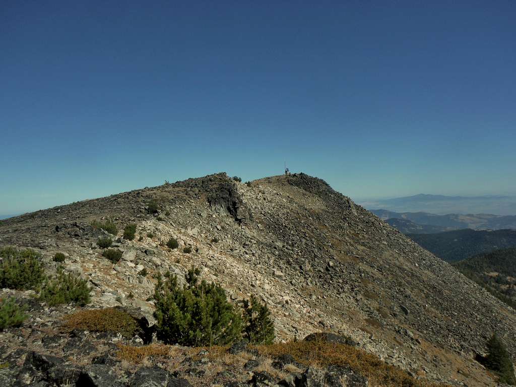
The summit view..
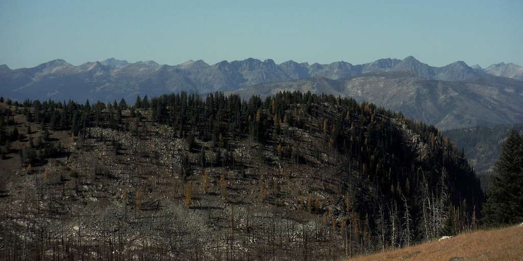
 Rock Mountain from Tiffany Mountain | 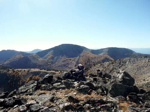 Looking at Tiffany Mountain from the summit of Rock Mountain |
Getting There
From the town of Winthrop, Washington: Head north on Riverside Ave out of downtown for 0.2 miles. The road will then veer right and continue as Bluff Street for 0.5 miles. The road will then change to East Chewuch Road. Stay on it for 5.8 miles. At 5.8 miles make a slight right onto right onto NF-37 which may be hard to see so pay attention once you are getting close. Stay on it for 12.8 miles until you run into NF-39. Make a left on NF-39 and stay for 3.2 miles to the Freezeout Ridge trail pull out for 7 miles to the Tiffany Springs Campground.
Route
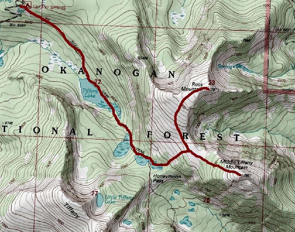
Map of the Route from Tiffany Spring Campground (8 miles, 2500 feet)
THE EASIER ROUTE:
This route starts from the Tiffany Springs and drops down to Tiffany Lake before rising again all the way until one hits Honeymoon Pass. From there one goes off trail (no bootpath here) and take it the somewhat steep but very doable slopes all the way to gap between Middle Tiffany and Rock Mountain. From the gap one continues off trail to whichever summit they want first. There is absolutely no hand scrambling on Rock Mountain and very little on Middle Tiffany Mountain and that is only at the very top.
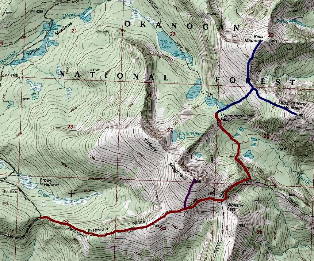
Combining Tiffany, Middle Tiffany and Rock Mountain (12 miles; 4500 elevation gain/loss)
COMBINING TIFFANY, MIDDLE TIFFANY AND ROCK MOUNTAIN:
This is a much longer and more demanding route due to the ups and down of the route. Though most of the route is trail until Honeymoon Pass, the route itself will require one to rise from 6600 up 8200 than back down to 6800 then up to nearly 8000 twice with an additional 500 feet between the two summit. All told this is roughly 12 miles and 4500 feet of elevation gain and loss. This is still very doable for most in shape hikers but one should expect a long day.
Red Tape
Because of the burn area in this region and the lack of popularity there is no fees. In fact there was not even a fee when I was at the cap area on September 30th, 2015.When to Climb
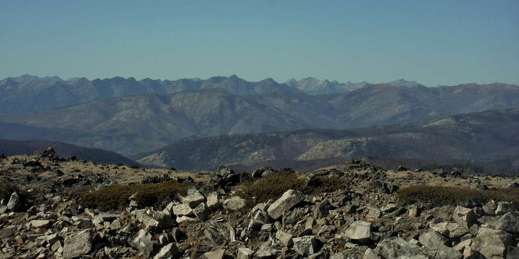
Because this peak has such a high trailhead this peak is strongly recommended from July to October. Personally I would strongly recommend late September to early October so this way one could enjoy the change of color of the larches that dot some of these slopes. On rare time the road can open up on April or May but don't count on it.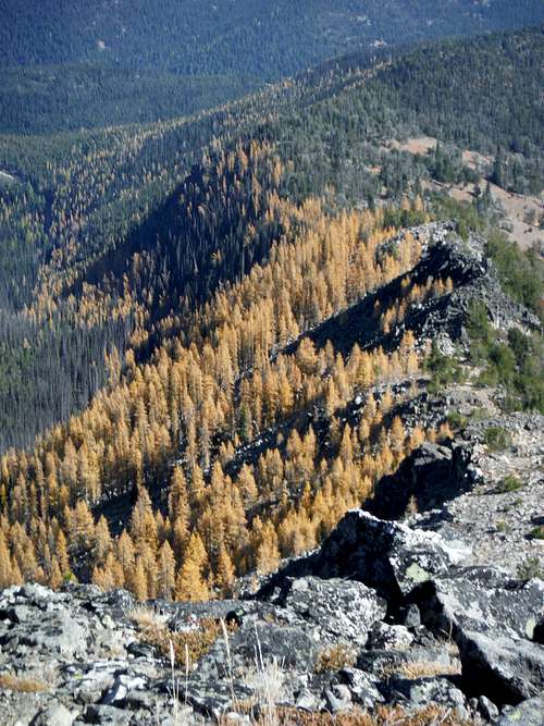 A good look at the beautiful larches over the eastern ridge | 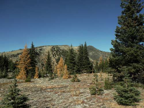 Rock Mountain and larches |