
|
|
Mountain/Rock |
|---|---|
|
|
35.97235°N / 81.10869°W |
|
|
Alexander |
|
|
Hiking |
|
|
Spring, Summer, Fall, Winter |
|
|
1795 ft / 547 m |
|
|
Overview
Rocky Face Mountain is a classic pluton. Formed as a pool of magma far beneath the surface of the Earth, the softer terrain slowly eroded away to reveal the metamorphosed granitic dome it has become.This summit is typical of the other such plutons located throughout the southeast and within the state. In many ways it is similar to North Carolina's Stone Mountain, but is not quite as large, nor does it have the precipitous cliffs typical of such mountains as Looking Glass Rock, John Rock, and Stone Mountain.
Rock Climbing
Rocky Face does have a number of exposed slopes which are quite steep, but do not qualify as cliff faces. Some of these inclines show the effects of classic exfoliation, and one can even see it in action with substantial sheets of granite in the process of shearing off.
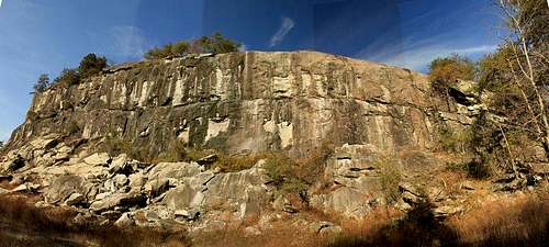
In times past, part of Rocky Face was subjected to quarrying. This part of the mountain now has artificial cliffs where rock climbing is allowed. Fortunately, the quarry was confined to one small part of the peak, and so most of the 400 acres of the park did not suffer.

Forests
In addition to rock climbing, the park has a short, but excellent series of trails. There are about five miles of trails in the Recreation Area, with a new trail under construction. These new trails were created by an Idaho firm and are exceedingly well engineered.
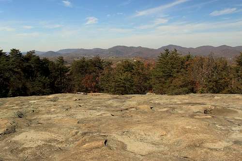
Views.
Getting There
From Interstate 40 in Iredell County, travel US 64 West approximately 14 miles. Turn right at stoplight on Millersville Road. Travel one-half mile to stop sign on NC 90 and turn left. Travel one-half mile and turn right on White Plains Rd. Travel to stop sign and turn right on Rocky Springs Road. Travel 1.4 miles and turn left on Rocky Face Church Road. Park is 1.2 miles on right.From Interstate 40 in Catawba County, travel NC 16 North toward Taylorsville and turn east onto US 64. Travel to stoplight at Millersville Road and turn left.Travel one-half mile to stop sign on NC 90 and turn left. Travel one-half mile and turn right on White Plains Rd. Travel to stop sign and turn right on Rocky Springs Road. Travel 1.4 miles and turn left on Rocky Face Church Road. Park is 1.2 miles on right.
From NC 16 North in Wilkes County, travel NC 16 South toward Taylorsville and turn east onto US 64. (Follow directions above from Millersville Road) From US 64/NC 90 in Caldwell County. Travel east onto US 64. (Follow directions above from Millersville Road)
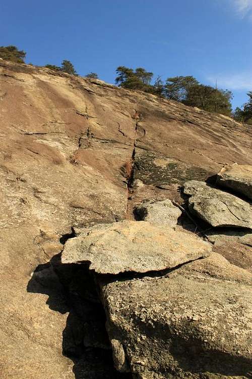
Exfoliation
Red Tape
Park use is confined to park hours. No camping.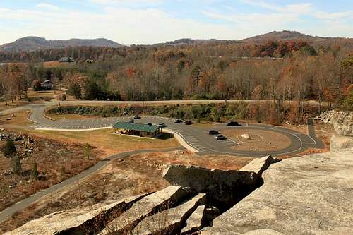
Facilities
Camping
There is no camping in the park. I am aware of no camping in the immediate vicinity.External Links
Rocky Face Mountain Recreation Area.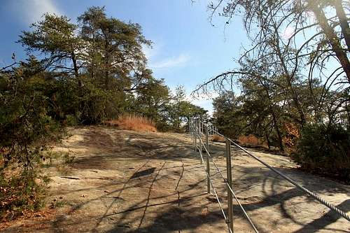
Trails.