Toggle navigation
Mountains
Routes
Images
Trip Reports
Forum
What's New
People
Areas & Ranges
Articles
Trailheads
Canyons
Huts & Campgrounds
Albums
Logistical Centers
Fact Sheets
Lists
Custom Objects
Gear
Plans & Partners
WELCOME TO SUMMITPOST
SIGN IN
REGISTER
Glockner GROUP
Additional Parents
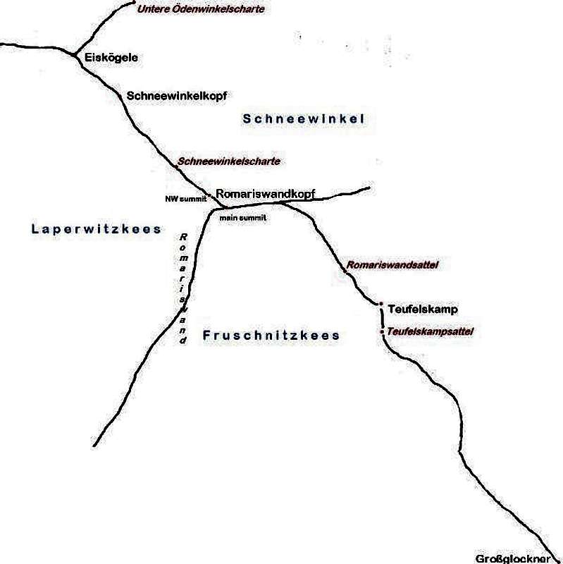
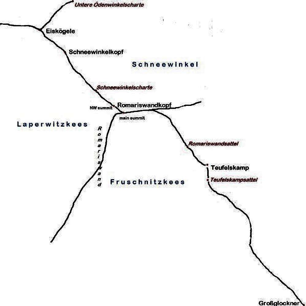
Romariswandkopf
Image
Romariswandkopf map
View High-Resolution Image
Romariswandkopf map
« PREV
NEXT »
rgg
on
Sep 19, 2011 11:53 pm
Comments & voting
Other parents
Lat/Lon:
47.09100°N / 12.66900°E
Image Type(s):
Topo/Diagram
Image ID:
747601
1551 Hits
72.08
% Score
2
Votes
Log in to vote
Comments
No comments posted yet.
to post!
Don't have an account?
Glockner GROUP
(Area/Range)
« PREV
Viewing
#154 of 177
GALLERY
NEXT »
rgg's Image Gallery
« PREV
Viewing
#4936 of 8665
GALLERY
NEXT »
Romariswandkopf
(Mountain/Rock)
Loading....
×
You need to login in order to vote!
User Name
Password
Remember me
Forgot your password?
Log me out when I close my browser.
Keep me logged in all the time.
sign in as a user
Don't have an account?
Register now for FREE
Rating available
Suggested routes for you
People who climb the same things as you
Comments Available
Create Albums
Register Here


