Toggle navigation
Mountains
Routes
Images
Trip Reports
Forum
What's New
People
Areas & Ranges
Articles
Trailheads
Canyons
Huts & Campgrounds
Albums
Logistical Centers
Fact Sheets
Lists
Custom Objects
Gear
Plans & Partners
WELCOME TO SUMMITPOST
SIGN IN
REGISTER
Cathedral Peak (Santa Barbara)
Additional Parents
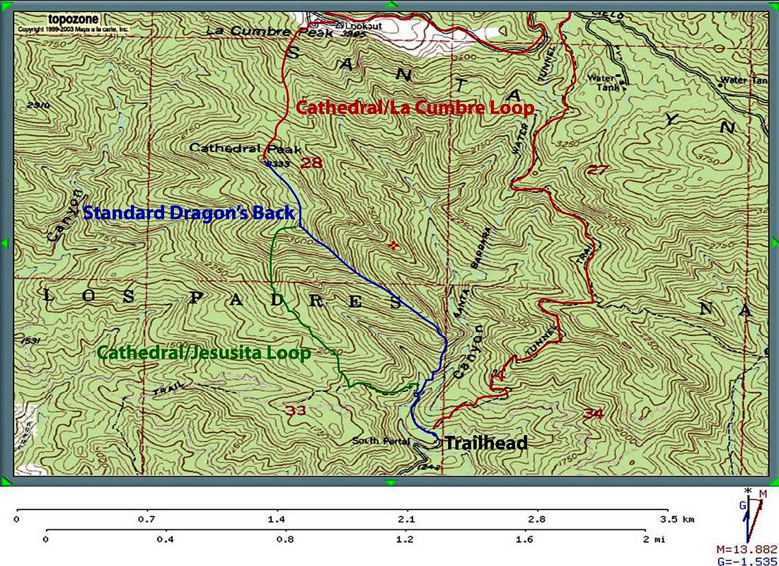
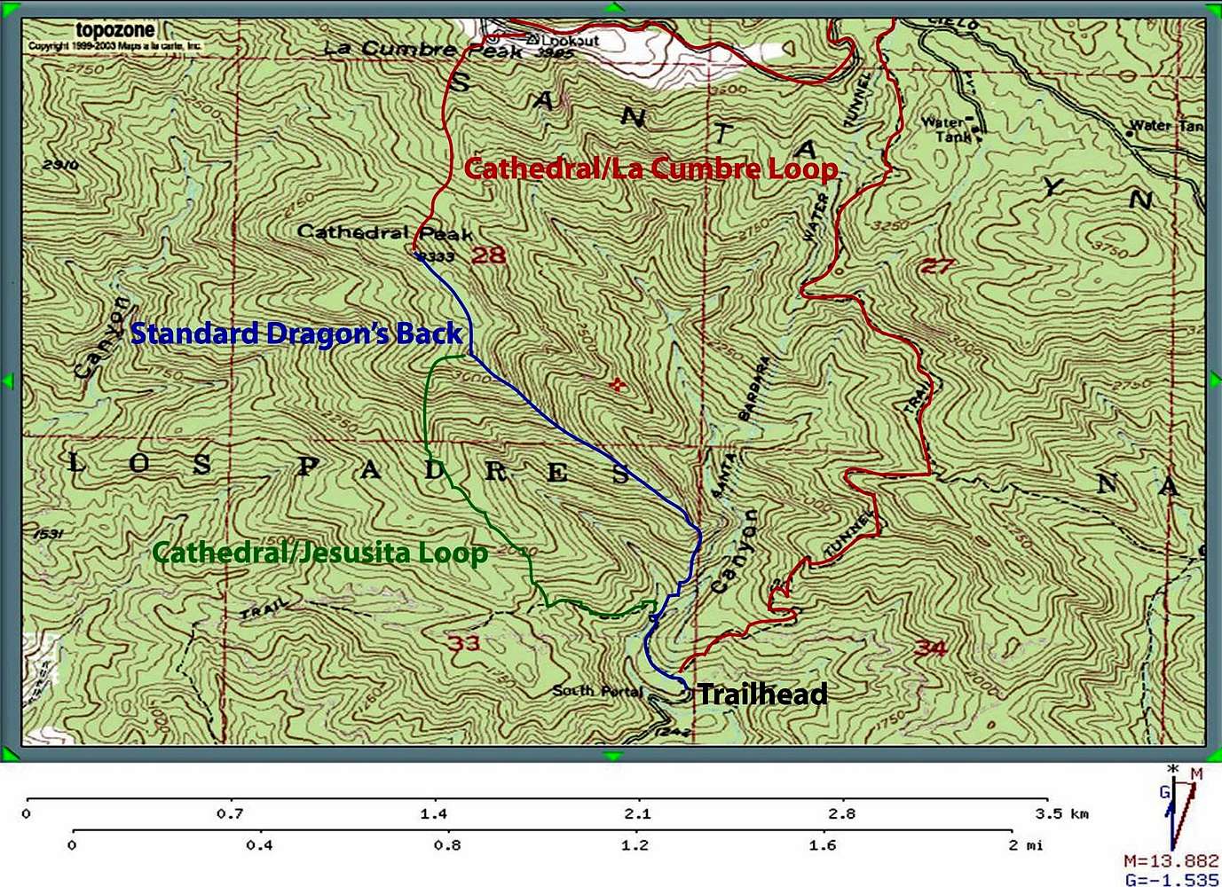
Image
Route Map for Cathedral Peak (Santa Barbara)
View High-Resolution Image
Route Map for Cathedral Peak (Santa Barbara)
Map from Topozone roughly outlining the three routes on Cathedral Peak.
« PREV
NEXT »
birdhead
on
Mar 20, 2006 3:13 am
Comments & voting
Other parents
Lat/Lon:
34.48600°N / 119.716°W
Image Type(s):
Hiking
,
Topo/Diagram
,
Informational
Image ID:
182145
14057 Hits
72.08
% Score
2
Votes
Log in to vote
Comments
No comments posted yet.
to post!
Don't have an account?
Cathedral Peak (Santa Barbara)
(Mountain/Rock)
« PREV
Viewing
#8 of 25
GALLERY
NEXT »
birdhead's Image Gallery
« PREV
Viewing
#29 of 42
GALLERY
NEXT »
×
You need to login in order to vote!
User Name
Password
Remember me
Forgot your password?
Log me out when I close my browser.
Keep me logged in all the time.
sign in as a user
Don't have an account?
Register now for FREE
Rating available
Suggested routes for you
People who climb the same things as you
Comments Available
Create Albums
Register Here


