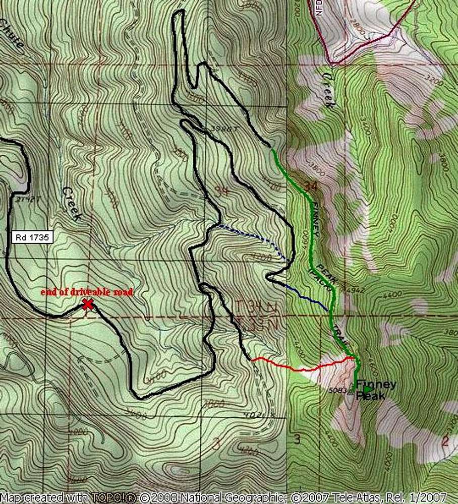
The black lines are the roads, although after the red "X", the road is no longer drivable and in some places is completely washed out and overgrown. The green line is the old trail, which is very difficult to find. The red is the route we took up to the slide chute. It is EXTREMELY thick brush. The blue line is the way we came back, which was much better. We were able to pick up the trail in the woods. The dotted blue line is the stream bed we took on the way down to cut off the road walk. It would be difficult going up.


