Toggle navigation
Mountains
Routes
Images
Trip Reports
Forum
What's New
People
Areas & Ranges
Articles
Trailheads
Canyons
Huts & Campgrounds
Albums
Logistical Centers
Fact Sheets
Lists
Custom Objects
Gear
Plans & Partners
WELCOME TO SUMMITPOST
SIGN IN
REGISTER
From Aqua Caliente Canyon
Additional Parents
Image
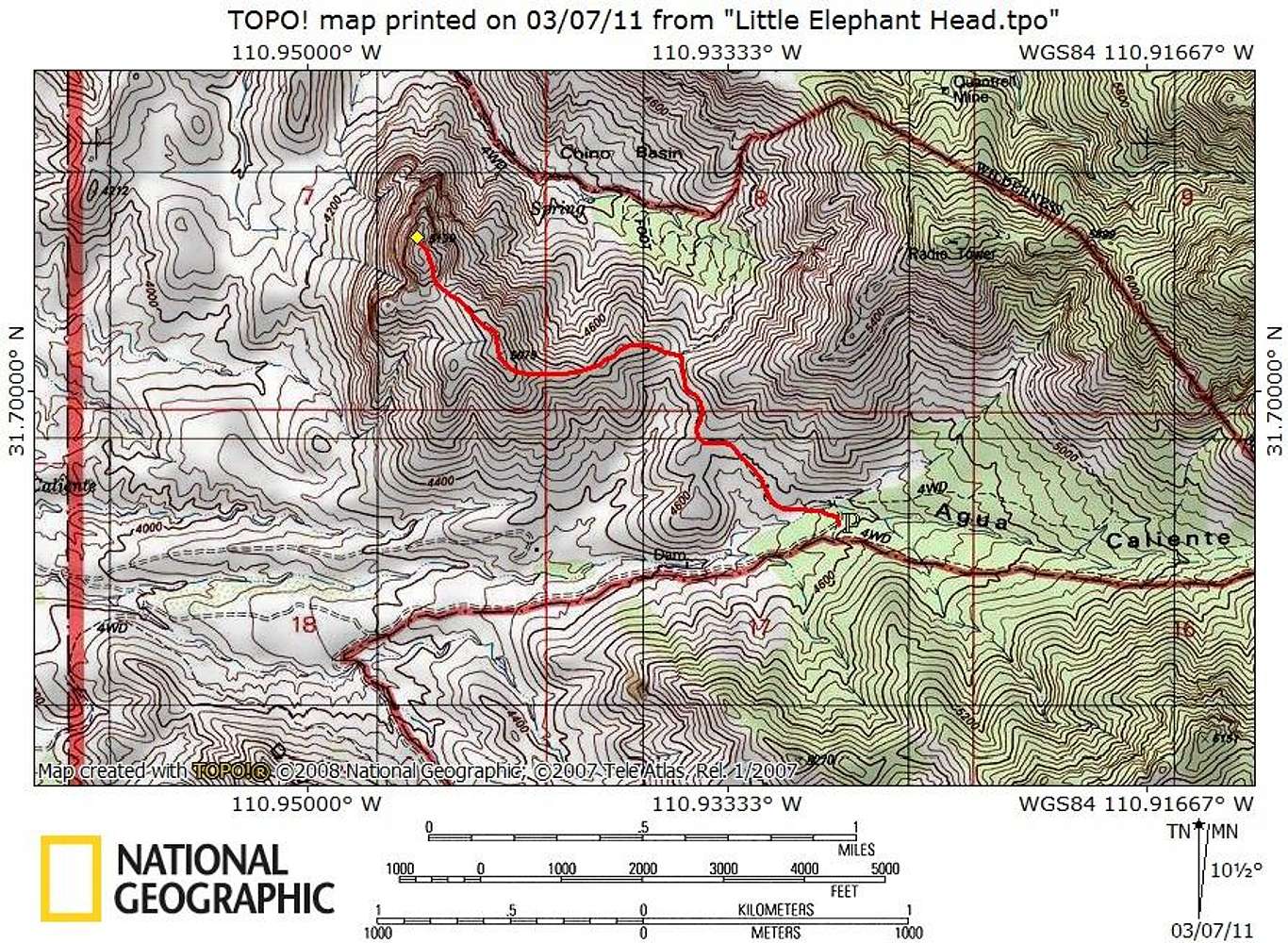
Route Map
View High-Resolution Image
Route Map
The trip starts in high grasses and scrubby trees, moves into rolling hills covered with Ocatillo and prickly pear and finishes on a bear rocky summit.
Map designed March 2011
« PREV
NEXT »
Sarah Simon
on
Mar 8, 2011 8:46 pm
Comments & voting
Other parents
Lat/Lon:
31.70520°N / 110.9455°W
Image Type(s):
Topo/Diagram
Image ID:
703345
1339 Hits
74.01
% Score
4
Votes
Log in to vote
Comments
No comments posted yet.
to post!
Don't have an account?
From Aqua Caliente Canyon
(Route)
You are at
the First
Image
Viewing
#1 of 15
GALLERY
NEXT »
Sarah Simon's Image Gallery
« PREV
Viewing
#1863 of 5480
GALLERY
NEXT »
×
You need to login in order to vote!
User Name
Password
Remember me
Forgot your password?
Log me out when I close my browser.
Keep me logged in all the time.
sign in as a user
Don't have an account?
Register now for FREE
Rating available
Suggested routes for you
People who climb the same things as you
Comments Available
Create Albums
Register Here


