Toggle navigation
Mountains
Routes
Images
Trip Reports
Forum
What's New
People
Areas & Ranges
Articles
Trailheads
Canyons
Huts & Campgrounds
Albums
Logistical Centers
Fact Sheets
Lists
Custom Objects
Gear
Plans & Partners
WELCOME TO SUMMITPOST
SIGN IN
REGISTER
Gray Wolf Peak
Additional Parents
Image
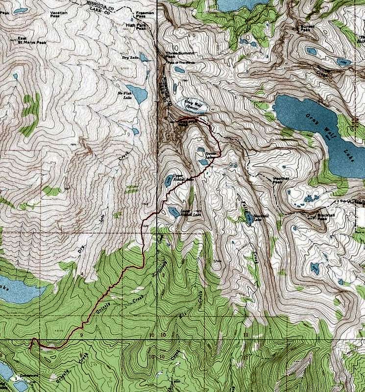
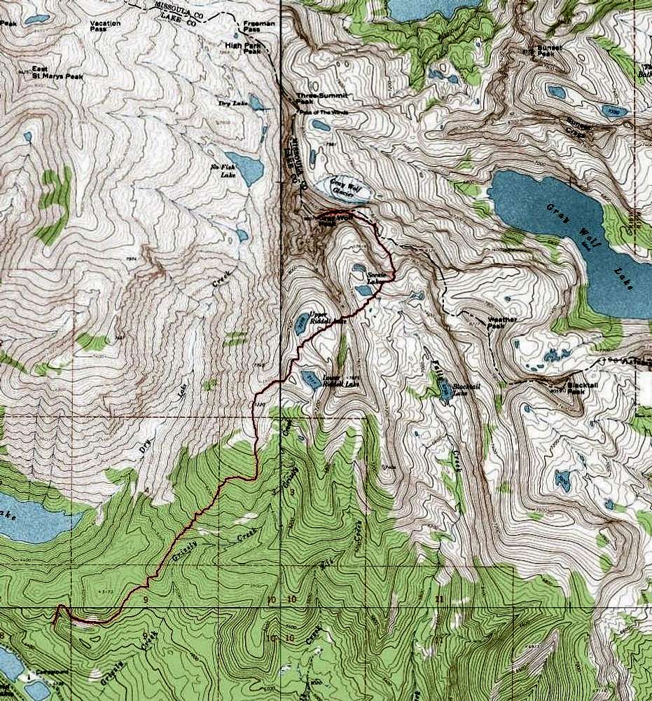
Route Topo
View High-Resolution Image
Route Topo
The Topo Map for the Gray Wolf Northeast Ridge Route. GPS recorded 10aug08. 5.6 miles
(one way)
5,435' gain
(round trip total)
« PREV
NEXT »
Michael Hoyt
on
Aug 11, 2008 12:48 pm
Comments & voting
Other parents
Image Type(s):
Topo/Diagram
,
Informational
Image ID:
430519
1714 Hits
71.06
% Score
1
Votes
Log in to vote
Comments
No comments posted yet.
to post!
Don't have an account?
Gray Wolf Peak
(Mountain/Rock)
« PREV
Viewing
#58 of 61
GALLERY
NEXT »
Michael Hoyt's Image Gallery
« PREV
Viewing
#1622 of 1801
GALLERY
NEXT »
×
You need to login in order to vote!
User Name
Password
Remember me
Forgot your password?
Log me out when I close my browser.
Keep me logged in all the time.
sign in as a user
Don't have an account?
Register now for FREE
Rating available
Suggested routes for you
People who climb the same things as you
Comments Available
Create Albums
Register Here


