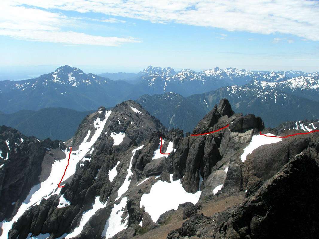
Here's a view of the Mount Constance South Chute route from the summit. The route starts on the left where you come over the South Chute notch. After descending 175', it turns left, up another scree slope. The
scree ascent route isn't visible from the summit, hidden by the E-W ridge. Next you can see the route again when it comes
through the notch in the East-West ridge. After a 75' descent, the route goes west and back east, and is again obscured until popping out between the
buttress and large rock, heading N-NW toward the Finger Traverse (FT). After following the ledge N-NW, we went left (out of this view) to avoid the FT. The FT bypass route drops over to the West side of the ridge, before rejoining the FT route at the
snow field right (north) of the FT. The gap in our route on the right is the FT, and the
Terrible Traverse is bottom-center. July 13, 2008


