
|
|
Route |
|---|---|
|
|
38.64970°N / 78.3175°W |
|
|
Rock Scramble - Bushwhack |
|
|
Less than two hours |
|
|
Class 2-3 Bushwhack |
|
|
Overview
Mary's Rock offers a couple very nice trails to its rocky summit. Both offer some opportunity for some boulder hopping. Yet, the East face of Mary's Rock has an even more compelling trek up Mary's Rock. Boulder fields rise from Skyline Drive, just begging to be climbed. So, one day in January 2005, that is just what I did. The rocky area of Mary's Rock is visible from the Valley
The reason for waiting until January was that Shenandoah National Park was dry that year, and there wasn't too much snow. I wanted to avoid poison ivy and overgrowth on the route.
Overall, I would say this route is especially fun, and is something different than the normal hikes you'll find in Shenandoah National Park.
Approach
Follow the directions to Skyline Drive. Once you get onto Skyline Drive, take it South for about 1 mile. Just after MP 32, you will see a tunnel. Go through the tunnel and park at the Tunnel Parking Overlook (2510'). From here, you will see the large boulder fields.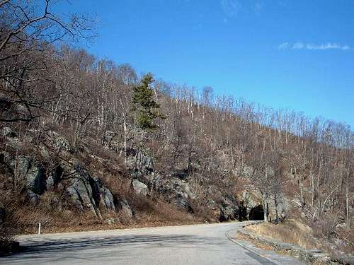 The tunnel
 |  | 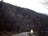 |
Route Description
From the overlook you will see boulder fields across the way. This is how you will get up to the summit of Mary's Rock.The first step is finding a cross-over point to the right side (mountain side) of Skyline Drive. While it is tempting to head straight up the side, the best access point is actually over the tunnel. What you should do is to stay on the other side of the road. Head to the right side of the tunnel, which is basically part of the mountain. Walk over the tunnel, and head left (south). Soon, you will find some stable boulders that go straight up the mountain. The difficulty varies from Class II to Class III. Follow these for about 15-20 minutes and you will reach the Appalachian Trail.
 Boulder field straight up the mountain
From here your adventure can end, and you can take the AT to the summit, or you can continue up the rocks. The boulder fields dissipate at this point, so you will have to bushwhack to get to the summit. If you choose to bushwhack, you want to head left and up, which is the only way to reach the summit.
As for the descent, I recommend taking the Appalachian Trail down until you reach the big rock with a crack in it (see photo below). From there, you can then descend the rocks back to your car. Head right (north) to get back to the tunnel.
This route will certainly test your endurance and your routefinding skills.
Be careful, and be smart, and you will have a great time!
Elevation Gain: 1,004 feet
Round Trip Hiking distance: 2.5 miles
Time to climb to the summit: 45 minutes - 1 hour
 The cracked rock
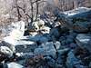 | 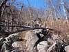 | 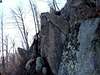 |