
-
 4279 Hits
-
 74.92% Score
-
 5 Votes
|
|
Route |
|---|---|
|
|
40.58510°N / 111.6011°W |
|
|
Winter run |
|
|
Half a day |
|
|
Intermediate backcountry |
|
|
Approach
This winter route may be used for ascending the summit off Brighton or Solitude Nordic Ctr parking lots via Lake Mary, but is best saved for descent. Therefore, the recommended starting point is the summit of Wolverine, or a lower section of the ridge immediately to the South-East.Route Description
To keep the descent easy, proper routefinding is essential, as the most logical directions of downhill travel eventually cliff out, and although there are very passable chutes through the cliffs, these chutes might not be safe or enjoyable at all times.General topography
The East bowl is separated into two half-bowles by a line of fir trees dropping from the ridge short way ESE of the summit. Thus, the Northern half-bowl is immediately below the summit, and the steeper Southern half-bowl abuts the ridge connecting to Tuscarora. Alexis Kelner's guidebook suggests that the line of trees separating the bowl offers some avy protection, but the grade is also a bit steeper over there.
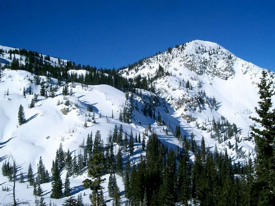
The two half-bowls drain into Lake Mary. Both gullies mellow out in the woods below, then both cliff out right above the lake. The Northern (i.e. left or main) gully ends up in very narrow steep chute. The Southern i.e. right gully ends up in a more manageable chute. The exits of the cutes are next to one another atop a moderately steep treeless slope dropping to Lake Mary (as seen on the right).
The chute-less routes are found further South of the Souther gully
To keep it easy...
 follow these directions: cross the line of trees separating the half-bowls at (or not far below) a break in the line clearly visible at the photo on the right. Keep right, continue dropping to the Southern bowl, cross the flats under a prominent rocky knob on the spur ridge of Tuscarora. Keep slightly right (do not follow the gully draining the not-so-flat flats). Just around the corner, you will see an inviting gully-slope which would get you down to Lake Martha (it's down the center of the photo on the right).
 If you prefer a direct descent to Lake Mary instead, then stay left of the Lake Martha gully. Literally in a hundred yards, you will find the second wide gully, which will get you to Lake Mary.
From the lakes to the road
Just keep in mind that the gentle ridge on NE side of Lake Mary (behind the dam and to its left) hides steep cliffs on its other side. You may prefer to keep right of the dam, or left of the NW corner of the lake, or to glide along the ridge separating Lake Mary from Dog Lake.