
-
 5366 Hits
-
 73.06% Score
-
 3 Votes
|
|
Route |
|---|---|
|
|
39.39940°N / 106.138°W |
|
|
Hiking |
|
|
Most of a day |
|
|
Class 2+ |
|
|
Overview
Drift Peak can be climbed for this alternate route from the east side. The route is steep and loose, but does provide a reasonable opportunity for a combination with Fletcher Mountain. I climbed this route in August, but imagine there is the potential for this gully to provide an interesting snow climb in spring.Approach

Access to this route is is via the Blue Lakes Dam Trailhead. Park at the dam and walk around the right (north) side of the lake. There are some sections of climbers trails here to aid with the willows. The standard route for Fletcher follows a drainage to the right, continue instead around the lake to its western shore. The slopes on the western side of the lake are mainly grassy with some willows mixed in as it follows Monte Cristo Creek. Ahead you can see Wheeler and the connecting ridge to Drift. Above you to your left is North Star. Follow Monte Cristo Creek as it turns to the north towards Drift at approximately 12,200'. As you get closer to Drift identify a southeast facing gully that leads to a point between the true summit and a 13,880' false summit on the right. The base of this gully is the start of the climb.
Route Description
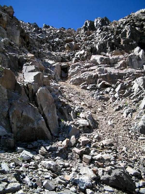
Begin to ascend the scree and dirt filled gully (13,200'). The center of this gully can be quite loose in some places. The gully steepens from 13,400' to the notch. The rock on the right and left side is a little more solid and provides some light scrambling. We actually split our party so that we each went up opposite sides and avoided having to climb below one another. Continue to climb up as the gully becomes more defined. Towards the top, the scree begins to turns more to dirt. From the notch head left (south) to the summit of Drift Peak. You can descend this same way or connect to Fletcher. It is also possible to connect to Wheeler, a trip report is here.
Essential Gear
Larger parties may wish to wear helmets. There is a lot of loose scree in the gully.Spring may provide for a reasonable snow climb, an axe and crampons would be recommended.
Traverse to Fletcher
Note that this traverse is described in reverse of our climb, we climbed Fletcher first.
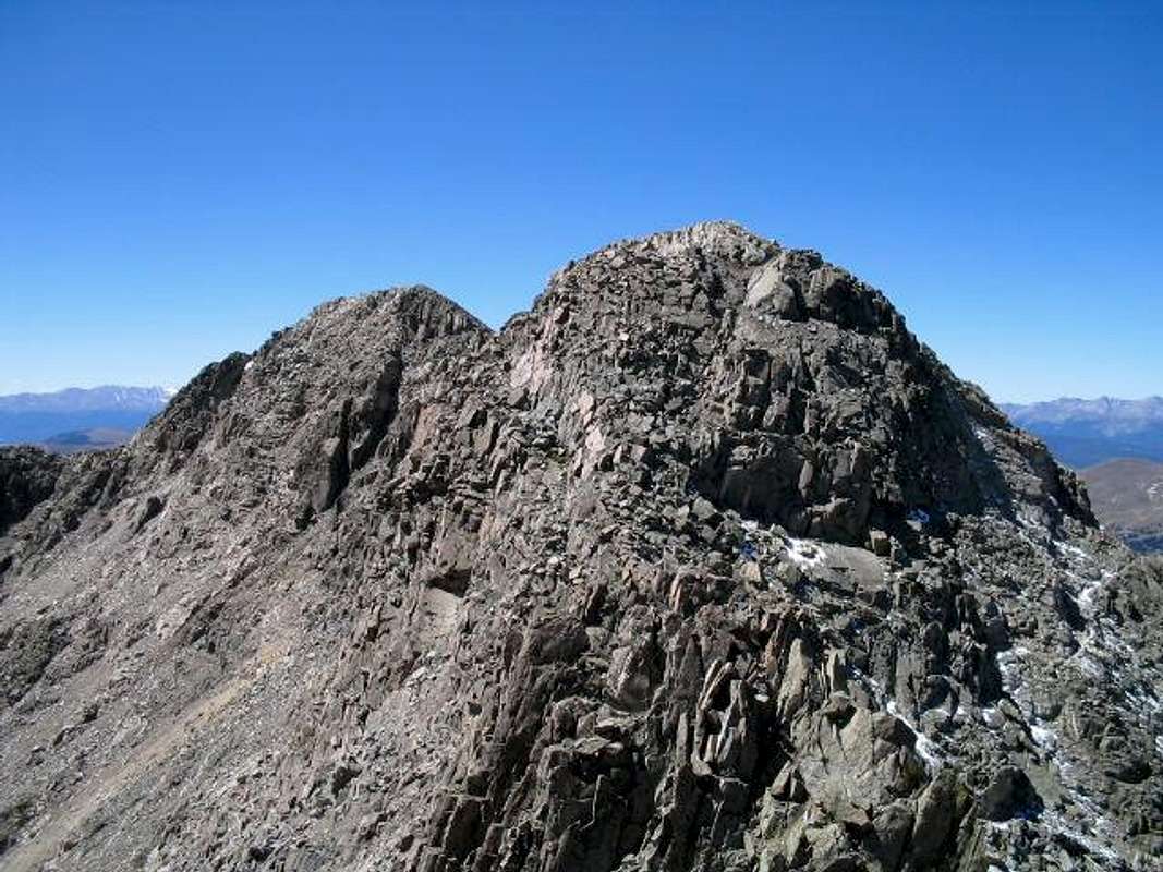
From the summit of Drift, head northeast along the ridge, across the notch and over a false summit at 13,880. From here descend on the right side to a pronounced notch. Further passage is guarded by a large rock step. Instead head to climbers left through the notch and descend 80-100 feet of class 3 terrain. This gully may hold snow late into spring, when we climbed in August there was actually 3-5 inches of fresh snow. At the base of this section continue climbers right to a small class 3 rib and upclimb the rib. The route eases here and you may find climbers trail as you work around a large rock tower to the Fletcher-Drift saddle at approximately 13,620'. Ascend class 2 terrain to Fletcher's summit and then descend the standard route on Fletcher back to Blue Lakes Dam.
 |  |