
|
|
Route |
|---|---|
|
|
19.47550°N / 155.6055°W |
|
|
Hiking |
|
|
Spring, Summer, Fall, Winter |
|
|
A few days |
|
|
Class 1+ |
|
|
Overview
The Mauna Loa Trail is the longest, but interestingly, the most popular trail on the mountain. The trail is long, but not overly steep or difficult. It can be hot since there is no shade available for much of the route, and it is almost always cold on top. There are two cabins to stay in along the way.
If you are staying overnight on Mauna Loa (which almost everyone would have to), you are required to register at the Kilauea Visitor Center, where you will receive the latest information about the cabins, water, weather number of people on the trail, etc.
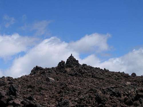 The true summit of Mauna Loa.
Trail Closure
As of right now the trail is closed above Red Hill due to the 2022 eruption.
Check below for updates:
Mauna Loa Updates
Getting There
To get to the trailhead, located the signed road off Highway 11 not far west of the visitor center. Drive for 11.5 miles and park. In February 1995, we waited about an hour for a ride up to the trailhead. Hitching is possible, but can be slow.
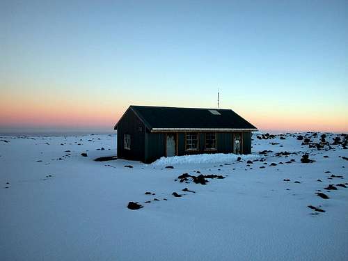 Summit Cabin
Route Description
From the trailhead (elevation 6660 feet), locate the signed Mauna Loa trail and a gate. The trail isn’t too steep and it is 7.5 miles to Red Hill Cabin. There are some small trees at first, but the higher you go, the more barren it becomes. Timberline is at 8800 feet. This section of the trail is often misty, but if the sun is out take care, as the sun reflecting of the rocks can sunburn you in minutes (this is where I received my worst sunburn in my life!). Many lava tubes are passed along the way.
Make sure to stop at the Red Hill Cabin (elevation 10,035 feet) as there doesn’t seem to be many campsites at all along the entire route. The cabin is seldom crowded, and we had it all to ourselves on a holiday weekend. Unless it has been a very prolonged drought, there should be water available at the cabin stored in a rainwater tank.
The next leg of the trail is 11.8 miles long and ends at the Summit Cabin (which isn’t on the summit-see below). The trail is much like the one to Red Hill, but more volcanic cones are passed along the way and this section of the trail is longer.
After 5.6 miles from the cabin, and at an elevation of 11845 feet, there is a signed spur trail for a waterhole. The water is almost always frozen, or at least has ice on it. Continuing on the main trail, you will reach a junction 9.5 miles from the Red Hill cabin and near the crater rim. The left branch leads to the Summit Cabin, and the right branch to the true summit.
If you turn left, you will reach the Summit Cabin after 2.1 miles. If you turn right, you will reach the true summit after 2.5 miles. Most people stay at the summit cabin and hit the true summit on the way down. The cabin itself is at 13,250 feet and usually has rainwater. There is also ice (permanent) in a crack just south of the cabin in case the watertank is empty. Usually the Summit Cabin is a fine place to stay and is usually sunny, but way above the clouds. It is chilly up here year round, so bring warm clothes.
Total round trip distance is 43.2 miles assuming you visit both the summit cabin and the true summit, and usually takes 3-4 days. Four is recommended.
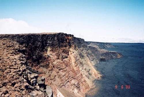 Mokuaweoweo caldera from Mauna Loa summit
Essential Gear
A good pair of boots is needed.