
|
|
Route |
|---|---|
|
|
47.05375°N / 12.28855°E |
|
|
Hiking, Mountaineering, Scrambling, Skiing |
|
|
Spring, Summer, Fall, Winter |
|
|
Half a day |
|
|
Medium hard marked route. |
|
|
Getting There
For this approach you have to follow the road until Matrei, then the Virgental to the end of the valley to the village Streden, 1403m where there is a parking place. You have to pay 3 euros for one day or 9 euros for one week.From the parking place you must reach the hut Essener-Rostocker, 2208m over the long valley Maurer Tal. The route is well marked. You will need from 2-3 hours to the hut.
Route Description
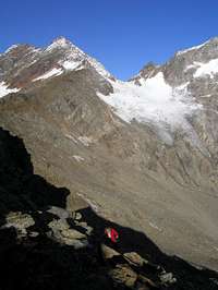 The north approach.
From the hut you follow the signposts for the marked route number 920 in the west direction. First you walk on the narrow ridge, an old glacier moraine just above the hut. You cross a long slopes and soon you start ascending over the steep north slopes over big rocks to the summit ridge. Be careful because it could be icy. You reach the summit ridge and you have some 20 meters to the main summit.
You descend by the same route or by the Carl Bremer Weg.