
-
 17293 Hits
-
 80.49% Score
-
 12 Votes
|
|
Route |
|---|---|
|
|
48.71043°N / 113.68934°W |
|
|
Mountaineering |
|
|
Summer, Fall |
|
|
Half a day |
|
|
Lunch Creek Route
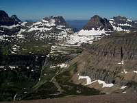 Logan Pass from Piegan Route
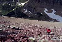 Lunch Creek Scree Fields
|
|---|
Overview
The most direct route to the Piegan and Pollock Saddle which give access to Piegan, Pollock and The Bishops Cap.To the summit of Piegan the Lunch Creek route is about 2 miles in length and has an elevation gain of 2,800 feet.
An up-to-date guidebook for this route can be found in Climb Glacier National Park, Routes for Beginning and Intermediate Climbers; Volume 1: Logan Pass, The Garden Wall, and Siyeh Bend. Purchase it when you arrive in northwestern Montana or purchase it on-line at Climb Glacier National Park.
 Logan Pass Logan Pass |
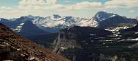 Jackson and Blackfoot Glaciers Jackson and Blackfoot Glaciers |
 Heavens Peak Heavens Peak |
The Views
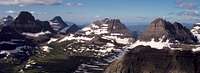
 Siyeh from the summit of Piegan
 Heavy Runner Mountain from Piegan
 Reynolds Mountain from Piegan Mountain
Getting There
 Piegan Route
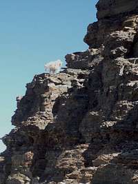 Mountain Goats on Piegan Mountain
 Piegan-Pollock Saddle and Pollock
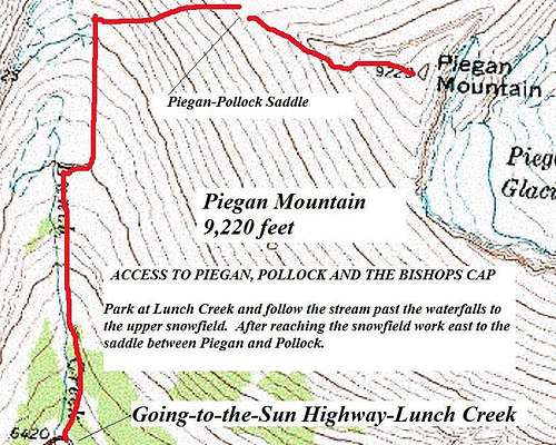 Route Topo
In his Guidebook, A CLIMBER'S GUIDE TO GLACIER NATIONAL PARK, J. Gordon Edwards suggests this route for descent from Piegan Mountain on pages 296-297.
Lunch Creek is the first stream crossing on the east side of Logan Pass.
It is a short 10-15 minute walk down from Logan Pass if the shuttle is taken. There is ample parking for private vehicles at Lunch Creek as well.
For other information on Red Tape, Links, Glacier's Shuttle System and an Overview of Piegan Mountain please see the Piegan main page.
Route Description
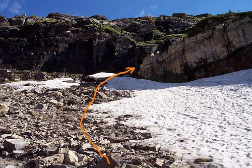 Route Past Large Waterfall
The goal is to reach the saddle between Piegan and Pollock.
It is necessary to navigate through the maze of climber's trails (stay near the creek) at the bottom of Lunch Creek. Following the creek affords easy walking along the climber's trail to the large waterfall. Climb the cliffs just east of the waterfall (see photo on this page). Continue up the basin to the upper snowfield. Upon reaching the upper snowfield scramble through easy class 2 cliffs to the saddle between Piegan and Pollock.
A climber's trail leads towards the Piegan summit for a short way and then fades as it reaches class 2 gullies which lead to the summit.
Please note: This is a pretty basic route with many options. The cliffs above the basin can be climbed pretty much anywhere with little difficulty. It may be easiest to follow the route suggested by Edwards.