
|
|
Route |
|---|---|
|
|
40.08220°N / 107.0964°W |
|
|
Hiking |
|
|
Spring, Summer, Fall, Winter |
|
|
Most of a day |
|
|
The Dry Feet Route
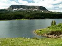 Beside Stillwater
 Northwest summit
I always steer away from swampy areas in early summer. And that was my first reason for using this route. The route follows a popular trail from Stillwater Reservoir to the portal of Devils Causeway, and then turns away from the Causeway, toward Orno Peak. It is not the shortest route to the summit, but it is doable as a day hike. You will hike for miles, crossing the full length and breadth of the vast summit plateau. The scenery is other-worldly, and highly recommended!
For information on the Devils Causeway, see the External Links section, below.
Although 98% of your hike is in Garfield County, this route description includes the Rio Blanco County high point which is on Orno Peak's northwest arm. Orno Peak's true summit is in Garfield County, 2 miles away on the east arm. The round trip distance, including both high points, is 19 miles. But they are fast miles and easy miles because most of them cover flat terrain. Figure on 7 hours hiking time, plus stops.
Getting There
 Getting to Devils Causeway
Camping is not permitted at the parking area. Consider camping on a level area on the summit plateau. It would be a heavenly experience in decent weather. Alternatively, make camp at one of the developed campsites along the forest road.
The Route
 View from Devils Causeway
Follow a good trail along the north side of the reservoir. After 10 minutes of level hiking, turn right (north) at the fork in the trail, leaving the reservoir behind. This trail junction is signed. Follow the trail north by northwest as it gradually elevates you past a swampy area and then past Little Causeway Lake at 10,750'. At mile 2.0, the trail steepens, elevating you to the saddle between Devils Causeway on your left, and the long Orno Peak plateau on your right. This is at mile 2.4. Up to this point you will encounter plenty of traffic, but from this point on, you may have the entire mountain to yourself.
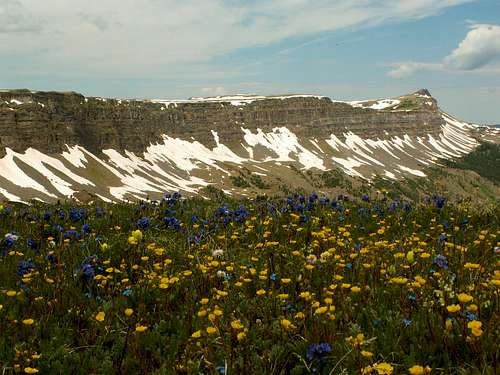
 Looking across the summit plateau
Immediately as you crest the saddle, look for a break in the willows to your right. The willow thicket lasts for only a few minutes. Try to find a trail across the summit tundra. The trail will minimize the number and the severity of the stream crossings for you, but even without the trail, you should have no trouble. Simply hike north across the vast plateau. It is flat but not level. Numerous, shallow stream crossings punctuate the route, but you should be able to keep your feet dry unless it rains on you all afternoon, as it did on me. Watch for coyote, deer, ptarmigan and many other bird species. You will have plenty of time for contemplation, praying, and bird watching as you hike along the plateau.
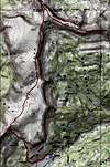 map
mapSet your heading NNE for Mandall Pass, which does not become visible until you are very close to it. See topo map. You will be walking near the east rim much of the time. From Mandall Pass, it is a short 0.7 mile hike north to the high point of the Orno's northwest ridge extension. This is an important waypoint if you are into county high points. The register there was signed five or six times in 2008, but my July 2 visit was the first sign-in for 2009.
Next, head southeast to the true summit of Orno Peak. It is 2 miles away as the crow flies, but more like 2.2 miles hiking distance.
Return via Mandall Pass and the long trek back south across the summit plateau.
Essential Gear
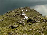 Exposure to the elements
Rain gear is essential - you are utterly exposed to thunderstorms for hours on end. Leave your lightning rod, er uh, ice ax, at home.
External Links
Devils Causeway on coloradohiker.comDevils Causeway on rockymountainscenery.com
Devils Causeway on summitpost.