
-
 49812 Hits
-
 84.67% Score
-
 21 Votes
|
|
Mountain/Rock |
|---|---|
|
|
42.35450°N / 122.7857°W |
|
|
Hiking |
|
|
Spring, Summer, Fall, Winter |
|
|
3573 ft / 1089 m |
|
|
Overview
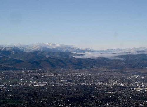
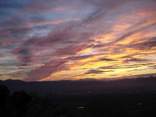
Roxy Ann Peak is located in a City Park in Medford, Oregon. The peak is east of downtown Medford and rises about 2,200 ft above the city. The views from the summit are not only great for the City of Medford and the Rogue Valley, but also for many peaks that surround the valley. Some of the summits visible from Roxy Ann Peak include: Mt. Shasta , Pilot Rock , Mt. Ashland , Wagner Butte , Grayback Mountain , Mt. Thielsen , Crater Lake Caldera , Mt. McLoughlin , Brown Mountain , Aspen Butte , and Soda Mountain .
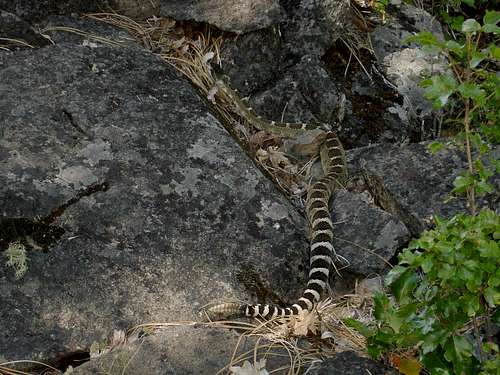
Roxy Ann Peak is an old dormant volcano that sits in the middle of the Rogue Valley. The slopes are tree and brush covered. The lower south and west slopes are being developed as high dollar residential areas for the City of Medford. Roxy Ann Peak sits in the center of Prescott Park and this park has been left with natural vegetation. There is a good access road and there are some trails in the upper part of the park. Cougars, bears, deer, and rattlesnakes have all been seen in the park. Roxy Ann Peak was named for the wife of an early pioneer family who owned property on the slopes of the mountain. Prescott Park was named for Constable George J. Prescott who was shot in the line of duty in 1937. The park today covers 1,720 acres.
The Willamette Meridian passes nearby for you surveyors and geography buffs. Prescott Park and Roxy Ann Peak are popular recreation areas frequented by local hikers, bikers, dog walkers, and horse lovers. Except during inclement weather, there are usually other people enjoying themselves outdoors in the Park. Once you get to a trailhead, there are many different routes and trails to follow to get to the summit of Roxy Ann Peak. Consult the Route Descriptions for that information. I’ve combined all the routes and trails into one long hike just for training purposes.
Getting There
Finding Roxy Ann Peak is easy. It is the volcano you can see on the east side of the City of Medford. Interstate 5 bisects Medford. Take either exit from I-5 and follow one of the options below. Option 1: Take the north I-5 exit (exit 30) and head north towards Crater Lake National Park on Hwy 62. At the second signal (about 1 mile from I-5) turn right on Delta Waters Rd. Roxy Ann Peak is straight ahead at this point. Stay on Delta Waters until it ends (about 1.8 mile) at Foothill Rd and turn right. Go 1.3 miles to East McAndrews Road, go under the bridge and turn right on the clover leaf to go east on McAndrews. Option 2: Take the south I-5 exit (exit 27) and head east on Barnett Rd. Stay on Barnett, pass the Rogue Valley Hospital, and at the signal at the intersection with Foothill Rd, turn left (about 2.0 miles from I-5). Go 2.0 miles to East McAndrews Road, turn left before the bridge onto the clover leaf that will take you east on McAndrews Road. Once you are on East McAndrews Rd heading east towards Roxy Ann Peak, go 1.6 miles to where McAndrews ends and Hillcrest continues up the hill. Go another 1.0 miles and turn left on Roxy Ann Rd.
Red Tape
No Red Tape here. There is a curfew. The lower gate closes at 5:00PM in the winter and 9:00PM in the summer. You can walk the area 24 hours a day if you want because it is a city park.
Camping
No camping is allowed in the city park. I’m sure you could find a place to stealth bivy up here if you were so inclined and didn’t bother the neighbors.
When to Climb
The park is open all year round. In the summer an occasional thunderstorm may keep you off the peak. In the winter some of the storms may force you to stay off the peak also.
Mountain Conditions
You can usually see the summit of Roxy Ann Peak from the City of Medford . For a weather report, follow this link: Medford Weather When it is foggy in Medford, it is usually clear and beautiful on Roxy Ann Peak. These are some of the best days to hike on the peak.