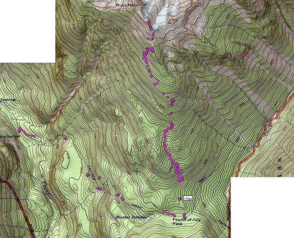
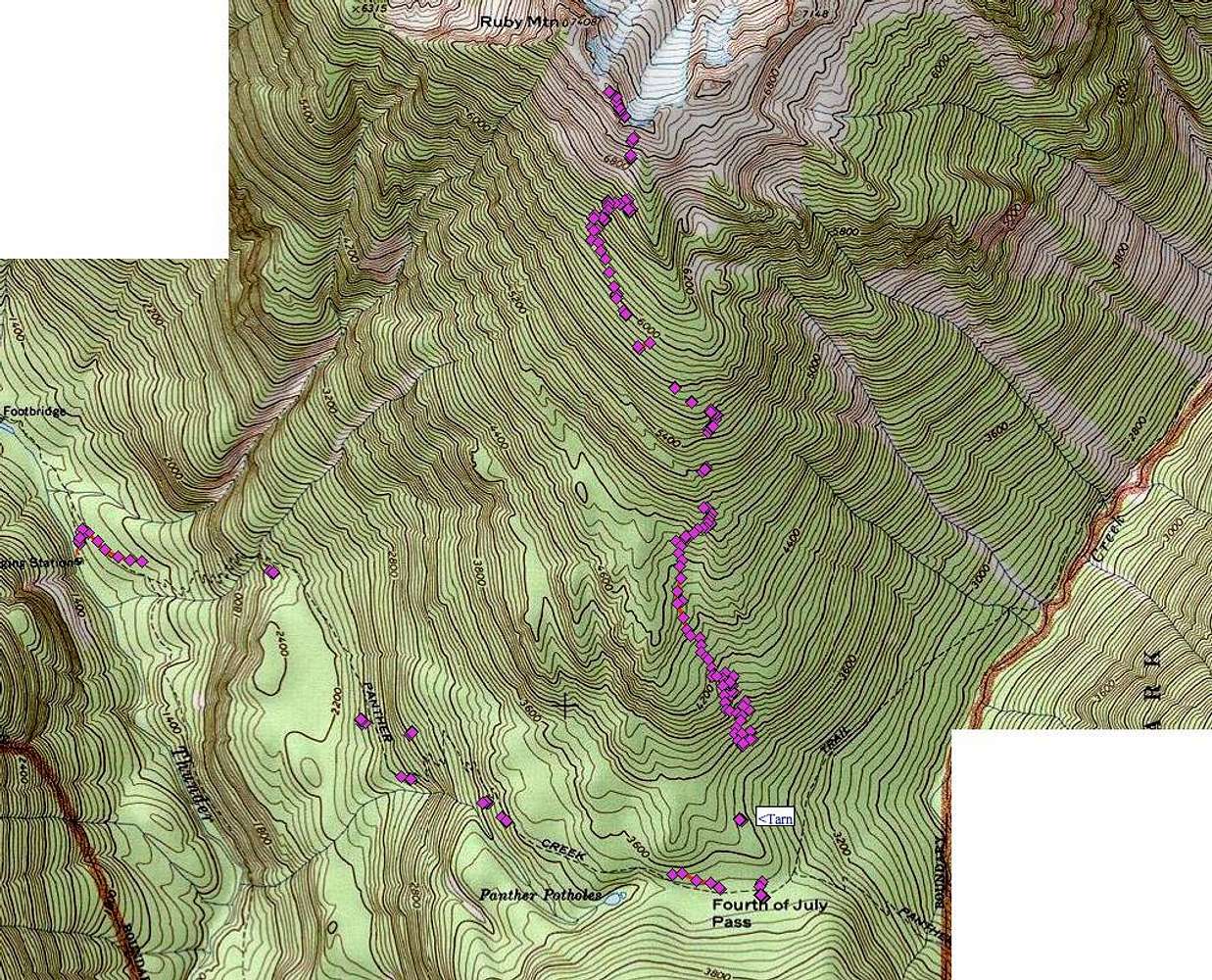
This is a series of waypoints taken by my GPS while tracking the fading trail up Ruby Mtn. These are not exact and are intermittent but hopefully this gives a sense of where the trail is generally at. Of course, you'll still have to do plenty of sniffing around to follow it in places on its various twists and turns. The cluster of waypoints at 6600' marks where it seemed to fade out completely and we just headed right for the ridge from there and easily walked the ridgeline. A switchback at 3880' or so proved to be the trickiest spot and this is where we lost it on the way down by mistakenly following flagging that continued ahead rather than cutting back to the left. Basically, we were able to follow it the whole way down. You could do this peak certainly without the trail but it makes things faster and easier.


