
Comments
No comments posted yet.
|
|
Trip Report |
|---|---|
|
|
40.64291°N / 115.42063°W |
|
|
May 29, 2021 |
|
|
Mixed |
|
|
Spring |
This unofficially named peak is known to catch the eye of many who take the scenic byway into Lamoille Canyon. Such has been the case for me since living in the area, now for a little more than two years. In some circles this peak is known as "Ruby Spire," though it is difficult to find any literature referring to such a name anywhere. It is also unlikely that you'll ever hear anyone discussing this peak since the Ruby Mountains are much more well known for Ruby Dome (the range's high point), Mount Gilbert and other more popular peaks in the region.
The below journaling and commentary describes some of the adventure.
"On road. Thick cirruses over Rubies. Seem likely to burn off later. 43-degrees Fahrenheit."
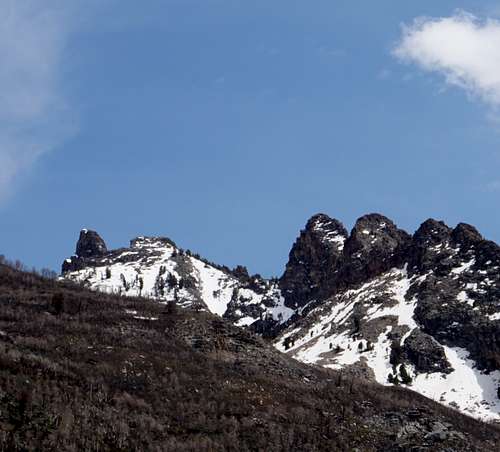
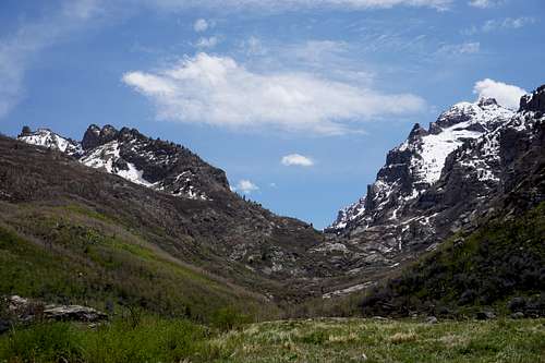
The clouds were more likely nimbostratus or altostratus. I stopped to snap a picture before turning down the road to Camp Lamoille where the trailhead is. You can see the "Ruby Spire" below. It is the far-left peak in the picture. The goal would be to head up the sloping ridgeline that is going from right to left in the picture. This would be possible by taking the canyon's right-fork trail and then heading through some light brush to begin ascending the mountainside.

"Start"
After organizing the gear a little better, the hike began. Some RV's and "fifth wheels" sat silently in Camp Lamoille as I passed. Nobody was up yet. The sound of rushing water was everywhere from farther up the road to here and down to the mouth of the canyon where the ranch land begins. I passed the sign that says "Trail," and then minutes later I carefully crossed the rickety, foot-and-a-half-wide bridge that spans five to ten feet of rushing water. The bridge is due to be replaced or at least reinforced, I thought as it bowed beneath my weight.
"Turning onto mountain east of Mt. Gilb. Light clouds. Perf temp."
It didn't seem like I'd been hiking for more than an hour. That was approximately two miles so far after some steady hiking and a few small breaks on the way. It was important to conserve my 2.5 liters of water for when the breathing got heavier.
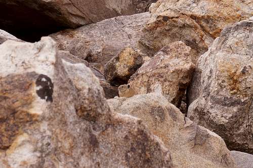
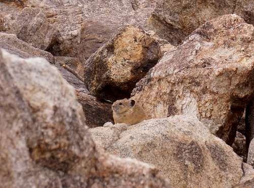
"Takin 5 approximately 300m [vertical] from what I believe should be peak. A nearby pika has warned others w/ its call. Seemingly a gentle haze lingers in the main canyon. The light sweat on my temples creates a burning sensation. A chipmunk shuffled by five feet to my left. Nobody is visible on the trail far below, though I can see the campers near the trailhead. A bird let out a wild call that echoed. Thick cirrus or even cumulous are slowly drifting east. The nearby dark orange-brown trees are naked, victims of the '18 fire even at this alt of approx 9000' (~3000m)."
A morning pika watching me from the distance.
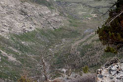
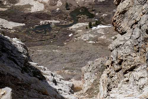
The territory below with Camp Lamoille toward upper-right of picture.
"Reached first knob that I believe is noticeable from road. Wonderful scrambling w/ little snow so far. Still overcast, making it perfectly cool/warm. I believe I've two more peaks to hit before the actual spire. We'll see."
It was a nice feeling to experience part of the area I'd looked up at so many times from the road and from other mountainsides within the canyon.
"It's disappointing to report that I've reached an impasse along the ridgeline. The north side is simply too difficult to traverse due to unpleasant-looking angles and snow with a very steep drop-off below that area. If I were able to surpass that I could potentially, probably make an easy go at the spire. Now I'll attempt dropping down and ascending this north flank if reasonable today. Weather remains overcast and maybe 65F. No wind at all. Saw a tick on me earlier."
The Spire stood on the other side of one more pinnacle along the ridge. I made it to the top of this second-to-last one in the following pictures, though I regreftfully didn't photograph the final pinnacle between The Spire and me because my gear was down below. The scrambling had become climbing, and the 30-pound pack became too unwieldy to deal with.
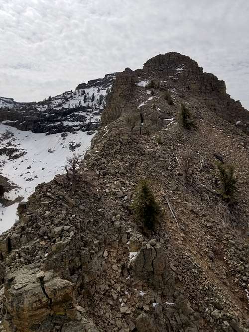
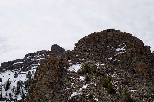
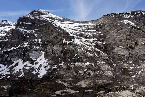
In the picture below you can see the last, tallest pinnacle that blocked my way onto the easy slope leading up to The Spire.
Further considering a traverse along the north side of the ridge did not entice me. It was vertiguous to look down this face in search of good steps onto the snow. The other side involved dry but very steep faces and loose scree. In the distance, to the northeast was the larger part of the mountain that would be easier to get to but would require another day of hiking.
I then made it up in my mind to turn back, which didn't go as planned.
"I'm descending thru a chute in light of doubting how I might get back down from the way I came. Some sense of worry pervaded me for a little while, but now I think I am almost free of the mountain. Perhaps 75m away is a brush patch. Beyond are rock fields and then the creek flowing strongly, and then massive Mt. Gilbert on the other side. I do think I could've gotten over the rock that I needed to, but as I looked up at it, I wondered how I'd even came down from it."
When I went to ascend back over the formation from which I'd come down, I decided that it wasn't worth the trouble if there was another way. The north side was too snowy for my liking. A chute seemed to descend into the valley though. Some snow melt flowed down it in tiny rivulets, which was comforting in case I'd reach an impasse there as well. My last liter of fresh water wouldn't last long.
"I made it out of the chute, thank goodness. I saw a couple on trail as I was coming off the mountainside. Then I ran into another, two guys, seemingly family. It's getting hot and my neck is sure to be sunburned. Still have perhaps an hour or 1.25 [hrs] - 1.5 [hrs] to go. The day has become gorgeous. Clouds continue to pass the canyon while heading east."
In the picture below, the chute through which I descended goes from bottom-center to upper-right. At one point when descending down a wet, steep section of 10 vertical feet or so, I lowered my pack with my 550 cord so I could safely descend facing out in crab-walk fashion.
Below, Mount Gilbert stands enourmously on the other side of the canyon.
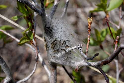
An interesting caterpillar nest.
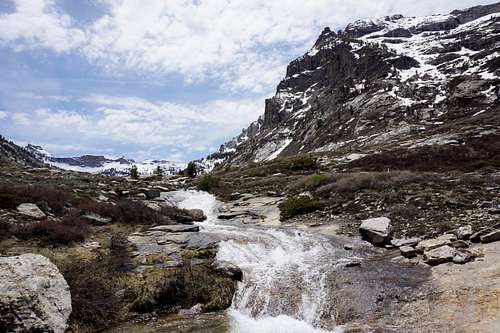
Rushing water in the middle of Lamoille Canyon's right fork. Far off and to the left is barely visible Mount Fitzgerald. To the right is Mount Gilbert.
"7hr 5min back to vehicle. Is frustrating to look back at The Spire knowing I was so close."
It was warm and breezy now, and the canyon smelled fresh as always in the spring. I now knew of the best way up, and it would only be a matter of time before an ascent happened, I thought to myself.
When I arrived home, a sizeable Rocky Mountain wood tick was stuck to the small of my back.
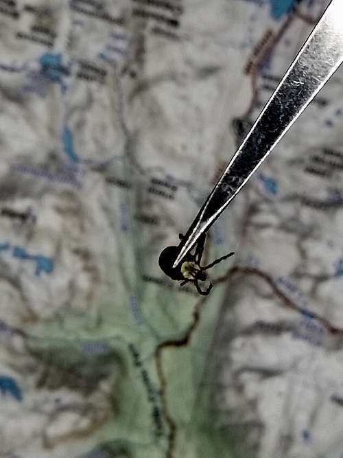
Note that the chance of some type of infection due to these ticks is approximately 1/1000, and it seems that the chance is even less if the tick is removed in less than 20 hours. Officials recommend that people use fine-tip tweezers to grasp the tick as straight across the head and as close to the host's skin as possible when plucking one off. My tweezers were not where they are in this picture when I pulled the tick off. They were going just behind its head from its left side to its right side. Avoid squeezing the tick from the rear during this procedure since that could subject the host to more infection if the tick is carrying anything. Then clean the area of the bite with alcohol or a similar disinfectant.