
|
|
Area/Range |
|---|---|
|
|
0.38315°N / 29.89792°E |
|
|
Mountaineering |
|
|
Summer |
|
|
Overview
The Rwenzori Mountains are located on the border of Uganda and the Democratic Republic of the Congo. Although the isolated volcanoes of Mt. Kilimanjaro and Mt. Kenya are taller, they are the highest range of mountains in Africa with the highest summit of Mt. Stanley reaching 5109 meters. When the peaks were first explored at the end of the 19th century, there were six separate massifs that held glaciers on their flanks. At this point, the number has dwindled down to just three, with one of those holding only tattered remnants of its earlier glaciation.
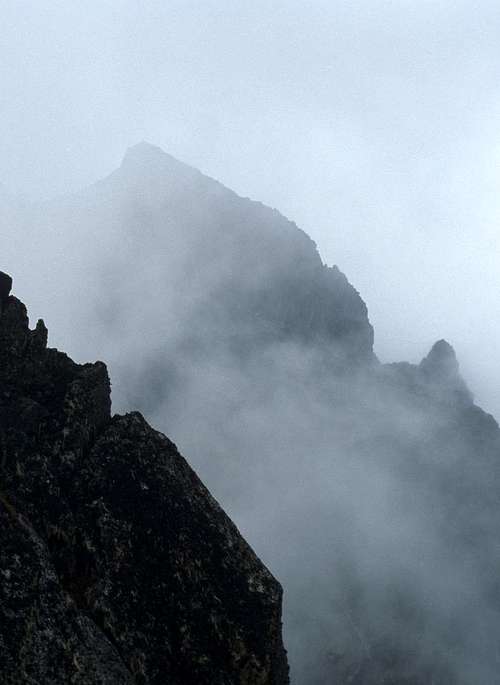
The peaks found in this range are not as shear or as individually spectacular as those seen in the Himalaya, the Andes or even the Alps. However, there is something about the range: its perpetual mists, the wild plants that seem better suited for some otherworldly science fiction fantasy than anywhere that is actually real, the rime encrusted glaciers less than 50 kilometers from the equator, its long and fabled history or the difficulty of access and frequent political instability around it that make this place one of the world's greatest treasures. It was the place that I had wanted to visit above all others for many many years. When after thirty years I finally did reach it, and even stood on its summit, I was reminded of the transient nature of our access by an almost immediate electric humming on the rather fanciful summit sign (found on many of the highest peaks) that forced an immediate retreat back down to lower slopes.
Geology
Unlike the higher peaks of Mt. Kilimanjaro and Mt. Kenya, the Rwenzori Mountains are a fault block mountain range that has formed due to the rifting that has taken place in East Africa over the past 10 million years. Most of the rocks of the range are metamorphic in nature, largely gneisses in the northern and southern parts of the range, and a metamorphosed igneous rock, amphibolite, among the high central peaks.
During the last ice age, glaciers extended far down the slope, and I have read that even the Nyabitaba Hut at 2600 meters is built on a moraine from a long retreated glacier. A hundred years ago, the Duke of Abruzzi and others encountered much more extensive glaciation than currently seen, with six glaciated peaks and reports of ice avalanches tumbling off of the higher peaks of the range such as Mt. Baker, through the perpetual mists. Three massifs have lost their ice entirely. Currently, that peak only has a few minor remnant glaciers (in 2004), and Mt. Speke a single remaining glacier of any consequence. Only Mt. Stanley still boasts extensive glaciation. Recent studies indicate that the ice may be entirely gone by the year 2025. Click here and here for information. The information for this section is from Wielochowski, 1989.
History
Mt. Emin. The cairn left by the Duke of Abruzzi can be seen on the summit
As early as the time of the Ancient Greeks, there were tales of mountains of snow and ice forming the source of the Nile River. Aeschylus talked of "Egypt nurtured by snows" and Arstotle noted 'Mountains of Silver, the source of the Nile' in the fourth century B.C. Ptolemy labeled these mountains in the correct location as “Lunae Montes” (The Mountains of the Moon) in his map published some 1800 years ago. According to the expedition account of the Duke of Abruzzi, this was actually a translation error from the name “white mountains”, but the name has stuck through the millennia.
Despite the legends, the existence of these mountains was not confirmed outside of Central Africa until the arrival of Henry Morton Stanley. In 1876 he first glimpsed the range, then in 1888 he noticed what he first thought to be a cloud then later realized was the slopes of a mountain covered with snow.
For a number of years explorers attempted to reach the peaks but were always turned back from the highest summits by the thick vegetation, bad weather, disease, or lack of time.
In 1889, G. W. Stairs reached over 3000 meters on Mt. Emin but never got beyond the thick vegetation. Two years later, in 1891 Emin Pasha and Dr. Franz Stulman reached high into the range and realized that it was a true mountain range and not a single peak. Scott Elliot came to the range a few years later and ascended much or the Mubuku and Bujuku Valleys. The glaciers were reached in 1900 by J.E.S. Moore and later the Stanley Plateau by Dr. J.J. David from the Congo in 1904. The highest peaks were first climbed in 1906. Graur's party made an ascent of Graur's rock on Mt. Baker, then H.B. Wollaston climbed Wollaston Peak of Mt. Baker in February of that year. In June, the Duke of Abruzzi arrived and climbed the six central glaciated massifs of the range during a protracted expedition.
It wasn't until many years later that others came to further the exploration: Noel Humphries of Mt. Everest fame made seven trips into the mountains around 1930 and Shipton and Tilman climbed a number of new routes in 1932. In the same year, a major Belgan expedition explored the range from the west and made the first ascent of Mt. Stanley from that side. The Congo side of the Rwenzori Mountains were included in Albert National Park in 1929. The name was changed to Virunga National Park (Parc National des Virunga) in 1969, and was included as a U.N. World Heritage Site in 1979. During the instability around 2001 there were significant incursions into this area by rebel forces. On the Ugandan side of the border, the area was protected as the Rwenzori National Park in 1993 and declared a United NAtions World Heritage Site in 1994.
This level of protection is in part due to the extensive work and lobbying of Guy Yeoman who explored all over the Rwenzori in the late 20th Century. Currently, trips to the Rwenzori are accompanied by local guides and porters, in a tradition kept going by the well known individual John Matte. Although some might argue it would be easier to just go by themselves, I greatly enjoyed the company and the wisdom of these people. It provided a much broader experience, as well as infusing valuable cash to the porters and guides. The destiny of parks such as the Rwenzori hinges strongly on buy in from the local peoples and hiring these guides serves as an important means of protecting what is so special about this range.
The Rwenzori are a fragile place. There is a ghost forest south of Kitandara Lake that was a victim of incendiary bombs during the recent instability in the Congo. I have heard rumors of land mines being placed there, and my own tour was accompanied by a park guide toting an AK-47. Although he said this was protection against animals such as the elephant, I'm sure that the presence of armed bands of rebels in the Congo plays into the decision by the park to include such precautions. In 2003, there were reports of cannibalism across the rift valley in the town of Bunia, and even as I right, there is continued starvation and death in the Democratic Republic of the Congo.
If you ever get the chance to visit, treat the Rwenzori well. It is a special place.
Getting There


Currently, the best access to the Rwenzori is from Uganda. The Entebbe Airport, on the shores of Lake Victoria, is excellent with frequent connections to Nairobi. It is actually a much more modern airport than Nairobi and may become increasingly prominent if the unrest in Kenya during 2008 continues. There are many hotels available in Entebbe and in Kampala only about half an hour to the north. From Kampala, there are two major routes to the mountain: a northern one through the beautiful town of Fort Portal, then south to Ibanda, and a southern route through Kasese that crosses the equator twice. Each of these takes the better part of a day to reach Ibanda at the foot of the mountains. The roads on the northern route vary from excellent to rough dirt tracks, while those on the southern route are generally good paved surfaces. Sadly when I visited, there was the constant smell of burning forests on the northern route as the once extensive forests are converted by slash and burn agriculture.
I have heard that public transportation from Kampala to the Rwenzori, although cheap, is rather difficult to take advantage of. When I went, I hired a local outfitter (Churchill Safaris) to take care of the logistics, and was driven to the mountains in an air conditioned four wheel drive vehicle.
The mountains have also been approached from the Democratic Republic of the Congo to the West. Old guides talk of flying into Kigali in Rwanda then taking a bus to Gisenyi, crossing into the Congo and continuing to Beni. From there, if you continue in the direction of Kasindi then to Beni you pass within 13 km of Mutwanga, the traditional starting off point for expeditions from this side. Osmaston reports one group accessing the range by this means in 2006, and stresses that it might be necessary to pay bribes to people along the way. It seems as if the political situation has stabilized somewhat in the last year or two but there may still be considerable risk in attempting an approach from the Democratic Republic of the Congo. In the tours portion, I do note one service that organized trips from the DRC.
Red Tape
I don't have any first hand knowledge about entry into the range from the Democratic Republic of the Congo. Even though the situation may be slightly improved over five years ago, the Democratic Republic of the Congo has experienced the world's worst war since World War II, and the eastern portion of the country is still not completely stable. Over 120 park rangers have been murdered in Parc National des Virunga over the past decade, and there are reports that there are currently rebels in the park. In the fall of 2007, a mountain gorilla was killed in the portion of the park bordering Rwanda. Although this is quite some distance from the Rwenzori, any entry into the Eastern Congo will involve some risk in this regard. Virunga National Park reports that it is possible to access the range at this point. There is a fee of USD 200 as well as an additional fee of USD 116 to sleep in the huts. Flights can be arranged from Goma, or access might be gained from the Mpondwe/Kasindi border. In terms of food, gear, and working out wages to pay porters, you are on your own... This conflict has been documented extensively on the internet but largely ignored internationally. For background on the D.R.C. click here. For passport information and travel warnings click here. Travel to the DRC is currently not recommended by the State Department as of January, 2017.
Uganda has had its own political instability. Until the past year or two there were frequent reports of horrible events in the northern part of the country. During 2006 and 2007 things seemed to settle down somewhat as a tentative cease fire was reached. Current information on Uganda can be read here. Further information including travel warnings, passport and visa requirements can be accessed here.
As noted above, the Rwenzori Mountains are a U.N. Heritage Site and are protected as National Park on both sides of the border. Visitors to the park are to be accompanied by a guide and porters. When I was there in 2004 I also had the escort of a park ranger carrying an AK-47 to protect me against the elephants. I would surmise that he was also armed as a deterrent against Congolese rebels, but he stated that this was not a current concern. Climbing in the Rwenzori is administered by the Uganda Wildlife Authority and the Rwenzori Mountaineering Services. Currently, the fee for a week long trip into the range including an ascent of Margherita Peak is US $990, with a US $150 charge for each additional peak on Mt. Stanley. There are additional fees if you wish to ascend other mountains in the range.
When I visited, the guides and porters were extremely friendly and helpful, as were the Ugandan people in general. The overall tone among Ugandans that I came in contact with was one of optimism and good natured banter. The presence of the guides and porters on the trip made the experience much fuller than if they had been absent. I also had a cook who prepared outstanding food during the trip. I would highly recommend this as it is nice to come back to a delicious dinner after a day of hiking in the range's mists, sleet and snow.
When To Visit: Weather

John with rime on Alexandra Peak
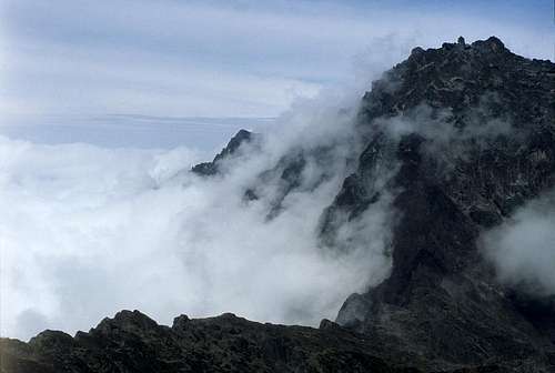
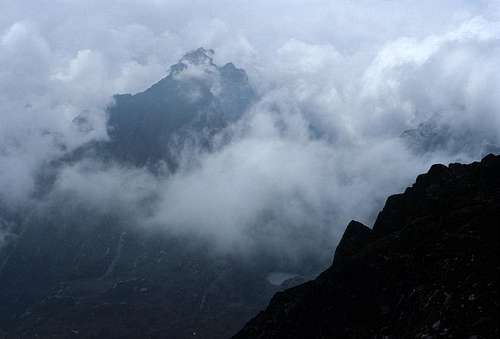
The weather in the Rwenzori is generally wet, with the peaks shrouded in mists most of the time. Although this makes for really wild rime formations on the higher summits and glaciers, it can make mountaineering and route finding challenging.
Worldwide, there is a band of rising air near the equator that leads to heavy rains, known as the Intertropical Convergence Zone (ITCZ). It is also called the doldrums. In June, this migrates northward, giving India and the Himalaya its monsoon season. In December, it is in the Southern Hemisphere, giving heavy rains to northern Australia and such places. During the spring and the fall, this zone of heavy precipitation passes over the Equator. Since the Rwenzori are equatorial, spring and fall are a bad time to visit! During January and February there is a drier "NE Monsoon" and in June and July a drier "SE Monsoon". These are the preferred months to visit the range. However, with that said, I went during July and encountered rain or thunder every single day that I was in the mountains. Generally, though, the rain and snow during these times are not heavy or long lasting and most of the days are fine for backpacking and wandering among the peaks.
If you are planning a peak ascent, it is best to do so early in the morning. Generally, the best weather is between the hours of 2:00 AM and about 8:00 AM, after which mists and clouds often veil the peaks. When I was there, there were frequent thunderstorms at night and even dawn, then in the afternoons, but not during the hours of about 7:00 AM to 10:00 AM.
If you want to ski on the Stanley Plateau, you might consider a trip right at the transition between the wet and dry seasons, as later in the dry seasons the glaciers may be bare ice in many places.
Camping
There is an extensive system of huts along the main circuit of the Rwenzori. These include Nyabitaba hut at 2650 meters, John Matte Hut at 3380 meters, the Bujuku Hut at 3977 meters, Elena Hut high on the flanks of Mt. Stanley at 4540 meters, the Kitandara Lake Hut at 4027 meters and the Guy Yeoman Hut down the Mubuku River Valley at 3260 meters.
There are five huts on the Western side of the range in the Democratic Republic of the Congo. These include Kyandolere at 1700 meters, Kalongi at 2140 meters, Mahungu at 3310 meters, Kyondo at 4303 meters and the Moraine hut at 4500 meters. All were built in 1942 (Osmaston, 2006).
If you to going off of the main circuit, it is possible to camp in tents and frequently under rock overhangs that are very common in the range.
Central Circuit
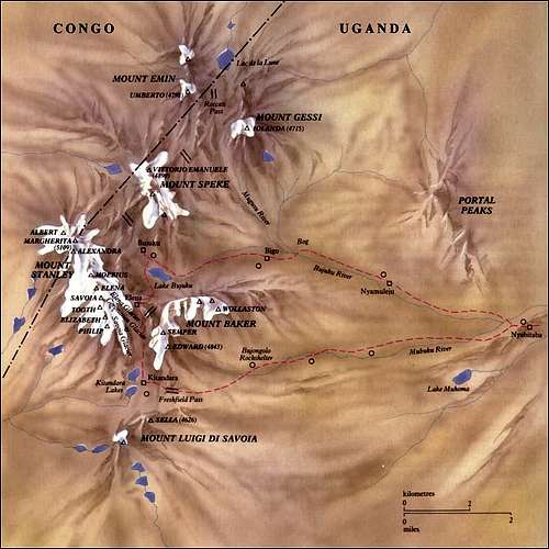 The Central Circuit of the Rwenzori. There is no longer anywhere near this much ice on the peaks. Map from:http://www.skimountaineer.com/ROF/Beyond/Stanley/RuwenzoriMap.jpg
Traditionally, people trekking the Rwenzori have used the beautiful circuit heading up the Bujuku valley, over the Scott Elliot Pass to the stunning Kitandara Lakes then over Freshfield Pass into the Mubuku Valley. As mentioned abover, there are numerous huts along this section, most of which are quite nice. The trails are very rough and contain deep mud in many places but are quite well maintained given the weather and conditions. At various times efforts have been made to install boardwalks over some of the deeper bogs but many of these have rotted and are currently in various states of disrepair. Recent trip reports indicate that the RMS has reliability problems and that the level of mountaineering experience of at least some of their guides is minimal. It takes most people roughly a week to approach and climb Mt. Standley. The following gives an idea of the itinerary that many people travel:
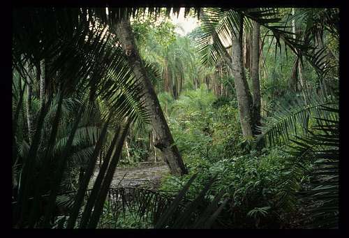
Day 1: Leave Ibanda, travel up the road to the Nyakalengija gate. From here one follows the Mubuku River for a ways through lush jungle, then across thickets hiding elephants and cobras to the start of a steep glacial moraine. This is climbed up past enormous ferns to the Nyabitaba hut at 2600 m where chimpanzees and monkeys may be heard or seen. Most people take about 5 hours to hike up a gain of 1200 meters. The hut has a spectacular view of the Portal Peaks.
Day 2: Descend down from the moraine to cross the Mubuku River, then a phenomenal hike through bamboo and trees coated with moss and ferns to the John Matte Hut at 3500 m. Sections of the trail on this day are extremely rough. 915 meters gained in 7 hours of hiking for many people.
Day 3: From the John Matte hut one crosses the Lower Bigo Bog to the older Bigo hut. At this point, it is possible to make a side trip (one or many days) up the Mugusu Valley to the Lac de la Lune, maybe Ptolomy’s source for the Nile. This valley also provides access for Mt. Gessi and Mt. Emin. If one stays on the main circuit, continue through spectacular vegetation past the Upper Bigo Bog and Lake Bujuku to the Bujuku Hut at 4075 meters. This takes many people 5 hours to ascend the 560 meters. If the weather is good, there are good views of Mt. Stanley from here. The Bujuku Hut serves as the usual base to climb Mt. Speke. Some fast hikers do the approach and peak ascent on the same day. In recent years, there has been talk of moving the hut to just below and east of Lake Bujuku.
-L.jpg)
-L.jpg)
Johnstone Peak, Mt. Speke
Day 4: Ascent to the Elena Hut, which once was beside the Elena Glacier at 4540 meters. It takes several hours to make the steep ascent. One portion of the climb is actually up a prolonged ladder (Groundsel Gully). Just past this point, there is a wonderful vantage point to survey the valley. The top portion of the climb is on steep moss covered slabs. The view from the hut is usually of fog but can be spectacular if the weather clears with the Portal Peaks and Mt. Baker prominent, as well as an impressive view of the Coronation Glacier on Mt. Standley. In many ways the crux of the climbing can be navigating ice coated ledges from the hut to the outhouse in the middle of the night.
Day 5: Many people use this day to climb Mt. Stanley by ascending up steep often wet/verglassed slabs to the Elena Glacier and the Stanley Plateau, Africa's largest icefield. There are several possible lines that are used depending upon the conditions. From here, one has good access to the excellent SE ridge of Alexandra Peak. One can also cross the Stanley Plateau to the north reaching the tow of Alexandra's SE Ridge, drop down a steep gully to the Margherita Glacier, ascend this to the Alexandra/Margherita Col then from here climb to the summit of Margherita Peak on snow trending left somewhat, then generally wet or icy rock. The Margherita glacier is heavily crevassed, many of which are covered by a thin layer of snow. In addtion, there are often wild ice formations along the way and on the adjacent ridges. At the summit, be sure to step to the West of the sign to enter the Democratic Republic of the Congo. It is also possible to continue along the ridge to the west to reach Albert Peak. Descend back to the Elena hut then continue down to the beautiful Kitandara Lakes. There is a large area out of site down the valley from here where all of the vegetation was denuded. When I asked the guide why he said that during the war (1996 – 2001 or so) there were planes then he made a motion of the plane dropping an incendiary bomb.
If you do not wish to climb Mt. Stanley, you can combine days 4 and 5 into a single day by taking a different trail from the Bujuku Hut up to Scott-Elliot Pass. At the pass, there is a trail junction with one that goes up to the Elena Hut. The stretch of the trail just to the south of the pass is very rough, but after a short stretch, it becomes mellower and continues to Kitandara Lake Hut.
Day 6 (or 5): Climb over Freshfield Pass (300 meters elevation gain) then descend to the Guy Yeoman Hut (3500 m). From near the pass it is possible to climb Mt. Baker or Mt. Liugi Di Savoia. The vegetation is phenomenal. On the descent, you pass by an old campsite of the Duke of Abruzzi (Bujongolo) where there is graffiti from expeditions from the early part of the 20th century.
From the Guy Yeoman Hut it would be possible to climb Mt. Cagni up the steep ravine to the north, then east and back south. Supposedly, there is a nice sharp summit ridge to traverse in reaching the highest point.
Day 7 (or 6): Exit to the Nyabitaba Hut then on out to the road. Of these forests, the Duke of Abruzzi wrote (1908):
“In this forest trunks and boughs are entirely smothered in a thick layer of moss which hang like waving beards from every span, cushion and engorge every knot, curl and swell around each twig, deform every outline and obliterate every feature ‘til the trees are a mere mass of grotesque contortions, monstrous tumefactions of discolored, leprous growth.
“No forest can be grimmer and stranger than this. The vegetation seems primeval, of some period when forms were uncertain and provisory. The silence is profound, and the absence of any sign of life completes the image of a remote age before the beginning of animal existence.”
Truly a spot as magnificent in its own way as any on earth.
Some people may want to stop at the Nyabitaba Hut and hike out to Ibanda the next morning.
Kilembe Route
In 2009, a new route to the mountains, the Kilembe Route, was opened. It begins in the town of Kilembe, and approaches the main peaks from the south-east, joining up with the Central Circuit near the Kitandara Lakes. This route can be used to climb Weismann Peak of Mt. Luigi de Savoia, the peaks of Mt. Stanley or other high peaks in the area. The treks take approximately six to nine days and can include one or several high peaks.
This route is operated by Rwenzori Trekking Services. SummitPost member Tijs recently took this route and speaks highly of it and the service provided by Rwenzori Trekking Services. He notes that, unfortunately, people cannot take the Kilembe Route into the mountains and the Central Circuit out due to the fact that there are different tour operators for the two routes. At least one person has climbed many of the peaks using this service, and recent visitors have been much more satisfied with the service provided by RTS as compared to RMS.
For a map of this route, go here.
The Mountains
Mt. Gessi
When the earliest explorers visited the range, there were six massifs that had permanent glaciers. I will give a brief description of each in the order that they are likely to be seen when one does a counter-clockwise circuit around the main peaks of the range.
Mt. Gessi (4715 meters)
This peak is named for Romulo Gessi (1831 - 1881) who was an Italian explorer of the Nile. In 1774 he made a circumnavigation of Lake Albert to the north of the Rwenzori but did not see the mountains. For a number of years he was a governor of the Bhar-el-Ghazal Province of the Egyptian Sudan, but was recalled in 1881 by the Egyptian government. Hundreds of people in his party died en route to Egypt, and he himself passed away shortly after his arrival in Egypt.
Mt. Gessi itself is located to the north of the Bigo Hut, and can be accessed by ascending the Mugusu Valley. There are two summits, Iolanda (4715 meters) and Bottego (4699 meters) slightly to its north. The first ascent of the peak was made by The Duke of Abruzzi, J. Petgax, L. Petigax and C. Ollier on July 17, 1906. The ascent route used by the Duke has melted out, though, and is now a series of horribly mossy steep slabs and is not recommended. The standard route, if one could call it that, is to climb up the Mugusu Valley through spectacular Groundsel forests to Roccati Pass, where it is possible to turn south-east and ascend through thick brush and steep slabs, eventually reaching the ridge between the two peaks. All of the glaciers have melted from this once ice covered massif.
Mt. Emin (4798 meters)

Climbing Kraepelin Peak.
Mt. Emin is named for Mohammed Emin Pasha (1840 - 1892) who became a governor of the Equitoria Province in Sudan in 1878, explored central Africa extensively, got isolated with rebel forces after an 1883 revolt, was rescued by Sir Henry Morton Stanley in 1888 but declined to return to Egypt. Later that year he was caught in a second revolt, imprisoned but eventually released. On a later trip into central Africa in 1892, he was murdered in what is now the Democratic Republic of the Congo.
The Peak is the fourth highest Massif in the range and like Mt. Gessi is composed of two main summits connected in this case by a very narrow ridge. The southern peak (Umberto) is slightly higher and was climbed first by The Duke of Abruzzi, J. Petigax, L. Petigax, and C. Ollier on June 28, 1906 by the Southwest Ridge. There have been no further ascents of the peak recorded by this route. The standard route (again almost never climbed is to ascend up the Mugusu Valley to Roccati Pass then turn West into the Democratic Republic of the Congo and climb steep slopes and thick groundsel to the vicinity of the pass between the two main peaks. From here, turn left and work around a minor peak on ledges to the East, eventually gaining the ridge, and following it to the summit. There is a steep drop that might require a rappel, then several additional pitches of possibly 5th class climbing along the narrow ridge. There is a second major summit, Kraepelin Peak, 4791 meters that can be ascended by climbing a gully that heads north-west from near the col between the two main peaks, and reaching the summit from the south in fairly short order.
Like Mt. Gessi, there are no longer glaciers on this massif.
Mt. Speke (4890 meters)

Speke Glacier
Ensonga Peak
Mt. Speke is named for John Hanning Speke (1827 - 1864) who explored central Africa with Sir Richard Burton in the 1850's. Together, they reached Lake Tanganyika in 1858 then alone, he is believed to be the first European to see Lake Victoria at the source of the Nile. Although he strongly believed that this was the river's source, he was never able to prove it and died in a shooting incident thought to be suicide by many.
Mt. Speke is the Second highest Massif in the Range and one of two that reaches over 16,000 feet in elevation. Like most of the Rwenzori it is a long ridge with a number of high summits including Johnson (4834 m.), Vittorio Emanuele (4890 m.) and Ensonga (4865 m.). Like so many of the summits, it massifs, it was first climbed by the Duke of Abruzzi, J. Petigax, and C. Oliver on June 23, 1906. The normal route to the summit climbs west from the Bujuku Hut to Stuhlman Pass, then north up very steep slopes via a couple possible lines to the Speke Glacier which is climbed for a while. Once the top of this is reached, one continues up the Southwest ridge to the summit. Although this was formerly a extensive snow climb, it would be possible at this point to bypass the glacier entirely and make the entire ascent in tennis shoes from the hut if the mud isn't too bad. The great glaciers that used to lie on the north side of Mt. Speke have now melted, leaving only a remnant of the Speke Glacier on the South, and several smaller bodies of ice in the direction of Ensonga Peak.
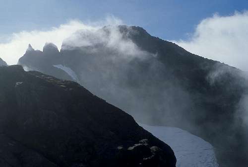
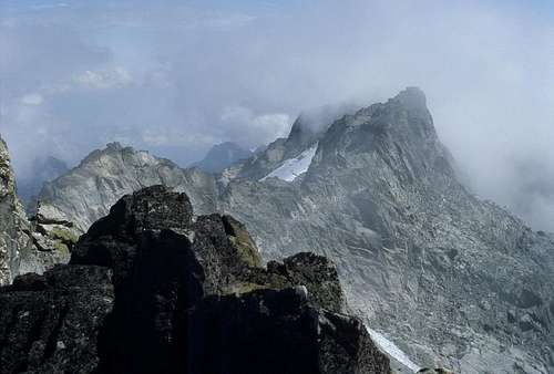
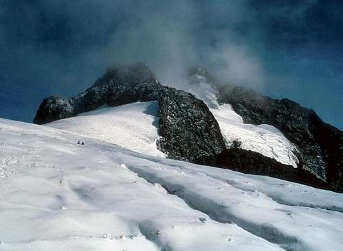
Mt. Stanley (5109 meters)

Mt. Stanley
Mt. Stanley is named for Sir Henry Morton Stanley (1841 - 1904), a British explorer who is perhaps most know for finding Dr. Livingstone in 1871 on the shores of Lake Tanganyika during one of the six expeditions he took to central Africa during his life. In the mid 1870's he circumnavigated Lakes Victoria and Tanganyika, then continued to the west down the Congo River to the Atlantic. On an expedition in 1888, he made a definite sighting of the Rwenzori Mountains (although others in his expedition reportedly saw the mountains first, and the local people already knew of them as well.) He was the one who reported the name of the range as the Ruwenzori to other Europeans on his return. The name is a collection of Bantu words that together mean 'hill of rains' but was not used for the range by the locals. Many currently in Africa hold a very negative view of Stanley and the colonialism that he brought.
Margherita and Alexandra Peaks
Mt. Stanley was first climbed by The Duke of Abruzzi, J. Petigax, C. Ollier, and J. Brocherel on June 18, 1906, and is a high massif of some eleven summits rising from numerous glaciers including the Stanley Plateau which is the largest mass of ice in the Rwenzori Mountians and is over a kilometer in length. The highest summit is Margherita Peak, which is usually climbed from the Elena hut up first rocks then across the snow and ice Stanley Plateau towards Alexandra Peak, the second highest summit of the massif. Once nearly at the east ridge of this peak, the standard route for Margherita descends a steep gully then climbs the dramatic Margherita Glacier to the Col between Margherita Peak and Alexandra Peak. From here, one can ascend north to a short but steep rock wall which is climbed to the summit. A rope will be desired for the extensively crevassed glacier and the summit rocks. The peak itself forms the boundary between Uganda and the Democratic Republic of the Congo. The East Ridge of Alexandra Peak (4990 m.) is an excellent climb as well. To the south, there is another cluster of peaks topped by Savoia Peak (4977 m.) An ascent of any of these peaks across the great tropical glaciers is something otherworldly and an experience that will be savored by most fans of the exotic!
Mt. Luigi Di Savoia (4627 Meters)
Sella Peak, Mt. Luigi Di Savoia
This peak is named for the Duke of Abruzzi (1873 - 1933). Ironically, it is the only one of the six major massifs that he did not make the first ascent of. That honor went to others in his expedition: J. Brocherel, E. Botta and the amazing photographer V. Sella for whom the highest summit of the Massif is named. The Duke of Abruzzi is famed in mountaineering circles for making the first ascent of Mt. St. Elias in 1897, climbing high on K2 in the Karakoram, and nearly reaching the summit of Bride Peak on Chogalisa. His expedition to the Rwenzori climbed all six of the highest massifs in the range. He was a military hero as well, rescuing thousands of Yugoslav refugees from Albania during World War I, and spent his final years in Ethiopia was he was much beloved.
The massif, like the others is a long ridge with many summits, including Stairs Peak (4545 m.), Sella Peak (4627 m.) and Weismann Peak (4620 m.). The easiest route of ascent is from the vicinity of Freshfield Pass, where it is possible to ascend up the northern aspect of Sella Peak to its summit. It is the shortest of the six central massifs and was the first to lose its glacial ice.
Mount Baker (4843 meters)
Mt. Baker
Mt. Baker is the mountain that most people who come to trek in the Rwenzori encircle during their hike through the range. It is the third highest massif in the range and is named for Sir Samuel Baker (1821 - 1893) who along with his wife, were the first Europeans to see Lake Albert to the North of the Rwenzori and Murchison Falls on the course of the Nile during an expedition to discover the source to the Nile.
Mt. Baker contains several peaks, including Edward (4843 m.), Semper (4794 m), Moore (4623 m.), and Wollaston (4626 m). The first ascent route and the standard means to reach the summit is up the south ridge of the peak. Most people start at the beautiful Kitandara Lakes, and go up the trail towards Freshfield Pass to where the trail levels out. From here, it is possible to continue up the slope past several small ponds to a small saddle just west of the ridge. Continuing up to the west of the actual ridgeline it is now possible to reach the summit without ever stepping foot on snow or glaciers. It is possible that you might encounter a few 4th class moves on this route.
Other Peaks: Although I have just described the six largest massifs of the Rwenzori Range, it is somewhere around 50 km in length and has a number of other significant summits. The first peaks that you see on the standard circuit are actually the Portal Peaks, a small cluster of some 10 peaks with dramatic cliffs on the eastern sides. Kihuma at 4391 meters is the highest and can be ascended from the vicinity of the John Matte Hut, heading north to the swampy Bukurungu Pass then east to the summit. The range tapers off to the north of this, but even with Fort Portal 20 km to the north is the summit of Karangora (3014 meters) I know nothing about this peak.
As noted above, the Rwenzori Treking Service has opened a southern hiking route in the park. There is a large cluster of high summits to the south-west of Mt. Luigi Di Savoia, with the highest being Humphries (4578 meters). Osmaston reports that it is drier here, leading to pleasant walking and climbing of these peaks from the upper Nyamugasani Valley. To the south-east of this valley and its many lakes is yet another cluster of peaks, topped by Rwatamagufa at 4253 meters. These can be reached by various routes from the Rwatamagufa valley.
West of the main peaks in the Democratic Republic of the Congo, there are also several peaks of note. Mt. Mugule and Wasumeso (4462 meters) that would both provide spectacular views of Mt. Stanley given good weather, and Catafalque to the west of Mt. Speke.
The history presented in this section is from Pluth, 1996, pgs. 6 - 7.
Lakes
Lac de la Lune in typical weather
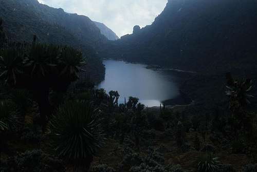
As discussed above, there has been extensive glaciation seen in the Rwenzori Mountain. With the retreat of the glaciers since the last ice age, there have been a large number of lakes left behind. Many of these are nestled deep under cliffs and steep slopes, surrounded by the wild and convoluted high altitude vegetation, and draped in swirling mists. They are among the most exotic and beautiful lakes in the world. For people hiking the circuit of the central peaks, the first major lake that most encounter is Lake Bujuku at the head of the Bujuku Valley right beneath the three highest mountains in the range. On clear days there are excellent views from the eastern bank of this lake up to the remnant glaciers on Mt. Stanley. Continuing over Scott Eliot Pass, one reaches the two Kitandara Lakes, with the Kitandara Hut located right on the banks of the lower lake. This is one of the most beautiful spots that I have ever seen.
At the headwaters of the Rwanoli River in the Democratic Republic of the Congo lies the spectacular Lac de la Lune. Several, including Noel Huphries to suggested that it is Herodotus' bottomless lake forming the source of the Nile between the two peaks he called Crophi and Mophi (from Yeoman, 1989, pg. 148).
Fauna and Flora
Lobelia by Kitandara Lake
In general, large wild animals are quite rare in the Rwenzori. In the lower elevations, elephants and buffalo can sometimes be encountered and I saw a cobra within a hundred meters of the Park gate near Ibanda. In lowland forests such as those near the Nyabitaba hut there are chimpanzees that can commonly be heard, but are rarely seen. More common are the blue monkeys and the Rwenzori colobus monkey. Early accounts of the range such as those of the Duke of Abruzzi frequently mentioned leopards wandering the high valleys and visiting the members of the expeditions. Hydrax, duikers and forest hogs may also be seen.
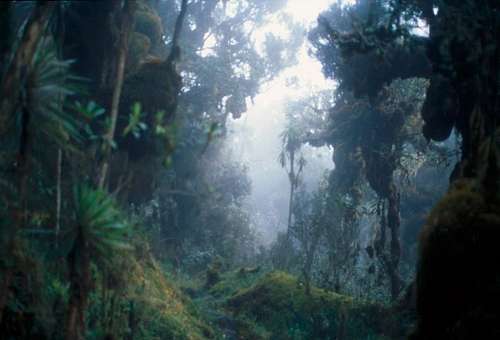
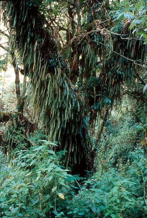
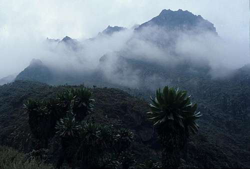
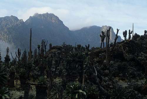
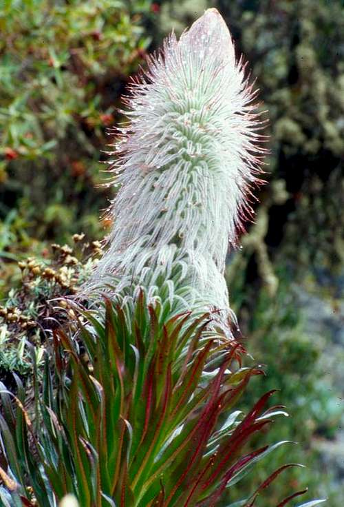
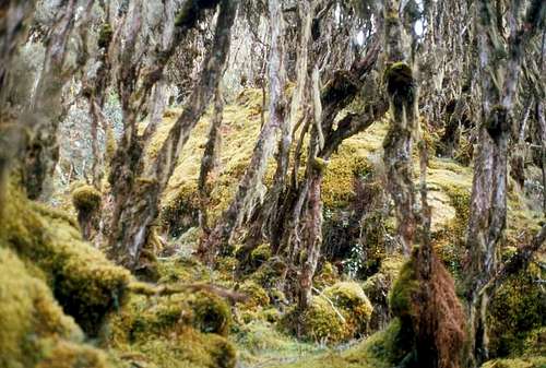
The flora of the Rwenzori is unlike any other place on earth, and in a word is magnificent. Similar types of plants can be found on Mt. Elgon, Kilimanjaro, Kenya and other high points in central Africa but nowhere in concentrations so luxurient and abundant as here. In the lower reaches, vast stretches of giant ferns cover the mountain sides. Then, in the range of 2500 - 3500 meters there are groves of bamboo on gentle slopes. Slightly higher, one encounters giant heathers (Philippia benguelensis and P. johnstonii) that are often coated with thick mosses and the lichen Old Man's Beard. At 3000 to 4000 meters elevation, giant tree groundsel (Senecio ericirosenii) and Lobelia bequaertii are both found, the later sometimes adorned with a spectacular display of flowers. This is also the range of the spectacular bogs with abundant liverwort, spagnum moss and other really cool vegetation.
At the highest elevations below the glaciated zone, one encounters magnificent forests of giant tree groundsels (Senecia adnivalis) and lobelia (Lobelia wollastonii) It has been found that Groundsel grow only about an inch (2.3 cm) per year. Given that they can reach a height of 8 meters or so, they can be extremely old. The giant size of the plants has been explained as a way to deal with the extreme fluctuation in temperature from sub-freezing nights to possibly quite warm days. They tend to trap water with their leaves, and there is enough of this that it can't fully freeze during the nights, thereby protecting the living part of the plant. In the day, the thin layer of ice melts and the plant is able to photosynthesize the abundant solar radiation at this latitude. Lobelia are much faster growing and send up magnificent flower stalks that often remain standing long after the plant dies. These forests are some of the most unusual and enchanting that I have ever encountered in all my travels.
After a trip around the central circuit in January 2006 by Berit Gehrke, Rod and Rachel Saunders and Peter Linder, Linder and Gehrke wrote up an excellent summary of the plants entitled "Common Plants of the Rwenzori, particularly in the upper zones" which can be downloaded for free here.
Both Wielochowski, 1989 and Yeoman, 1989 were used in preparing this section.
External Links and Information
This and the following section are also found on the Mt. Stanley Page.
The best text on the range is:
Fillipo de Fillipi Ruwemzori, an account of the expedition of H.R.H. Prince Luigi Amedeo of Savoy, The Duke of Abruzzi, Archibald Constable, Dutton, 1908. It can actually be purchased for about $25 at Bonanza books.
An excellent guide book to the range is:
H.A. Osmaston, Guide to the Ruwenzori: The Mountains of the Moon, Mountain Club of Uganda and West Col Productions, U.K. Second Edition 2006. It can be purchased at: Amazon.com for an insane amount of money. There is all sorts of information in this book, including an exhaustive bibliography of hundreds of Rwenzori related articles, books, etc.
The best map of the range is:
Andrew Wielochowski, Ruwenzori Map and Guide, West Col, 1989. It can be purchased at: Amazon.com for about $15 USD.
Heather trees and moss
An inspired early account of exploration and peak climbing in the range and on other African mountains is:
H.W. Tilman, Snow on the Equator, Bell, 1937
(This book was republished in a volume H.W. Tilman the Seven Mountain Travel Books, The Mountaineers, 1983.) This book contains the great description: "Such are the Mountians of the Moon - vying not with the austere splendour and subliity of the Alps and the Himalaya, but by their position, mystery, traditions, and matchless scenery, ranking, surely, amongst the wonders of the earth."
One of the best picture books written by a key figure in getting protection for the range is:
Guy Yeoman, Africa's Mountains of the Moon: Journeys to the Snowy Sources of the Nile, Hamish Hamilton; Universe Books, 1989
A good book with more recent photos is:
David Pluth, Uganda Rwenzori A Range of Images, Little Wolf Press, 1996.
My inspiration and interest in the Rwenzori began after reading: Paul Zahl, "Africa's Mountains of the Moon", National Geographic Magazine, March 1962, pgs. 412 - 434.
Vittorio Sella remains one of the best photographers ever to have lived. An excellent book to own and flip through from time to time for inspiration is: Vittorio Sella, Summit, Aperture Foundation, 1999. The book contains a chapter on the Rwenzori and additionally leaves you wanting to gaze upon Ushba, Gasherbrum IV and so much else.
There is a nice website and movie about the range called "Snows of the Nile" that was released in 2014. It details a trip made by two Boulder, Colorado climbers who won an unusual grant to document the change of glaciation between Sella's time and the present and has some outstanding photography of the range.
A book on the botany of the range called Flowers of the Moon can be purchased here.
The article describing loss of glacial ice in the Rwenzori can be found at:
Citation: Taylor, R. G., L. Mileham, C. Tindimugaya, A. Majugu, A. Muwanga, and B. Nakileza (2006), Recent glacial recession in the Rwenzori Mountains of East Africa due to rising air temperature, Geophys. Res. Lett., 33, L10402, doi:10.1029/2006GL025962. It can be purchased here.
Another article on glaciation in East Africa including the Ruwenzori (written in 1987) can be found here.
Summitpost member tom1725 visited the range recently and wrote this article centered upon the loss of glacial ice.
In recognition of the scientific work carried out by the Duke of Abruzzi, an expedition from Italy returned to the range in 2006. Their web page with related information and a number of Sella's photographs can be found here.
The group responsible for peak ascents of the Central Circuit:
Rwenzori Mountaineering Services
PO Box 33 Kasese Uganda
Tel. 256-41 237497
email: rwenzorims@yahoo.co.uk
The group carrying out peak ascents by the Kilembe Route is the Rwenzori Trekking Services.
Information about ascents from DRC can be found at Virunga National Park's page here. I have not heard of anyone going into the mountain this way, recently.
For Skiers: click here.
Lots of nice wildlife pictures, some Rwenzori pictures and such from a 2003 trip can be seen at this site.
An important book to read for anyone traveling to Uganda is an autobiographical account of a man who became Idi Amin's personal doctor:
Giles Foden, The Last King of Scotland, 1998
A recent book with photographs of the flowers and such is: 'Flowers of the Moon, Afroalpine vegetation of the Rwenzori Mountains', 2007, 5 Continents Editions, ISBN 978-88-7439-423-4
http://www.sebastianschutyser.com/engels/flowers.html
I have not looked at it, but the view the book feature at the web site made it look quite interesting!
Rob Woodall wrote up a nice report with great photos of a 2009/2010 trip to the range that included an ascent of Mt. Stanley. There are some great photos with this report. They had outstanding weather for their ascents!
David Noble visited the range in 1990 and has a great array of photos. Some of them are a bit dated in terms of where the glaciers are, but they are beautiful!
Commercial Expeditions
Mt. Stanley and Upper Kitandara Lake
Because of the logistics of organizing transportation, guides, food, etc. many people use commercial trips to climb Mt. Standley. Below, I have listed several commercial outfitters. I am personally unaquainted with most of these organizations and am not endorsing them, just presenting possible options for those who don't have the time to go it all alone.
Achieve Global Safaris
Adrift Adventure
Uganda Safaris
Churchill Safaris They will design an individual trip around what you want.
EWP This site has a nice map of the hiking circuit.
Rwenzori Mountain Climbing
Rwenzori Trekking Services operates treks of the Kilembe Route to the high peaks. For a list of their tours, go here.
Graben Safari says that they will arrange trips from the DRC. Although at least a couple groups have accessed the mountains from DRC in the past few years, Virunga National Park is currently closed to tourism due to political instability (4/2013)
Other Nearby Attractions
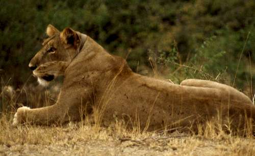
Lion, Queen Elizabeth National Park.
When I grew up, I dreamt of Africa: the jungles, rivers, wildlife, and people. Thus, when I went to the Rwenzori, I also wanted to spend a couple days seeing all of those animals from my childhood dreams. Luckily, there are several places nearby to the Rwenzori that are outstanding for this purpose. Below, I have listed a number of other attractions that can be combined with the Rwenzori Mountain trek to expand the experience:
Kibale Forest National Park
This park is directly on the northern route to the Rwenzori and is home to 13 different primate species including the red colobus monkey and the L'Hoest monkey. One can also see giant forest hogs, forest elephants, and over 300 species of birds. The park is a lush and beautiful rainforest.
Bwindi Inpenetrable Forest National Park
Bwindi is famed for its mountain gorillas. In addition, there are ten other primate species among some 90 mammal species found in the dense forests of the park. In 1998 rebels from the Democratic Republic of the Congo crossed into the park and murdered several guides and tourists. One can only hope that situations like this do not occur again in the future.
Queen Elizabeth National Park
This park is reported to have the highest biodiversity of any game reserve in the world with over 600 bird species and 100 mammal species in habitats ranging from wetlands and lakes to rainforest to dry savanna. There is a small village on the Mweya Peninsula at the eqge of Lake Edward. Nearby, you can catch a wonderful launch trip to see hundreds of hippos, Nile crocodiles and thousands of birds. Other park attractions include tree climbing lions, abundant buffalo, monkeys, hyena, elephants, leopards, antelope. On the eastern edge of the park, there is a dramatic ravine, the Kyambura Gorge, that slices into the savanna. The bottom is lush forest and is the home to a small band of chimpanzees.
Lake Mburo National Park
This park is directly on the southern approach to the Rwenzori and is the best place in Uganda to see the Eland antelope, zebra, and impala. The park has been encroached upon somewhat at its northern edge, although I was able to see zebra and impala from the main highway here. The plant life includes the well known flame trees (Erythrina abyssinica)
Mgahinga Gorilla National Park
This park is on the border with the Democratic Republic of the Congo and Rwanda and includes a portion of the dramatic Virunga Mountains. It is one of several places in the area where it is possible to see mountain gorillas, although sometimes they travel across into the other countries. There are three large volcanoes in this park, Muhavara (4127 meters), Mt. Gahinga (3474 meters) and Mt. Sabinya (3645 meters). It is possible to hike up at least Muhavara and Mt. Gahinga.
Murchison Falls National Park
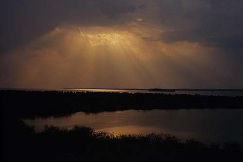
Sunset from Mweya Point, Queen Elizabeth National Park
This park contains a dramatic waterfall, where the Nile river plunges 43 meters into a narrow gorge that is only 6 meters wide. The park is also home to buffalo, giraffe, elephants, lions, chimps, hippos, crocodiles and many other animal species. In the past couple years the political instability in the region of this park has diminished and although nothing can be certain, it is currently fairly safe to visit.
Parc National des Volcans (Rwanda)
Located in the famous Virunga Mountains, this is one of the world's premier places to see mountain gorillas. It is where Dian Fossey did her research and is the home to rare monkeys such as the golden monkey and to such larger animals as forest elephant. One can also ascend the highest peak in the Virunga Mountains and all of Rwanda, Mt. Karisimbi (4507 meters).
Mount Elgon National Park
Mt. Elgon, on the border of Uganda and Kenya once rose higher than the current height of Mt. Kilimanjaro. Currently, there are beautiful stands of lobelia, dramatic caves and many spectacular waterfalls such as Sipi Falls on the flanks of this ancient volcano.
The Lonely Planet East Africa guidebook was invaluable to me for this part of my trip.
Hotels
Below I have indicated several options for hotels in the area around the Rwenzori. I have no first hand knowledge of most of these, so my putting them here is not an endorsement.
Hotels in Ibanda, where the hiking of the central circuit begins:
Rwenzori Basecamp Guesthouse
Rwenzori Mountaineering Services Bunkhouse - next to the park headquarters.
Ruboni Camp Tel +256 (0)41 501866, Mobile (0)752 503445 email: ucota@africaonline.co.ug
Hotels in Kasese: About 20 - 25 km south of Ibanda.
Margharita Hotel I stayed here and it was very nice.
Rwenzori International Hotel
Saad Hotel: Tel 0483 44139, 0772 499552, email info@newsaadhotel.com
White House Hotel: Tel 0483 44706
Hotels in Mitandi - 14 km south of Fort Portal on the Kasese road, then 8 km west, it isn't near the central circuit but can provide a base for hiking Mt. Karangura.
Camp Norway Tel +256 782 500979 (Tore), +256 782 348475 (Vigdis, email visitmitandi@yahoo.com, www.mitandi.com/mitandi
There is more detailed information about these establishments here
Accomodations in Fort Portal: about 45 km north of Ibanda This web site lists a number of establishments in this town at the northern end of the range.
Accomodations in Queen Elizabeth National Park (Mweya Penninsula):
Mweya Safari Lodge: I didn't stay here but the staff was very helpful and the location wonderful.
Ecology Institute</mushelusenge@yahoo.fr>
desi - Jan 25, 2010 9:54 am - Hasn't voted
Other way to the topBecause of the bad weather we stayed one day more at Bigo Hut and we did the summit direct from here (on the left respect normal route to Elena Hut). They call this "directissima". A nice way to rich the summit!
RobSC - Jan 31, 2010 2:26 am - Hasn't voted
Re: Other way to the topI'm glad you had a good trip! Definitely feel free to write up a route descriptiom to add to this or the Mt. Stanley page!
gaspar - Sep 23, 2010 12:28 pm - Hasn't voted
publication'Flowers of the Moon, Afroalpine vegetation of the Rwenzori Mountains', 2007, 5 Continents Editions, ISBN 978-88-7439-423-4 http://www.sebastianschutyser.com/engels/flowers.html