
|
|
Mountain/Rock |
|---|---|
|
|
47.15108°N / 121.43311°W |
|
|
King |
|
|
Hiking |
|
|
Spring, Summer, Fall |
|
|
5207 ft / 1587 m |
|
|
Overview
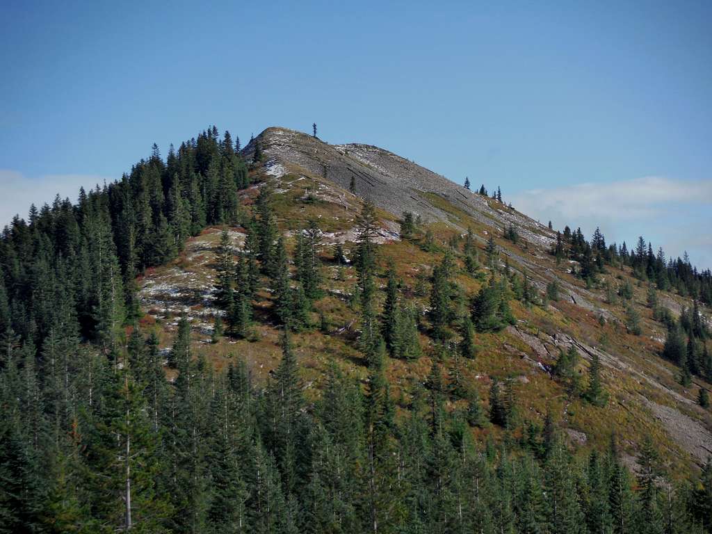
Sawmill Ridge in fall from the barrow pit
Sawmill Ridge located 25 miles north of mountain has almost all of the criteria that you would want in a summit. The summit itself has over 1000 feet of prominence and contains sweeping views of many surrounding peaks such as Mount Rainier, the Crystal Mountain Region and north towards Kaleetan Peak and Snoqualmie Mountain. The views off this ridge can be downright breathtaking from this summit and the open summit and the ridge give a unique character. When my friends and I were on the summit we spent at 30 minutes on this summit to really take in views and that was minus Mount Rainier which for us was covered in clouds. Often you have the summit all to yourself and if you can ignore some of the logging scars on the mountains you can really feel like you are isolated from the others in the region.
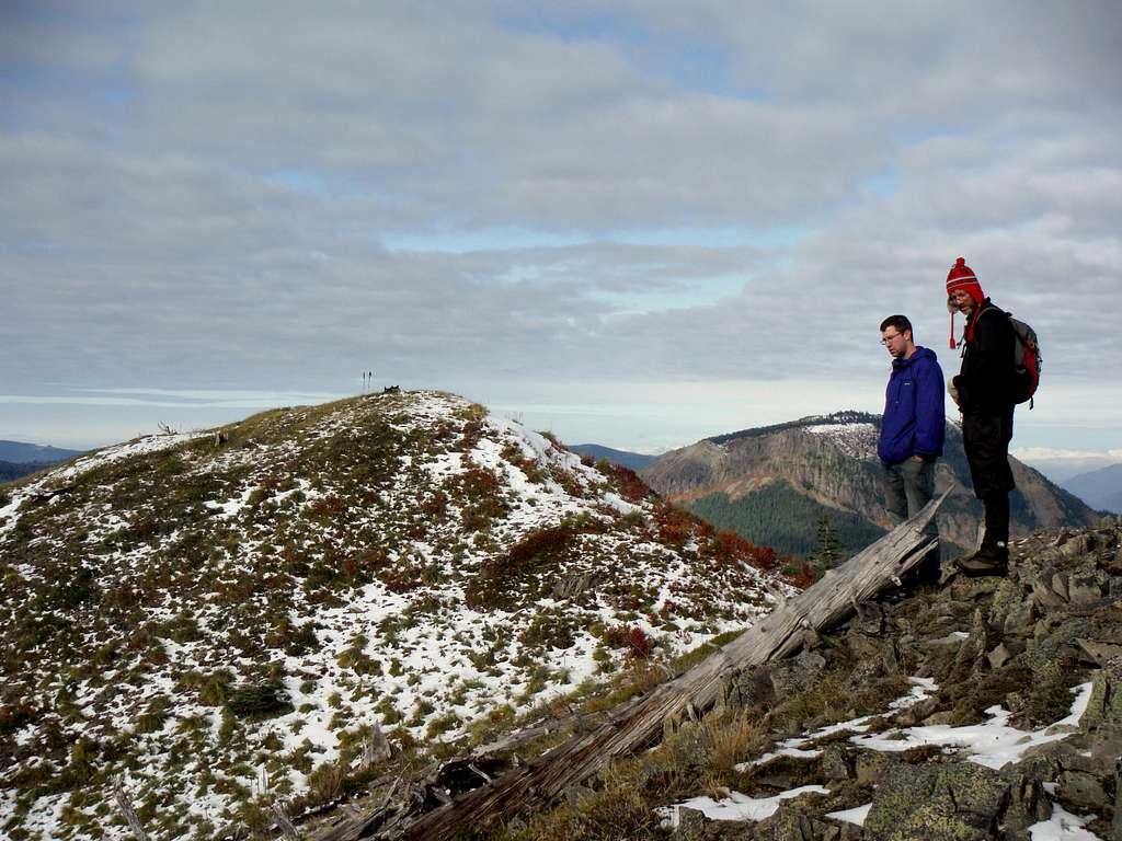
Tom and Jordan enjoy the view with the summit of Sawmill ridge in the close background
Unfortunately there is one major downfall to this summit. It is only 450 feet from the road to the summit and effort to summit required is very minimal. Most to go to summit this peak park in the barrow pit to the south and from there make the 0.6 mile road walk/bushwhack to the summit of Sawmill Ridge. If you go by this route you encounter a lot of open terrain and sweeping views on the way up the ridge. The ridge bushwhack is somewhat steep and open but not very exposed in terms of fall danger. In a sense you are hitting the climax of the mountain without hitting any of the elevation gain it require to hit this summit from the valley below. This is great if you don't want to put any effort into getting up a great mountain but for those who are interested in an epic climb, this would be a major disappointment. The Sawmill Ridge Trail named after Sawmill Ridge does not get to the true summit of Sawmill RIdge. That is because this particular part of the National Forest is still being heavily logged and there are a number of good gravel roads to get close to the summit. If you do choose to head up Sawmill Ridge you might not want to make it your only summit destination. Nearby Kelly Butte, Pyramid Peak and Blowout Mountain are close-by and one can easily tag two to four peaks on these logging roads a day. Bing your camera because this one and many other summits in this region have sweeping views despite the lack of effort getting to their summits.
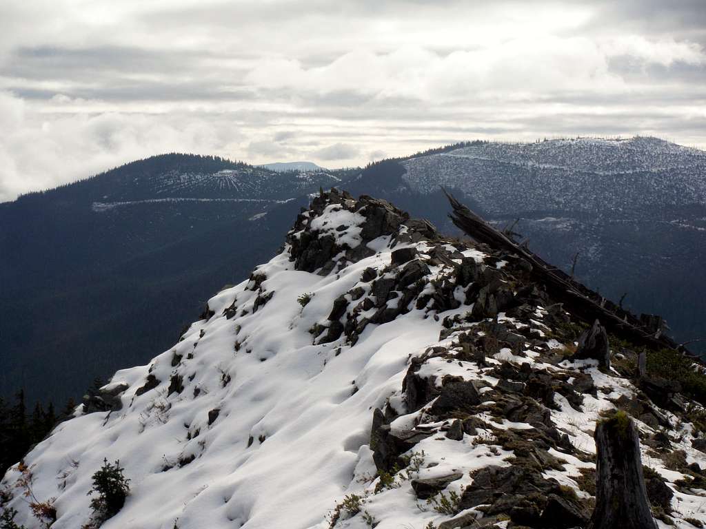
The sharp northern ridge
Getting There
FROM ENUMCLAW WASHINGTON TO BARROW PIT SOUTH OF THE SUMMIT OF SAWMILL RIDGE: Take Highway 410 east toward Greenwater. Once 1.5 miles passed the town of Greenwater make a let on National Forest Road 70. Stay on road roughly 7.5 miles. From there make a left onto 7030. Stay on Route 7030 for 6.5 miles. In 5 miles it will run into 7036. Stay to the left of this intersection and continue to head up until you reach Forest Road 7034 to your right. Go 1.3 miles and the Barrow Pit will be on your left. This will be the best place for you to park your car.Red Tape
In spring summer and fall there is no red tape for hiking this summit. Keep in mind that the roads up the mountain do have seasonal closure therefore this summit is only recommended when the roads are open. This summit is not recommended for winter travel unless one has a snowmobile and a SNO-PARK Pass. The Nearest SNO-PARK is Pyramid Creek which requires is SNO-PARK PERMIT ($22 for the day and $25 for the year)Pyramid Creek SNO PARK
Route
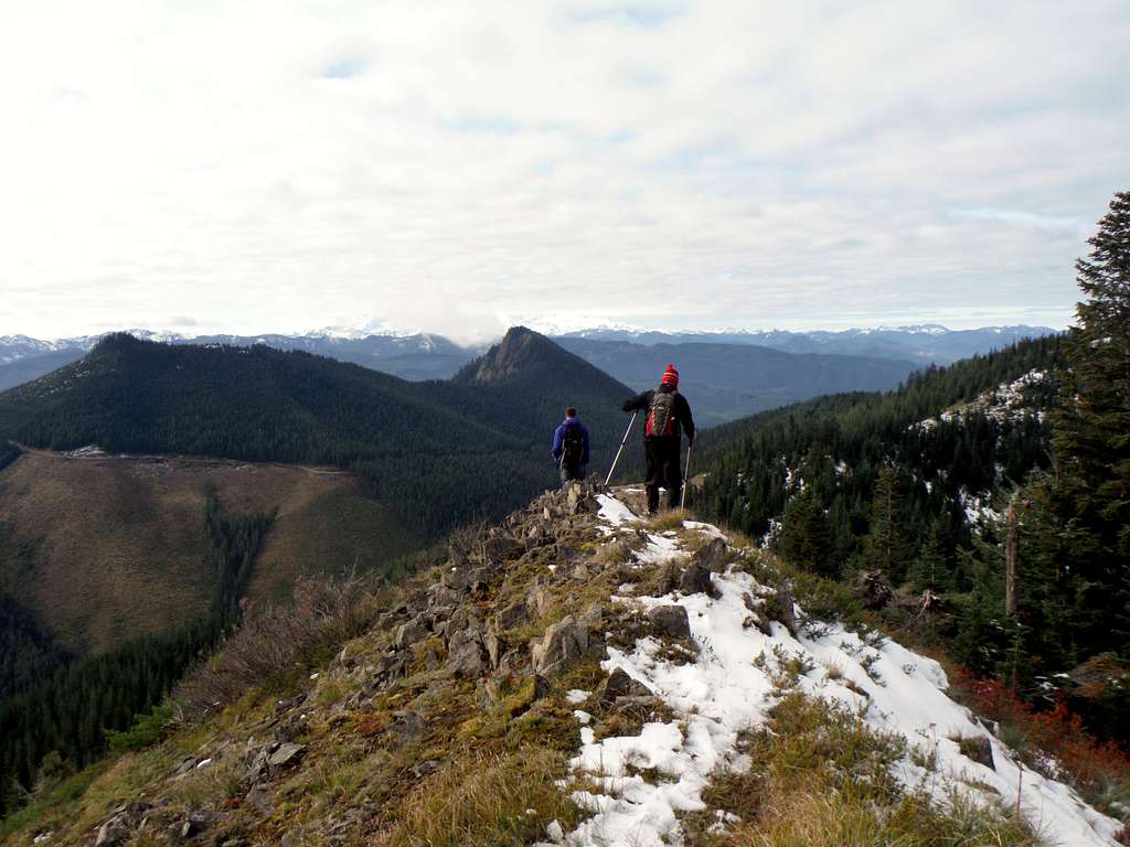
Traversing the ridge back down
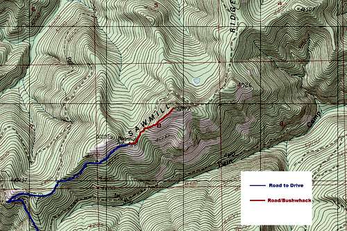
Sawmill Ridge Road and Bushwhack Map
When to Climb
Summer and Fall are the best times to climb this summit. It can also be done in winter but will either require a very long road slog or a snowmobile in order to reach the higher elevations. From what I can gather this summit is very rarely visited in winter.Camping
You can technically camp or bivy on the summit area but I would not recommend it. I honestly don't know why you would when the bushwhack from the road only requires 450 feet of elevation gain. Keep in mind though you are close to the road and there is no water up on the summit.External Links
Sawmill Ridge Peakbagger PageList of John Homepage