
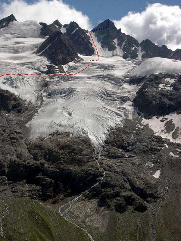
Schematic track of the route...
Schematic track of the route to the summit of the Torre del Gran San Pietro, from the facing Leonessa bivouac (2810 m): blue dots indicates the route on the East side, not visible.
The original photo was kindly provided by Livioz.
August 2004, 13th


