Comments
No comments posted yet.
|
|
Trip Report |
|---|---|
|
|
Sep 29, 2015 |
Date: September 29, 2015
Climbing time: 14hrs (incl multiple rest stops, and “casual day” wandering on descent)
Difficulty: Mostly class 2 walk-up via Clear Creek Trail-head
Elevation gain/loss: Approx. 15,200’ total
Mileage: 13.29 miles car-to-car
Mountains climbed: Mt Shasta
Summit: No
Gear: Gregory Palisade 80L pack (30lb weight); 3L Platypus reservoir; 1-32 oz bottle H2O; 2 GU gels; bonk bar; banana; gum; Keen Targhee II boots; Darn Tough socks; Columbia convertible cargo pants; Patagonia Capilene tee; LL Bean 1/4 zip fleece; Patagonia light down jacket; Native sunglasses; Garmin Forerunner 310XT; Shiseido sunblock SPF50; wool beanie; Black Diamond headlight.
Weather outlook: 42-60F, clear skies, NOAA weather reports little-no wind (ha!), no precipitation.
Trip Reflections
What a hike! After some initial decision making, I decided to climb Mt Shasta via the Clear Creek trail. It is said to be a less traveled route on the SE side of the mountain. Considering my famous aversion to crowds, this reputation appealed to me. There is a well-worn trail from the Trail-head to at least Clear Creek Meadow or Spring, which tells me the area at least to Mud Creek and the Spring does invite a bit of traffic.
I secured all permits and deposited summit fee at the trail-head kiosk, and began the hike at approximately 330am. There was a 3/4 moon in the early morning star-filled sky, but as the initial trail weaves beneath a canopy of old red firs, I opted to light the way ahead with the very bright spot headlight. The hike in even at night is impressive, as the east face of Shasta rises like a massive sentinel ahead to the left, coming into view now and again between the trees. There was a light breeze, the temperature was comfortable. It was quiet, save the sounds of my boots crackling along the trail, and the winds descending through the trees and southward into the deep canyon below to my left.
From the trail-head at 6400′, I made fairly quick time the first 2 miles/2000′ elevation gain to Clear Creek Meadow. I didn’t notice campers in the area, but as I scaled a stable incline of secure boulders mixed with occasional slipping scree, I spotted a fellow hiker, just a dark shadow, moving up beneath me to the right. Our paths crossed soon after and we introduced ourselves. He had camped at the Spring on the 28th, to acclimatize, and had started his summit push at 5am. It was nice to have a companion to walk at least some of the way up the hill.
Continuing on, we had gained elevation more quickly than I thought, reaching 10,000′ by 545am, the coming dawn reporting itself across the eastern horizon to our right.
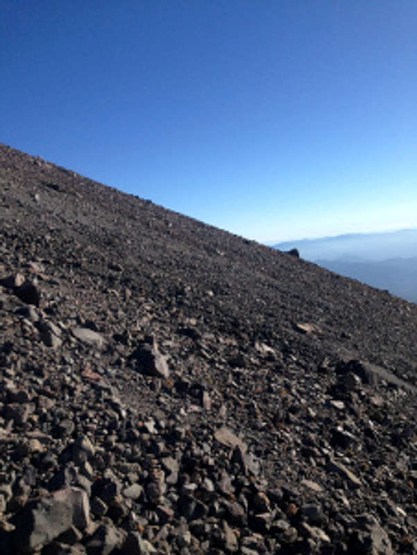
I felt good, but the going was slower than I imagined up the loose volcanic scree slope (about 30+ degrees avg).
Shasta Sept 29: As the sun rose, the hiker said he intended to slide left into a snow chute and push up. This was located more or less directly underneath the big red rock protrusion/false summit that over the next 3 hours seemed to hover up above and remain forever beyond my grasp. Anyway, frustrated with the now slow rate of progress up the sliding scree, and slightly alarmed by a very cold and steady wind that had presented itself (at this point 20+mph), pushing up on solid packed snow seemed a good idea, particularly up a chute with some wind protection characteristics. This was where, in hindsight, I may have erred this summit attempt.
There is a faint use trail that lies behind a butte at 11,500′, and after rounding this to the left, it presents the standard Clear Creek route to the top. The path we had chosen and were now set upon, was instead a more or less direct line of assault beneath the red rocks; it wasn’t a bad idea, considering the slope of the climb seemed the same in both places. But the same redoubtable problem emerged: I soon realized the snow patches were smaller than they initially seemed, and so the bulk of the effort remained the same slow slogging up scree.This would massively fatigue me for the duration of the climb.
Coupled with the rapid ascent from the trail-head, the elevation gain, me lugging far too heavy a pack (forgot my summit pack at home!), and that wind, I was starting to slow down. At a few points I considered rerouting east to catch the use trail, but each time I climbed out the chute I was pushed back by the increasingly cold/hard wind. With my 1 minute pauses every 10 minutes, the other hiker had by this point advanced about 400 yards above me. After a 15 minute rest stop to eat a snack at around 830am, I could no longer make him out. I figured he was at least 1.5-2hrs ahead of me at this stage.
I arrived at the “mushroom rock” at around 10am. I was pretty worn down. The sun felt warm, but this was rendered useless by the now howling steady wind, which seemed to gust every 10 seconds. The last hour up the scree chute was made an enormous challenge from the wind, and just retaining my balance was no small feat. Several strong gusts literally knocked me over onto my side. (This would happen over a dozen times the next 2 or so hours of ascent/descent.)
Arriving at last after a very slow, plodding hour up the scree from mushroom rock, I was now looking up from the base of the red rock protrusion. There were several routes up. I was aiming to find a path offering the most shelter from the hurricane force, bone-chilling wind; over the last couple of hours the wind had dried my lips and the area beneath my nose (next time, bring balaclava).
I climbed up a mostly easy Class 2/3 gully, actually the only notable climbing of the trip; it was protected nicely from the wind. It was here I took another break and found myself getting sleepy. It felt good closing my eyes. I must’ve slept more than a few minutes, it felt like more, until I was jarred awake by a voice telling me to “wake up, habibi.” So, I did.
The first thought was to turn back, mostly on account of the wind. Pushing up the scree for 2000’+ amid fierce winds had taken its toll. I’d gotten to about 13,500′. Under the circumstances, that wasn’t bad. But looking up, I realized the summit at 14,179′ was so close, or so it seemed.
It was an interesting moment. I was alone and no one would really know I’d not reached the top. I guess the realization that I would know was impetus enough. I decided at approx 1115am to focus on the summit, to give it the old college try.
It was more of the same above the red rock protrusion/saddle – pausing, trying to keep my balance on the steep, wind-swept slopes, trudging onward, upward. My legs were tingling from the cold; my pants provided virtually zero protection from the wind.
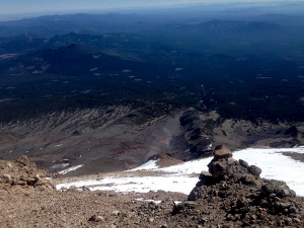
Around noon, I reached the summit plateau. I was now standing at 14,000′, about 200′ from the summit block. I was greeted by the absolutely strongest winds I’ve ever experienced. I had to keep a gloved hand atop my head to keep even my beanie from being blown off! I wanted to take a few photos, especially with the iPhone battery dying out.
Turning moments later to face the last portion of the climb, I realized I was spent. I was too tired. It had gotten too cold. The winds were so ferocious that my sole thought was running down the mountain.
In the end, I made the difficult decision to retreat, and head back. I felt I’d accomplished something, even though it fell short of my summit goal for my Climb CA for Syrian Refugees fundraiser. The culprit could be laid at the feet of unpredictable weather. The weather conditions I faced were nowhere in the forecast, which confirmed to me once again how, high up in the mountains above 10,000′, weather can change rapidly; and it is prudent to be prepared for it. The fact I attempted this as a day hike, which no doubt exhausted me (compounded by the weather), might also beg some attention.
The descent involved a lot of careful down-stepping for the first 1000′, mostly owing to the biting wind and its uncanny knack for pushing me off balance and onto my side or rear end. At around 13,000′ I began to sense a slow ski-style slalom was working. A half hour later, a serpentine near jog was possible. I was now leaving elevation rapidly. For some reason the scene from The In-Laws with the characters running “serpentine” came to my mind.
The hiker and I crossed paths again at about the place where we’d crossed over to head up the chute hours earlier. He had made the summit about an hour before me, but had paused near the summit block for a snack, and to hide from the wind which at that time was just starting to get ferocious. Thankfully, he was able to summit before the winds got really nasty. I congratulated him on his accomplishment. We said our goodbyes, and he glissaded down the final snow chute. Without waterproof pants, I was content to amble casually down the mountain.
On the way, I took time to study the array of pumice stone, volcanic fumaroles, and just soak in the vast grandeur of Shasta’s SE slope. It really is an amazing location, and an afternoon spent here would not be a wasted one. I paused at Clear Creek and drank from the spring without filtering – the famed running waters emanating from the foot of the nearby glacier was cold and refreshing.
I reached the car around sunset, not realizing the couple of hours I’d spent lingering on the mountain. I was glad to be back, and headed home. Driving the very long 8km dirt road to the highway from the trail-head, hoping my hybrid vehicle wouldn’t get stuck in the moon-dust road conditions (!), I felt a tinge of regret, more like unfinished business, having not reached the summit.
But there were lessons learned on this climb.
And God-willing, I’d be back to Shasta one day soon.
Great things are done when men and mountains meet – William Blake