
|
|
Area/Range |
|---|---|
|
|
32.49413°N / 107.16476°W |
|
|
Hiking |
|
|
Spring, Summer, Fall, Winter |
|
|
6625 ft / 2019 m |
|
|
Overview
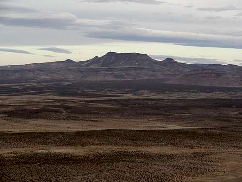
The Sierra De Las Uvas Mountains, meaning mountain of the grapes in spanish, are a mountain range to the west of Las Cruces, NM and South of Hatch, NM. This range received its name because at the very north end of the mountains a single grape vine was discovered near a spring. This grape vine covered an area of about an acre. Originally the spring was just named after the grape vine but soon the name spread to the whole mountain range. This vine is no longer in existence. Now the mountain range is just like any other desert peak and has plenty of cacti and thorn bushes.These mountains vary in elevation from a little over 5,000 feet to 6,625 feet at the top of Magdalena Peak. Magdalena peak has a prominence of 1,946 feet, which is enough for the 50 spot on the New Mexico Prominence list. On top of Magdalena peak is an observatory that is owned by New Mexico State University. Since this is located there, access to the top is restricted. There is a road leading to the top of Magdalena Peak but there is a gate at the bottom with about ten locks on it and signs that say no trespassing. However, some hikers walk around the back side and bushwack to the top. At The top there is a huge observatory along with another building. Both of which are surrounded by chain link fence with razor wire on top. Signs warn about video surveillance and consequences of jail time or a fine if one were to cross the fence.

These mountains receive a few visitors from 4 wheelers and hunters. This area is known for its relatively easy 4 wheeling trails. Many people can go 4 wheeling in this area without having to worry about damaging their vehicle. This area is also know for its white tail deer. Hunters often come to these mountains looking for them. This area however receives little attention from hikers. Even though not many hikers come to this area, it is a beautiful mountain range and even has some petroglyphs to see if you know where to look.

Getting There
From Las Cruces, take I-10 west. Take the airport exit, turn right then immediately left to get on the frontage road. Turn right into the entrance of the Corallitos ranch at county road 9. This is a paved road and any vehicle can take this road. Follow this road for quite a while and it will eventually turn into a rough dirt road. This road is somewhat rough. If you have a good off road vehicle you can take it into the mountain range.Hiking
There are no hiking trails in these mountains. However there are quite a few jeep trails that can be hiked on. If you want to climb one of the many peaks in the area you will have to bushwack to the top. Bushwacking here is relatively easy because there is not a lot of vegetation except in a few areas. Make sure you plan your route carefully when hiking off the trail. Most of the peaks have cliffs near the top. These can be avoided if you pick your route carefully from the bottom. If you wait until you get to the cliff to walk around it, you might have to walk a long distance to get around the cliff. These cliffs are usually very long in width but are short in height, about 10-15 feet. If you climb to the top of any of the high peaks in the range you will notice that it looks like you are on the top of a canyon not a mountain range. Most of the mountains in this range are relatively steep have very large and flat tops resembling a mesa.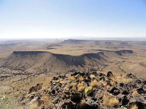

Red Tape

The Corralitos Ranch
The mountain range lies on the huge Corralitos ranch. This ranch is over 1,000 square miles. The owners of this ranch are very friendly and don't mind hikers or 4 wheelers on their ranch. The owners of this ranch even will give horse rides throughout the ranch even taking people to the petroglyphs and other old historic areas. You can visit their website to find more on their horse rides. www.corralitostrailrides.comWild Life

External Links
Sierra De Las Uvas 4 wheelingSierra De Las Uvas pictures