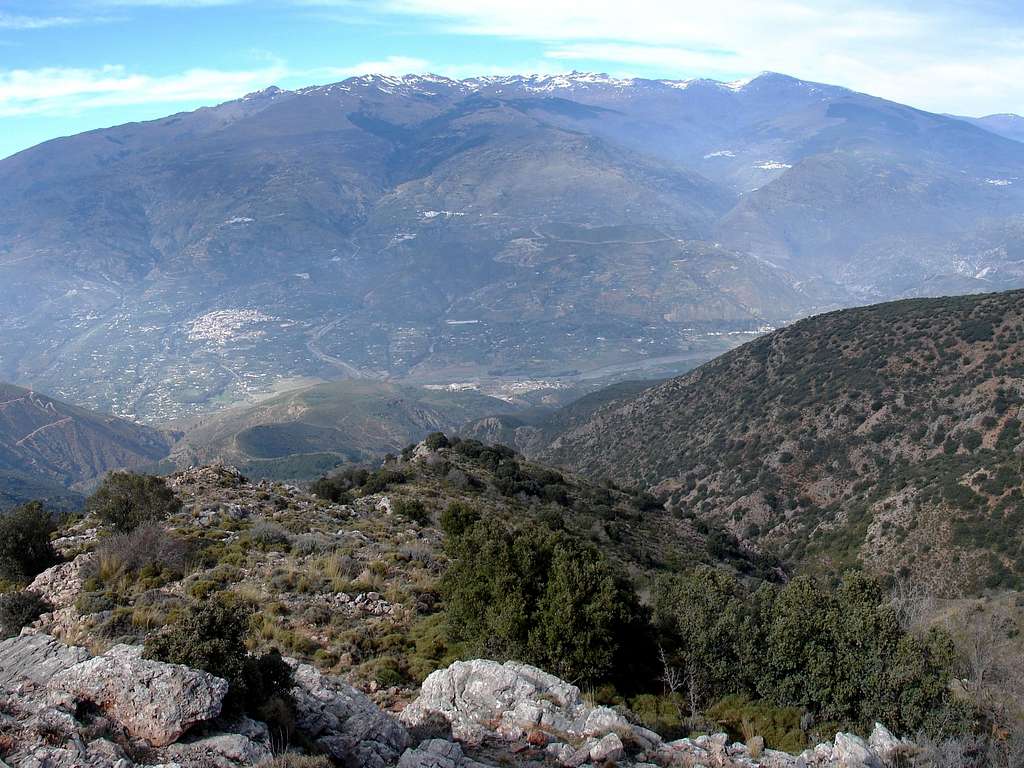
The westernmost crest section of Sierra Nevada, from Cerro del Caballo to Mulhacén, seen from the north face of Sierra de Lújar. To be precise, photo was taken from the El Salto hill, one of the routes to Los Pelaos, highest summit of Las Alpujarras, a modest mountain range between Sierra Nevada and Mediterranean Sea.
The most intesresting thing in this image is the big elevation gap between the highest points in the crest (Mulhacén - 3,483 ms; Veleta - 3,398 ms), and the bottom of the valley below: the altitude of the visible watercourse is slightly lower than 300 ms. In sum: 3,000 ms (about 9,000 ft)of elevation difference in just one sight.
Other references are the altitud of villages. The bigger, to the left of the hill, is Órgiva, at about 450 ms. The two higher on the right, just below Mulhacén, are Capileira (1,430 ms) and Bubión (1,300 ms).
When I take the photo I was going down from Los Pelaos to Órgiva along the visible hill, relaxing my legs and mind after having been seven hours walking solo through Las Alpujarras, including an elevation gain higher than 1,700 ms. This sight was the sweet dessert of a long and beautiful mountain day. March 15, 2008.


