
Viewing: 1-2 of 2

eza - May 31, 2004 10:35 am - Voted 10/10
¿Lo has hecho tú?¿O de dónde ha salido?. Estupendo, nuestros picos estaban necesitando esto. Gracias por el trabajo tanto si es tuyo como si no

Rafa Bartolome - May 31, 2004 5:07 pm - Hasn't voted
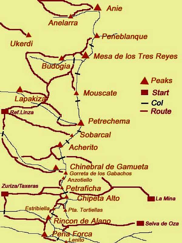
Re: ¿Lo has hecho tú?Efectivamente lo he hecho yo con un poco de paciencia y un mapa junto al ordenador. Los triangulos se construyen con la opción dibujar polígono de 3 lados con el photoshop y el resto es cuestión de mover el ratón para arriba y para abajo con buen pulso. Me costó 1 hora más o menos, pero disfruté bastante sacando las rutas y los collados haciendo futuros planes. Se puede luego poner el link en nuestras páginas de la zona a esta foto como referencia (tienes las rutas a Peña Forca por ejemplo).
Viewing: 1-2 of 2


Comments
Post a Comment