
Viewing: 1-3 of 3

desainme - Aug 24, 2003 11:48 am - Voted 10/10
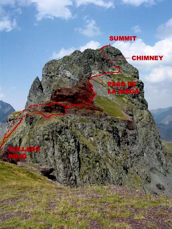
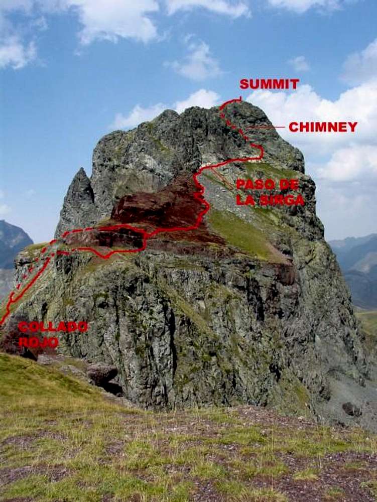
Nicely marked pathIs the brown area indicative of a landslide?

Rafa Bartolome - Aug 24, 2003 11:53 am - Hasn't voted
Re: Nicely marked pathNo landslide, the red color is for clayey area (the name Collado Rojo or Col Red is for this).

eza - Sep 10, 2003 10:09 am - Voted 10/10
Re: Nicely marked pathI agree with Rafa, that is the reason for the whole area north of Anayet being called "Canal Roya". It is the local term for "Red Valley"
Viewing: 1-3 of 3


Comments
Post a Comment