Toggle navigation
Mountains
Routes
Images
Trip Reports
Forum
What's New
People
Areas & Ranges
Articles
Trailheads
Canyons
Huts & Campgrounds
Albums
Logistical Centers
Fact Sheets
Lists
Custom Objects
Gear
Plans & Partners
WELCOME TO SUMMITPOST
SIGN IN
REGISTER
Siljevaca trail
Additional Parents
Image
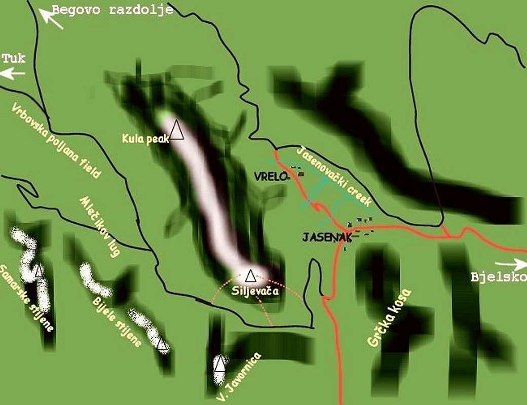
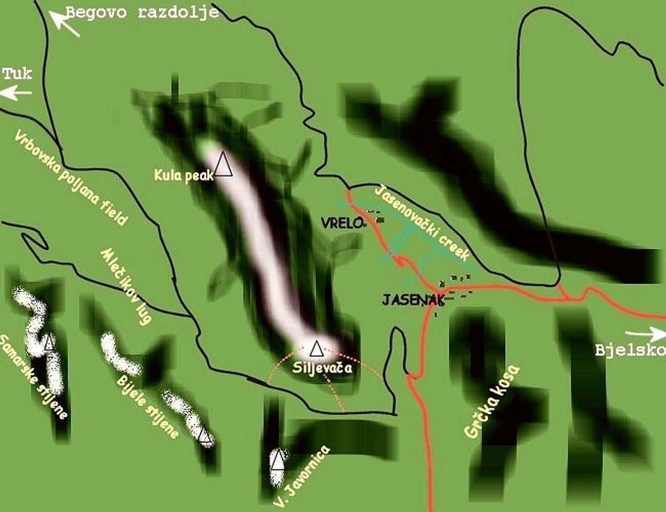
small reference sketch map of...
View High-Resolution Image
small reference sketch map of...
small reference sketch map of Bjelolasica
and surroundings.
Black lines are forrest roads,
Red lines a paved main roads,
Red dotted lines
indicate trails to Siljevaca rocks
« PREV
NEXT »
toc
on
May 12, 2005 2:47 pm
Comments & voting
Other parents
Lat/Lon:
45.27300°N / 14.96200°E
Image ID:
104730
1877 Hits
73.37
% Score
4
Votes
Log in to vote
Comments
No comments posted yet.
to post!
Don't have an account?
Siljevaca trail
(Route)
You are at
the First
Image
Viewing
#1 of 3
GALLERY
NEXT »
toc's Image Gallery
« PREV
Viewing
#320 of 664
GALLERY
NEXT »
Bjelolasica
(Mountain/Rock)
Loading....
×
You need to login in order to vote!
User Name
Password
Remember me
Forgot your password?
Log me out when I close my browser.
Keep me logged in all the time.
sign in as a user
Don't have an account?
Register now for FREE
Rating available
Suggested routes for you
People who climb the same things as you
Comments Available
Create Albums
Register Here


