


-
 1447 Hits
-
 77.48% Score
-
 8 Votes
|
|
Route |
|---|---|
|
|
45.74039°N / 7.31589°E |
|
|
Hiking |
|
|
Winter |
|
|
Half a day |
|
|
Note
|
La montagna chiama i suoi figli, ed essi rispondono fedelmente al suo appello… Osvaldo Cardellina, Diario alpinistico, 1964-65 Page texts: @ OsvaldoCardellina "Osva", passed away on May 2, 2022. Page owners: Christian Cardellina e Osvaldo Cardellina. Any updates from September 12, 2022: Antonio Giani, page administrator, friend and climbing companion. Testi della pagina: @ OsvaldoCardellina "Osva", scomparso il 2 maggio 2022. Proprietari pagina: Christian Cardellina e Osvaldo Cardellina. Eventuali aggiornamenti dal 12 settembre 2022: Antonio Giani, amministratore della pagina, amico e compagno di salite. |
Triple Overview
There is always a day of onset towards an activity or a new sport, a start point that is also a discovery. Initiation always begins with the first contact with the tool: a ball for basketball, a pair of skis for the ski, great gloves for boxing and a bow for shooting with the bow. And always with an opponent who can coincide with a team, a single athlete, a target to hit or a mountain to climb. Someone or something that always has a "problematic situation" to win or simply to overcome. For Snowshoeing, all this coincides with the altitude and the Fatigue". And then, if not a Guide, it is necessary a good Master, one that teaches you to pick up the tool and to know him a little at a time, experimenting paths always with prudent gradualism and prejudice in safety. Or, as has happened to us, you have to learn on your own, maybe listening to some advice on routes to be addressed at the beginning of this new adventure. Then "fly" by yourself, maybe occasionally "stumble". So you learn at progress. Here, we want to help in this eslusivamente second factor indicating to you three easy and simple routes to be in the Valley of Aosta. All three on the Southern slope where, thanks to the work of the sun, the snow turns and transforms more quickly allowing for better progression that is not where the same looks high or powdery and therefore more difficult to cross. Are three small paths to start the apprenticeship quietly without having too much "suffering": one at Testa (Head) Comagna towards "Lower Valley" between the Hill of St. Vincent and the Val d'Ayas, the second between the Southern Valtournanche (Torgnon ) and the Great Basin Verrayes/St. Denis in the "Media" reaching the Col des Bornes and for returning to St. Pantaleon Hill (wanting and having the capacity can reach the Becca d'Aver and Cima di Longhede, but in this case change the substance of the excursion).
![]()
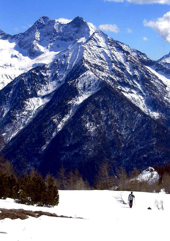
"Longhede (2416m) from Col des Bornes (1781m)", by emilius
The last at the beginning of the Valdigne at the entrance of the "Upper" going up by La Salle Common in Challancin and from this village, through the Bard's Pass, the nearby and namesake Court, great promontory rocky-wooded, over the Central Valley of Baltea. There are three tours that also comply with the progressive degree of commitment to training a good half a day there and back and nothing more: a chance to begin to prepare for other trails more long and difficult. As the purchase of the tool (there are of all kinds) please advise yourself, rather than from the merchants who probably has never shod the same, by who already uses it regularly. If we can intervene, we recommend is a lightweight, elastic, but also "robust", that is able to withstand the passage of mixed sections with rocks or walls between the lower lawn and the one above without breaking down. It sounds easy and logical, but do not be "enchanted" by the seller because, personal experience, you may have to expect often a considerable "swindles".
![]()
"From Col Tzecore towards Tête de Comagne (2106m)", by emilius
Esiste sempre un giorno d'esordio verso un'attività od uno sport nuovo, un punto d'inizio che é pure una scoperta. L'iniziazione incomincia sempre con la presa di contatto con l'attrezzo: una palla pel basket, un paio di sci per lo sci, dei guantoni per la boxe ed un arco per il tiro con l'arco. E sempre anche con un avversario che può coincidere con una squadra, un singolo atleta, un bersaglio da colpire oppure una montagna da scalare. Qualcuno o qualcosa che presenta una "situazione problematica" da vincere o semplicemente da superare. Per le Racchette da neve" questo coincide con il dislivello e la "Fatica". E poi, se non una Guida, é necessario un buon Maestro, uno che t'insegna a prendere in mano l'attrezzo ed a conoscerlo un pò alla volta, sperimentando i percorsi sempre con prudente gradualità e restando nella sicurezza. Oppure, come é successo a noi, si deve imparar da soli, magari ascoltando qualche consiglio sugli itinerari da affrontare all'inizio di questa nuova avventura. Poi si "vola" solitari, forse ogni tanto "inciampando". Così s'impara e si progredisce. Noi vogliamo eslusivamente aiutarvi in questo secondo fattore indicandovi tre facili e semplici percorsi da effettuare in Val d'Aosta. Tutti e tre sul Versante Meridionale dove, grazie all'opera del sole, la neve si trasforma più rapidamente consentendo una migliore progressione, che non là dove la stessa si presenta alta o farinosa e quindi più difficoltosa da attraversare. Tre piccoli percorsi per iniziare tranquillamente l'apprendistato senza dover troppo "soffrire": uno alla Testa di Comagna verso la "Bassa Valle" tra la Collina di St. Vincent e la Val d'Ayas, il secondo tra la parte Meridionale della Valtournanche (Torgnon) e la grande Conca di Verrayes/St. Denis nella "Media" raggiungendo il Col des Bornes e tornando per quello di St. Pantaléon (volendo ed avendone le capacità si possono raggiungere la Becca d'Aver e la Cima di Longhede, ma in questo caso cambia la sostanza dell'escursione). L'ultimo all'inizio della Valdigne ed all'ingresso dell'"Alta Valle" salendo dal Comune di La Salle a Challancin e da questo villaggio, tramite il Col de Bard, alla vicina omonima Court, grande promontorio boschivo-roccioso dominante la Valle Centrale della Dora. Tre gite che rispettano anche il progressivo grado d'allenamento con impegno di una buona mezza giornata tra andata e ritorno e nulla più: un'occasione per incominciare a prepararsi per altre più lunghe ed impegnative escursioni. In quanto all'acquisto dell'attrezzo (ne esiston di tutti i tipi) fatevi consiglliare da chi già l'usa abitualmente. Se possiamo intervenire, si consiglia un attrezzo leggero, elastico ma anche "robusto", cioé in grado di sopportare il passaggio su tratti misti con rocce o muretti tra prato sotto e quello sopra senza per questo rompersi. Sembra facile e logico, ma non fatevi "incantare" dal venditore ché per esperienza personale si posson spesso ricever "fregature" non indifferenti.
![]()
"Challancin Hamlet towards Court de Bard (2261m)", by Antonio
BY PLANE:
![]()
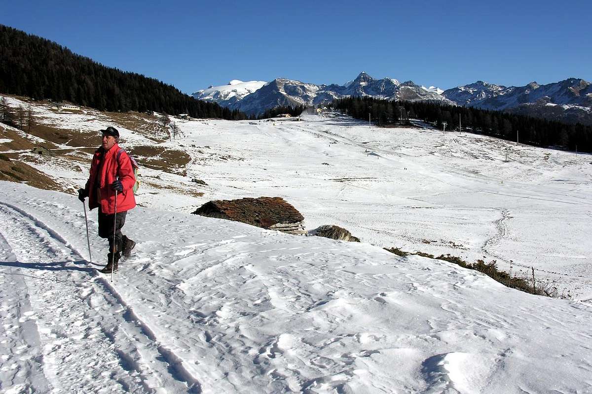
Descent from Tête Comagne, by emilius

Getting There
By car:- From TORINO, MILANO, etc: Motorway A5. Exit at IVREA or Quincinetto (PIEDMONT).
- From IVREA Town: in West to Pont Saint Martin, Donnas, Hône-Bard, Champdepraz, Pontey, Fénis, Saint Marcel, Grand Brissogne, Pollein, Charvensod, Gressan, Jovençan, Aymavilles, to Villeneuve, Arvier, Avise, Morgex and to Pré Saint Didier, Courmayeur Municipalities.
- From Courmayeur Resort: in East to Morgex, La Salle, Saint Pierre, Sarre, Aosta, Saint Chistophe; Quart, Nus, Chambave, Verrayes, Saint Denis, Châtillon, Saint Vincent, Emarese, Arnad, Verrès, Hône-Bard, Donnas, Pont Saint Martin Municipalities.
![]()
St. Denis/Verrayes Basin, by Antonio
Southern Sides:
From Aosta Town in East also by Ivrea City in West towards St. Vincent, Emarese, Châtillon, Chambave, Nus, St. Denis and Verrayes Municipalities
From SR.26, nearby Chambave, to Regional Road; towards Ollières, Marseiller (801m) to Verrayes (991m). With Municipal Road towards Tessellaz, Marquis, Dorinaz (13.23m), Charrière Villages to Grand-Villa Hamlet (1.437m), in Verrayes/Saint Denis Basin and to Aver-Longhede Area.
From A) - Verrayes, with Regional Road, towards Del (1.260m), Plau (1.305m), Semon to Cheresoulaz (1.487m) Villages. Also from B) - Saint Denis (803m; reached from Chambave, Marseiller) with Regional Road towards Gubioche, Etrobleyaz, Petit Bruson, to Del Villages. *** Road Connection towards Roves, Lozon (1.520m), Clavon, Fontane Villages, Pastures to Bornes Alp). From Cheresoulaz, through Municipal/Regional Roads, to Saint Pantaléon Hill (1.650m).![]()
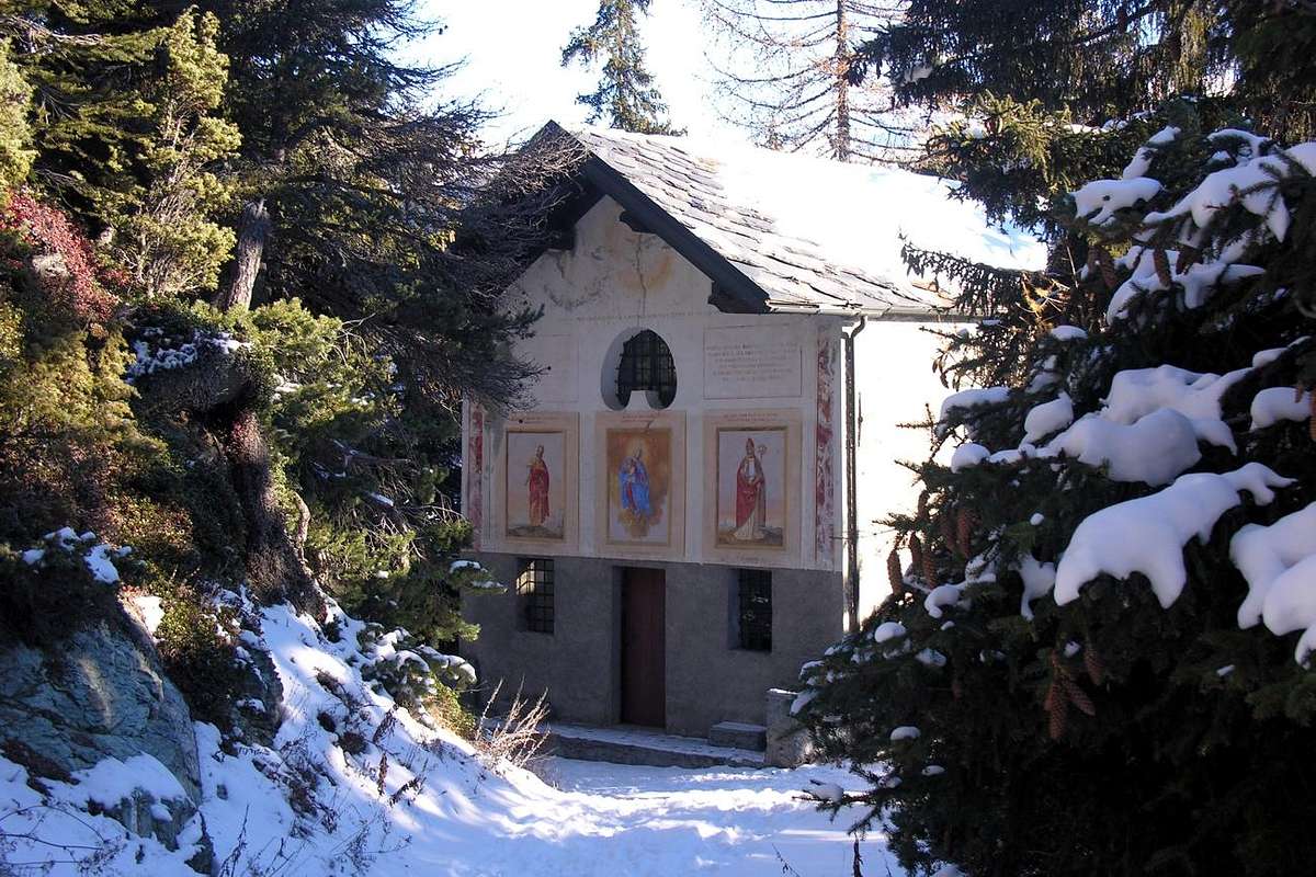
By Torgnon to Septumian Chapel, by emilius
From Châtillon (549m), with Regional Road, to Valtournanche and Breuil Cervinia Municipalities (2.004m). From Antey St. André Common (1.048m), through Regional Road in West, to Torgnon Municipality, (1.544/52m); by Municipal Road towards Septumian Fraction (1.679m) and, through dirt road and paths more in West, to Golette small Village (1.747/70m) and Pla Proz Rion or Prorion Resort (1.768/78m). Through dirt road with path concomitant towards Col des Bornes (1.781m)
From Saint Vincent, towards Cillian, Feilley Villages also from SR.26, towards Estaoud (595m), the both with Regional Roads, to Emarese Commune (1.048m); from this towards Erésaz (1.163m), Cuignon/Sommarèse/Longeon (1.549m, 1.536m, 1.516m) Hamlets to Zuccore Hill (1.607m).
Aosta in West towards Sarre, St. Pierre Arvier, Avise, La Salle Municipalities or by Courmayeur in East to Pré St. Didier, Morgex, Avise, Arvier, La Salle.
From La Salle (1.001m), with Regional Road, towards Challancin Village (1.610m), Ponteilles (1.741m), Arpilles (1.862m) Pastures to Bard Pass (2.178m) in Arpilles Conca.![]()
Passing near Arpilles Pasture, by livioz - From FRANCE: through the Mont Blanc Tunnel to Entrèves-crossroads to Vény/Ferret Valleys - Mountain Guides of Courmayeur - La Saxe Rock Gym - Courmayeur. By Little Saint Bernard Pass, closed since November until half May to La Thuile Valley - Pré Saint Didier - Courmayeur. It is not necessary to take Motorway A5: you can drive on SR.26, in the direction of AOSTA - IVREA - TURIN.
BY PLANE:
- Aeroporto "Corrado Gex" Saint Christophe (Aosta).
Eastern Routes Description (Comagne & Bornes with Variants)
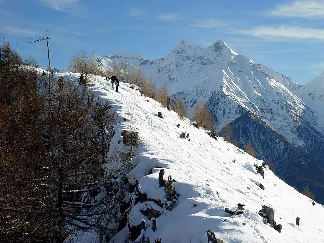
Route A (Tête Comagne): from the nearby Cuignon or Longeon Villages (1.530m), through path n° 5 on Southwestern Slope in Northeast, towards the Mont Zuccore (1.882m) and, with easy crossing on waterhed, always through the same trail, but more narrow, towards the Tête Comagne above the Col de Joux (E/F; 2h'30/2h'45).
VARIANTS
"Lower" Variant Aa (in the Southwest through the forest): from Cuignon Village, before with dirt road or concomitant path n° 5 up to the altitude 1.580/90 meters around, in West below the Mont Zuccore; after through path n° 5bis in Northeast into the underlying forest in the Southwest directly to Summit (EE/F+; 2h'10/2h'20).
Small Variant Ab: from Erésaz (1.163m) to Chassan Villages, through path n° 1 towards Cuignon small Village; also from Cuignon or from the nearby Longeon Village towards Zuccore Hill (1.607m), in part with the path n° 5 and in part by the Municipal Road (1.607m); T; 0h'40/0h'50). Possibility of descent along the Regional Road (or through various shortcuts) towards Arbaz Village (1.500m; characteristic old "rascards" in wood and in stone, but now in ruins) to Challand Saint Anselme Municipality in Ayas Valley.
Small Variant Ac towards the near and at the South Mont d'Arbaz: from Zuccore Hill (on-site better as "Tsicore or Tzecore"), through small path not numbered and traces into the short wood, towards the Mont d'Arbaz (1.653m; T; 0h '15/0h '20), between Zuccore Hill and Mont Ros (1.416m; entrances of Mines "Borna da Ghiasa").
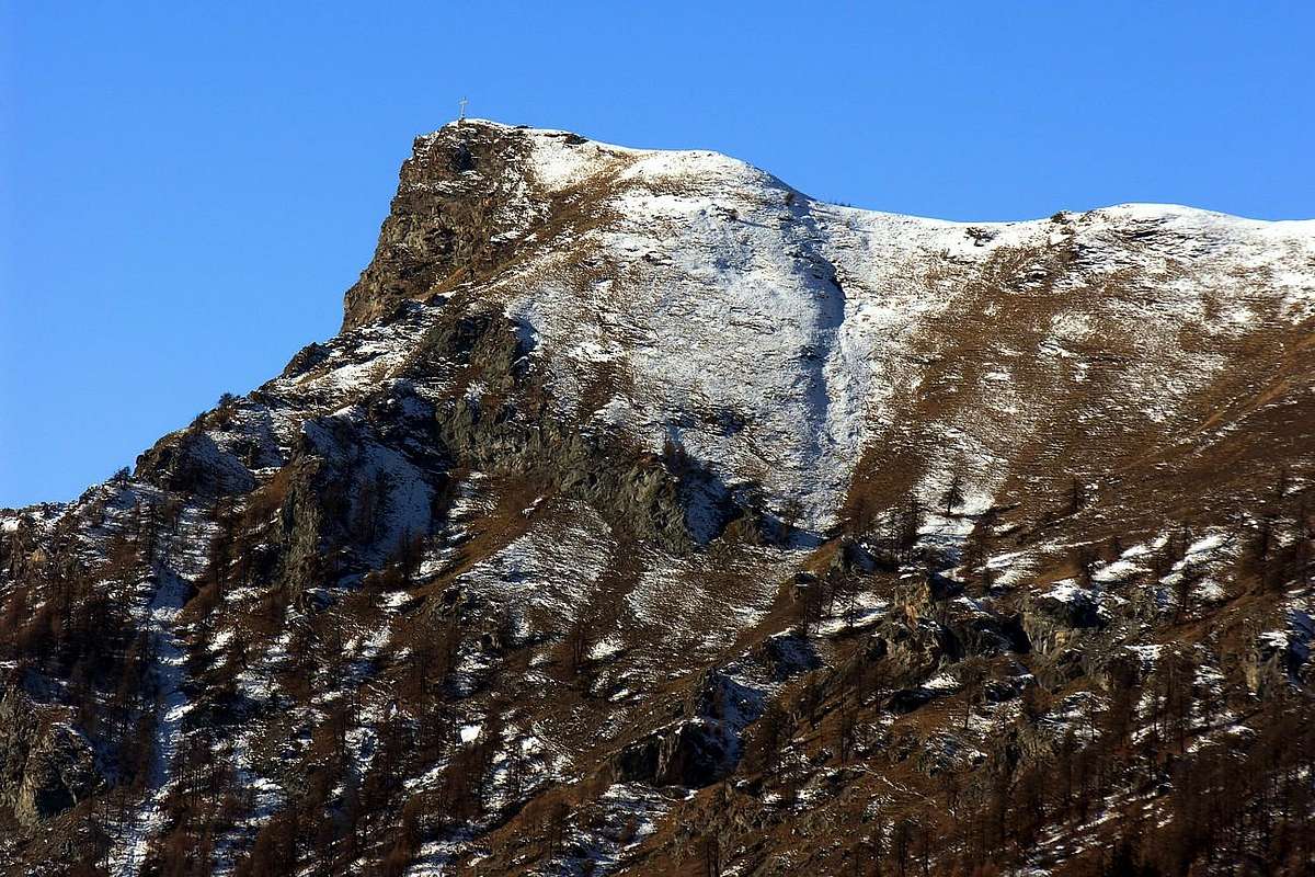
Variant Ad, through the asphalt road to the above Joux Hill: from Saint Vincent Municipality, with Regional Road to Brusson Common in Val d'Ayas and along the Regional Road towards the Joux Hill (1.635m). From this in ascent through small path n° 1B on forest and very dense Northern Side towards the Western great Shoulder (around 1.930m) and following traverse, through the easy and short Western Crest, towards the Tête de Comagne (2.106m; great cairn with Cross in Summit; EE/F; 2h'45/3h'15).
Variant Ae, starting from Emarese Common with asphalt road and by paths towards the Hill of Joux: from Emarese (1.048m), with Regional Road, towards Erésaz-Saint Roch (1.163m) Hamlets; from these towards Grand Rhun (1.385m) and Palud (1.605m small Villages, nearby the departure of three ski lifts, one towards the dense wood of Comagna West Shoulder. Through the paths n° 1/2, to the Joux Hill (1.635m; T/E; 1h '45/2h '00), between Saint Vincent, Emarese and Brusson Municipalities.
![]()
Tête Comagne (2.106m) from Col Tzecore (1.607m), by emilius
"Lower" Variant Aa (in the Southwest through the forest): from Cuignon Village, before with dirt road or concomitant path n° 5 up to the altitude 1.580/90 meters around, in West below the Mont Zuccore; after through path n° 5bis in Northeast into the underlying forest in the Southwest directly to Summit (EE/F+; 2h'10/2h'20).
Small Variant Ab: from Erésaz (1.163m) to Chassan Villages, through path n° 1 towards Cuignon small Village; also from Cuignon or from the nearby Longeon Village towards Zuccore Hill (1.607m), in part with the path n° 5 and in part by the Municipal Road (1.607m); T; 0h'40/0h'50). Possibility of descent along the Regional Road (or through various shortcuts) towards Arbaz Village (1.500m; characteristic old "rascards" in wood and in stone, but now in ruins) to Challand Saint Anselme Municipality in Ayas Valley.
Small Variant Ac towards the near and at the South Mont d'Arbaz: from Zuccore Hill (on-site better as "Tsicore or Tzecore"), through small path not numbered and traces into the short wood, towards the Mont d'Arbaz (1.653m; T; 0h '15/0h '20), between Zuccore Hill and Mont Ros (1.416m; entrances of Mines "Borna da Ghiasa").
Variant Ad, through the asphalt road to the above Joux Hill: from Saint Vincent Municipality, with Regional Road to Brusson Common in Val d'Ayas and along the Regional Road towards the Joux Hill (1.635m). From this in ascent through small path n° 1B on forest and very dense Northern Side towards the Western great Shoulder (around 1.930m) and following traverse, through the easy and short Western Crest, towards the Tête de Comagne (2.106m; great cairn with Cross in Summit; EE/F; 2h'45/3h'15).
Variant Ae, starting from Emarese Common with asphalt road and by paths towards the Hill of Joux: from Emarese (1.048m), with Regional Road, towards Erésaz-Saint Roch (1.163m) Hamlets; from these towards Grand Rhun (1.385m) and Palud (1.605m small Villages, nearby the departure of three ski lifts, one towards the dense wood of Comagna West Shoulder. Through the paths n° 1/2, to the Joux Hill (1.635m; T/E; 1h '45/2h '00), between Saint Vincent, Emarese and Brusson Municipalities.
Via A (Testa di Comagna): dai piccoli Villaggi di Cuignon/Longeon (1.530m), tramite sentiero n° 5 sul Versante Sudovest e con direzione Nordest verso il Mont Zuccore (1.882 m) e, con facile traversata sullo spartiacque, sempre con il medesimo sentiero ma più ristretto ed attraverso il bosco alla Tête de Comagne (E/F; 2h'30/2h'45).
VARIANTI
Variante "Bassa" Aa: dal Villaggio di Cuignon dapprima con la poderale oppure con il sentiero concomitante n° 5 insino a quota 1.580/90 metri circa, verso Occidente sottostantemente al Mont Zuccore; indi con sentiero alternativo n° 5bis a Nordest internamente alla foresta e quindi direttamente alla Sommità (EE/F+; 2h'10/2h'20).
Piccola Variante Ab: dal Villaggio di Erésaz (1.163 m) verso quello di Chassan, tramite sentiero n° 1 verso Cuignon; oppure partendo tra Cuignon/Longeon al Col Zuccore, in parte con il sentiero n° 5 ed in parte con la Strada Municipale (1.607 m); T; 0h'40/0h '50). Possibilità di scendere lungo la Strada Regionale (eventuali scorciatoie) al Villaggio di Arbaz (1.500m; caratteristico per i vari vecchi "rascards" in legno e pietra, oggi in semi rovina) e poi con strada asfaltata in direzione di Challand Saint Anselme in Val d'Ayas.
Variantina Ac al Mont d'Arbaz: dal Col Zuccore (localmente chiamato "Tsicore o Tzecore"), con sentierucolo non numerato verso Mezzogiorno seguito da tracce internamente al bosco, verso il viciniore Mont d'Arbaz (1.653m; T; 0h'15/0h'20), sito tra il Col Zuccore ed il Mont Ros (1.416m; imbocchi delle Miniere "Borna da Ghiasa").
Variante Ad, con Strada Regionale al Col di Joux: dal Comune di Saint Vincent, con la Strada Regionale verso il Comune di Brusson in Val d'Ayas, sino a raggiungere verso Sudovest il Col di Joux (1.635 m). Da questo con ascensione a Sudest con il sentierino n° 1B sul Versante Settentrionale dello Spallone Occidentale (circa 1.930 metri) nonché conseguente traversata, tramite la facile e breve Cresta Ovest, alla Tête de Comagne (2.106m; grande tumulo con dediche nonché Croce in Cima; EE/F; 2h'45/3h'15).
Variante Ae, con partenza dal Comune di Emarese e sempre tramite il Col di Joux: da Emarese (1.048 m), con la Strada Regionale, verso Erésaz-Saint Roch (1.163 m); da questi proseguire verso quelli di Grand Rhun (1.385 m), Palud (1.605 m; soprastante partenza dei tre ski lifts, uno dei quali diretto verso le falde boschive dello Spallone Occidentale della Testa di Comagna), tramite i sentieri n° 1/2, sino al Col di Joux (1.635 m; T/E; 1h'45/2h'00), a cavallo dei Comuni di Saint Vincent, Emarese e Brusson.
![]()
"From Chantorné Alpages to Mont Meabé", by emilius
Via B (Col des Bornes da Torgnon in Valtournanche): partendo da Torgnon Frazione di Septumian (1.547 m) verso i Villaggetti di Pecou (1.618 m) e Chatrian (1.650 m) fino al minuscolo Resort di Plan Proz Rion (1.773 m; Area Pic Nic con campetto da Calcio). Da qui verso Sud-sudest tramite la poderale dentro alla foresta sino al Col des Bornes ed il viciniore Alpeggio tramite il sentiero n° 1 concomitante alla poderale (1.725 m; T; 1h'00/1h'15 da Plan Proz Rion o Plan Prorion), sottostante alla Becca d'Aver (2.469 m).Dall'Alpe Golette con giro più largo ad Ovest: dall'Alpe di Golette, raggiungibile da Septumian tramite la strada asfaltata, con il sentiero n° 8 verso il Laghetto e gli Alpeggi di Baccard (1.902 m), Vieille (1.886 m), Fontarin (1.914 m), appena al di sopra di quelli di Chantorné Dèsott (1.863 m); continuare voltando a Sud tramite la poderale od i sentieri raggiungendo il bivio 1.818 metri soprastante Proz Rion; da quest'ultimo sempre verso Sud-sudest al Col des Bornes con sentiero-poderale n° 1 (1.781 m; E/F+; 3h'00/3h'15).
![]()
"Becca d'Aver from Chantorné Pastures", by Marco Cossard
Variante "Bassa" Aa: dal Villaggio di Cuignon dapprima con la poderale oppure con il sentiero concomitante n° 5 insino a quota 1.580/90 metri circa, verso Occidente sottostantemente al Mont Zuccore; indi con sentiero alternativo n° 5bis a Nordest internamente alla foresta e quindi direttamente alla Sommità (EE/F+; 2h'10/2h'20).
Piccola Variante Ab: dal Villaggio di Erésaz (1.163 m) verso quello di Chassan, tramite sentiero n° 1 verso Cuignon; oppure partendo tra Cuignon/Longeon al Col Zuccore, in parte con il sentiero n° 5 ed in parte con la Strada Municipale (1.607 m); T; 0h'40/0h '50). Possibilità di scendere lungo la Strada Regionale (eventuali scorciatoie) al Villaggio di Arbaz (1.500m; caratteristico per i vari vecchi "rascards" in legno e pietra, oggi in semi rovina) e poi con strada asfaltata in direzione di Challand Saint Anselme in Val d'Ayas.
Variantina Ac al Mont d'Arbaz: dal Col Zuccore (localmente chiamato "Tsicore o Tzecore"), con sentierucolo non numerato verso Mezzogiorno seguito da tracce internamente al bosco, verso il viciniore Mont d'Arbaz (1.653m; T; 0h'15/0h'20), sito tra il Col Zuccore ed il Mont Ros (1.416m; imbocchi delle Miniere "Borna da Ghiasa").
Variante Ad, con Strada Regionale al Col di Joux: dal Comune di Saint Vincent, con la Strada Regionale verso il Comune di Brusson in Val d'Ayas, sino a raggiungere verso Sudovest il Col di Joux (1.635 m). Da questo con ascensione a Sudest con il sentierino n° 1B sul Versante Settentrionale dello Spallone Occidentale (circa 1.930 metri) nonché conseguente traversata, tramite la facile e breve Cresta Ovest, alla Tête de Comagne (2.106m; grande tumulo con dediche nonché Croce in Cima; EE/F; 2h'45/3h'15).
Variante Ae, con partenza dal Comune di Emarese e sempre tramite il Col di Joux: da Emarese (1.048 m), con la Strada Regionale, verso Erésaz-Saint Roch (1.163 m); da questi proseguire verso quelli di Grand Rhun (1.385 m), Palud (1.605 m; soprastante partenza dei tre ski lifts, uno dei quali diretto verso le falde boschive dello Spallone Occidentale della Testa di Comagna), tramite i sentieri n° 1/2, sino al Col di Joux (1.635 m; T/E; 1h'45/2h'00), a cavallo dei Comuni di Saint Vincent, Emarese e Brusson.
Route B (Col des Bornes by Torgnon Common in Valtournanche): from Torgnon-Septumian Fraction (1.547m) towards Pecou (1.618m) and Chatrian (1.650m) Villages to small Resort of Plan Proz Rion at the beginning of the forest or Bois de Pointy (1.773m; Area Pic Nic with small Football Field). From this in Southwest through farms dirt road into the forest to Bornes Hill and nearby Alp through the path n° 1 (1.725m; T; 1h'00/1h'15 from Plan Proz Rion or Plan Prorion), below the Becca d'Aver (2.469m).
From Golette with more large trail to the West: from Golette, reached from Septumian through the asphalt road, with the trail n° 8 to a mini pond and towards Baccard (1.902m), Vieille (1.886m), Fontarin (1.914m) Alpages, above Chantorné Dèsott (1.863m). Continue turning South through dirt road or paths towards the fork 1.818 metres over Proz Rion; from this last always in South-southeast to Bornes Hill through the path n° 1 concomitant with the dirt road (1.781m; E/F+; 3h'00'/3h'15), below Becca d'Aver.
From Golette with more large trail to the West: from Golette, reached from Septumian through the asphalt road, with the trail n° 8 to a mini pond and towards Baccard (1.902m), Vieille (1.886m), Fontarin (1.914m) Alpages, above Chantorné Dèsott (1.863m). Continue turning South through dirt road or paths towards the fork 1.818 metres over Proz Rion; from this last always in South-southeast to Bornes Hill through the path n° 1 concomitant with the dirt road (1.781m; E/F+; 3h'00'/3h'15), below Becca d'Aver.
Via B (Col des Bornes da Torgnon in Valtournanche): partendo da Torgnon Frazione di Septumian (1.547 m) verso i Villaggetti di Pecou (1.618 m) e Chatrian (1.650 m) fino al minuscolo Resort di Plan Proz Rion (1.773 m; Area Pic Nic con campetto da Calcio). Da qui verso Sud-sudest tramite la poderale dentro alla foresta sino al Col des Bornes ed il viciniore Alpeggio tramite il sentiero n° 1 concomitante alla poderale (1.725 m; T; 1h'00/1h'15 da Plan Proz Rion o Plan Prorion), sottostante alla Becca d'Aver (2.469 m).Dall'Alpe Golette con giro più largo ad Ovest: dall'Alpe di Golette, raggiungibile da Septumian tramite la strada asfaltata, con il sentiero n° 8 verso il Laghetto e gli Alpeggi di Baccard (1.902 m), Vieille (1.886 m), Fontarin (1.914 m), appena al di sopra di quelli di Chantorné Dèsott (1.863 m); continuare voltando a Sud tramite la poderale od i sentieri raggiungendo il bivio 1.818 metri soprastante Proz Rion; da quest'ultimo sempre verso Sud-sudest al Col des Bornes con sentiero-poderale n° 1 (1.781 m; E/F+; 3h'00/3h'15).
Note: In addition to the crossing of the Col des Bornes, we present a series of tour options that are connected to the same especially concerning its South side, going up by the City of Chambave to the Basin of Verrayes-Saint Denis Commons. It is considered climbs to Becca Aver-Cima Longhede, Monte Ander and to the various hills of this Area.
Route BB with Southern Variants (Col des Bornes by Chambave): from SR.26, nearby Chambave Commune, to Regional Road; by this towards Ollières (647m) and Marseiller (801m) Villages; continue to Verrayes Municipality (Eglise 991m; Moulin 1.005m). With Municipal Road in North towards Plan de Verrayes 1.015m), Tessellaz (1.138m), Marquis (1.288m), Dorinaz (1.323m), Charrière Villages to Grand-Villa more great and ancient Hamlet (1.437m). By this last continue West to Vencorère (1.563m; end of road) Village; through dirt road in Northwest to Prelaz Alp (1.712m) and subsequent a) - Mont Ander (1.931m; M+; 2h'30/2h'45), through sparce traces and not numbered trail on easy Southeast Slope; also from Prelaz, by dirt road concomitant with path n° 6, to b) - Filon Pass, below Cima Longhede (1.894m; T/E; 0h'30 alp).
![]()
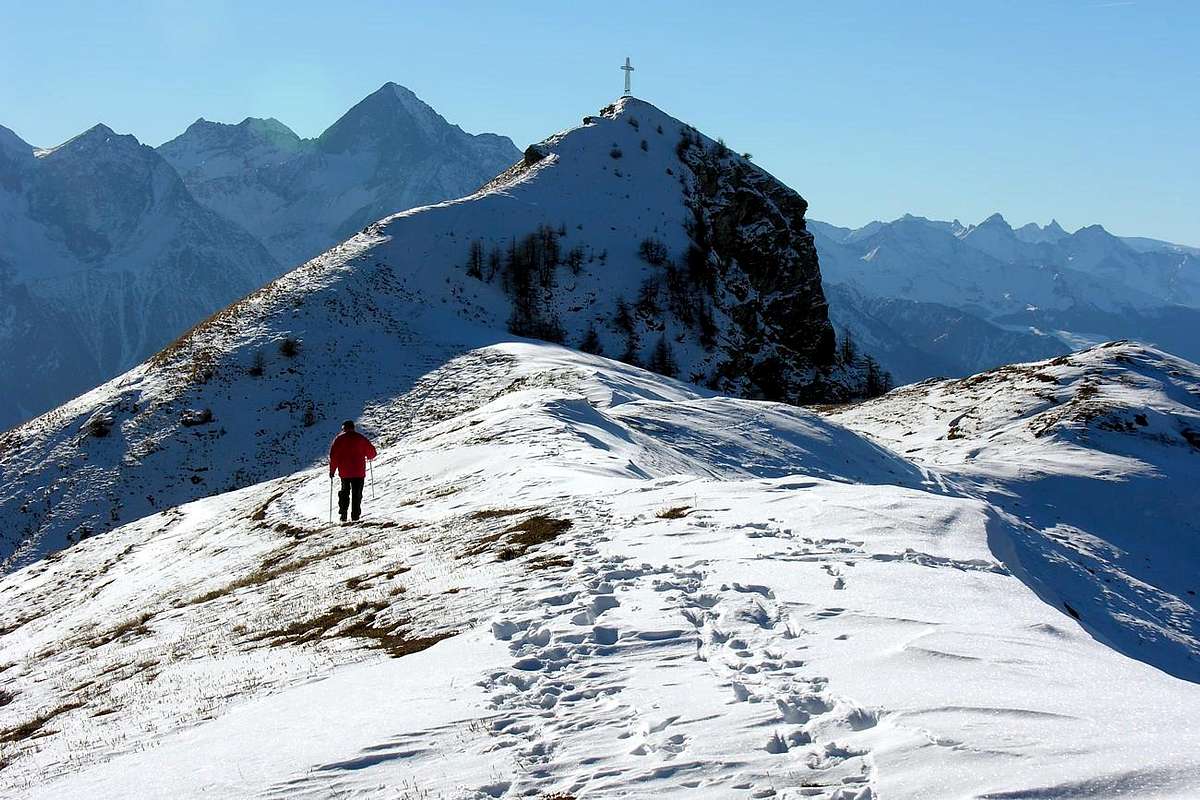
"Ascending on Becca d'Aver Col des Bornes", by emilius
Variant with ascent on Becca d'Aver and crossing towards Cima di Longhede: from Grand-Villa Hamlet towards Loson, Petit Loson small Villages (1.525m, 1.545m; pond); continue to Fontane, Champlong Damon (1.715m) Pastures reaching Bornes Alp and the nearby Hill (1.760 metres around, 1.774m). From this towards Aver Pass (about 2.330 meters) and Becca Aver (2.469m), through the easy South Slope and path n° 1, and crossing to nearby Cima Longhede with trail n° 16 (2.416m; D; 4h'30/4h'45).
Various little Variants: from a) - Verrayes, with Regional Road, towards Del (1.260m), Plau (1.305m), Semon, Cheresoula or Cherisoulaz (1.487m) Villages. Also from b) - St. Denis (803m, reached from Chambave Commune, Marseiller Hamlet with Regional Road but more in East, towards Gubioche, Etrobleyaz, Petit Bruson Villages to Del and Plau.
Bbis *** Roads Connection towards Roves (1.524m), Lozon (1.520m; pond), Clavon (1.643m), Fontane (1.599m) Villages or Pastures to Bornes Alp and nearby Hill (1.781m). From Cheresoula Village towards the Saint Pantaléon Hill (1.650m) through path n° 4; from this descent to Sémon Village (1.428m) through grassy fields or with paths n° 2 and return, with more large lap in East, in ascent towards the hill through the trail n° 2 (Saint Evançe Tour with trail in round trip; T; 1h'00/1h'15).
Variant passing on St: Pantaléon Hill: from Saint Pantaléon Hill, before through a good muletrack, after with the following path n° 4 in Northwest, crossing the forest almost in level route and in the final part with short descent, towards Bornes Hill near the homonym Alpage (neighbor a torrent; yellow signals to Becca d'Aver; T; 1h'0015/1h'30).
![]()
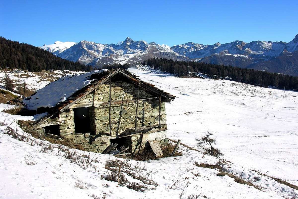
"Chantorné Dèsott Pastures", by emilius
Route BB with Southern Variants (Col des Bornes by Chambave): from SR.26, nearby Chambave Commune, to Regional Road; by this towards Ollières (647m) and Marseiller (801m) Villages; continue to Verrayes Municipality (Eglise 991m; Moulin 1.005m). With Municipal Road in North towards Plan de Verrayes 1.015m), Tessellaz (1.138m), Marquis (1.288m), Dorinaz (1.323m), Charrière Villages to Grand-Villa more great and ancient Hamlet (1.437m). By this last continue West to Vencorère (1.563m; end of road) Village; through dirt road in Northwest to Prelaz Alp (1.712m) and subsequent a) - Mont Ander (1.931m; M+; 2h'30/2h'45), through sparce traces and not numbered trail on easy Southeast Slope; also from Prelaz, by dirt road concomitant with path n° 6, to b) - Filon Pass, below Cima Longhede (1.894m; T/E; 0h'30 alp).

Variant with ascent on Becca d'Aver and crossing towards Cima di Longhede: from Grand-Villa Hamlet towards Loson, Petit Loson small Villages (1.525m, 1.545m; pond); continue to Fontane, Champlong Damon (1.715m) Pastures reaching Bornes Alp and the nearby Hill (1.760 metres around, 1.774m). From this towards Aver Pass (about 2.330 meters) and Becca Aver (2.469m), through the easy South Slope and path n° 1, and crossing to nearby Cima Longhede with trail n° 16 (2.416m; D; 4h'30/4h'45).
Various little Variants: from a) - Verrayes, with Regional Road, towards Del (1.260m), Plau (1.305m), Semon, Cheresoula or Cherisoulaz (1.487m) Villages. Also from b) - St. Denis (803m, reached from Chambave Commune, Marseiller Hamlet with Regional Road but more in East, towards Gubioche, Etrobleyaz, Petit Bruson Villages to Del and Plau.
Bbis *** Roads Connection towards Roves (1.524m), Lozon (1.520m; pond), Clavon (1.643m), Fontane (1.599m) Villages or Pastures to Bornes Alp and nearby Hill (1.781m). From Cheresoula Village towards the Saint Pantaléon Hill (1.650m) through path n° 4; from this descent to Sémon Village (1.428m) through grassy fields or with paths n° 2 and return, with more large lap in East, in ascent towards the hill through the trail n° 2 (Saint Evançe Tour with trail in round trip; T; 1h'00/1h'15).
Variant passing on St: Pantaléon Hill: from Saint Pantaléon Hill, before through a good muletrack, after with the following path n° 4 in Northwest, crossing the forest almost in level route and in the final part with short descent, towards Bornes Hill near the homonym Alpage (neighbor a torrent; yellow signals to Becca d'Aver; T; 1h'0015/1h'30).
Nota: Oltre alla traversata del Col des Bornes, presentiamo una serie di possibilità di gite collegantisi al medesimo soprattutto concernenti il suo versante Meridionale, salendo dal Comune di Chambave verso il Bacino di Verrayes/Saint Denis. Vengono prese in considerazione le ascensioni alla Becca di Aver-Cima di Longhede, al Monte Ander ed ai colli.
Via BB con Varianti da Mezzogiorno (Col des Bornes): dalla SS.26, presso il Comune di Chambave verso la Strada Regionale; con questa in direzione dei Villaggi di Ollières (647 m) e Marseiller (801m) donde al Comune di Verrayes (Chiesa 991 m; Mulino 1.005 m). Tramite la Strada Municipale verso Settentrione in direzione del Plan de Verrayes 1.015 m) ed i Villaggi di Tessellaz (1.138 m), Marquis (1.288 m), Dorinaz (1.323 m), Charrière e quindi al Villaggio più grande ed antico di Grand-Villa (1.437 m). Da questi continuare ad Ovest verso il Villaggio di Vencorère (1.563 m; termine della strada); con la poderale verso Nordovest raggiungere quello di Prelaz (1.712 m) e successivamente il a) - Mont Ander (1.931 m; M+; 2h'30/2h'45), su tracce discontinue nonché sentiero non numerato lungo il facile e non ripido Versante Sudest; oppure dall'Alpe di Prelaz, con la poderale concomitante al sentiero n° 6, verso il b) - Colle del Filone (1.894 m; T/E; 0h'30 dall'alpeggio), ai piedi del Versante Ovest della Longhede.
![]()
"Traverse from Becca d'Aver to Cima Longhede", by emilius
Variante con traversata a Becca d'Aver/Cima di Longhede: da Grand-Villa verso i Villaggetti di Loson e Petit Loson (1.525 m, 1.545 m; laghetto) e gli Alpeggi di Fontane, Champlong Damon (1.715 m) donde all'Alpe Bornes viciniora all'omonimo Colle (1.760 metri circa, 1.774 m). Da questo al Colle d'Aver Aver (circa 2.330 metri) e subito dopo con sentiero n° 1 alla Becca d'Aver (2.469 m), per mezzo del Versante Sud con relativa, volendo, traversata alla Cima Longhede con sentiero n° 16 (2.416 m; D; 4h'30/4h'45).
Varie piccole Varianti: dal Comune di a) - Verrayes, con la Regionale in direzione dei Villaggi di Del (1.260 m), Plau (1.305 m), Semon (1.359 m), Cheresoulaz o Cherisoulaz (1.475 m). Oppure partendo dal Comune di b) - Saint Denis (803 m; raggiungibile da quello di Chambave passando presso il Villaggio di Marseiller, tramite la Strada Regionale ma decisamente più ad Oriente, verso quelli di Sessina (781 m), Gubioche, Etrobleyaz, Petit Bruson (1.240 m) e sempre insino a Del e Plau subito al di sotto del Col Saint Pantaléon.
Bbis *** Connessione delle Strade verso le Alpi di Roves, Lozon (1.520 m; stagno), Clavon, Fontane sino all'Alpeggio ed al Col des Bornes). Dal Villaggio di Cheresoulaz col sentiero n° 4 al Col Saint Pantaléon (1.650 m); da questo con breve discesa sul sentiero n° 2 verso il piccolo Villaggio di Sémon (1.428 m) od attraverso le praterie o con i sentieri, nonché ritorno, tramite più largo giro ad Oriente, in salita verso il colle con il sentiero n° 2 (Saint Evançe Tour con percorso di andata e ritorno; T; 1h'00/1h'15).
Variante passando dal Colle St. Pantaléon: dal colle per mezzo d'una buona mulattiera che diventa poi sentiero n° 4 a Nordovest, attraversando quasi in falsopiano la fitta foresta ed una corta discesina nel finale si raggiunge il Col des Bornes presso all'omonimo Alpeggio (torrente; segnalazioni in giallo per la Becca d'Aver; T; 1h'15/1h'30).
"From Proz Rion Resort towards Col des Bornes with M. Tantané, M. Zerbion, Testa del Leone & Matterhorn in foreground ...", by emilius
![]()
Via BB con Varianti da Mezzogiorno (Col des Bornes): dalla SS.26, presso il Comune di Chambave verso la Strada Regionale; con questa in direzione dei Villaggi di Ollières (647 m) e Marseiller (801m) donde al Comune di Verrayes (Chiesa 991 m; Mulino 1.005 m). Tramite la Strada Municipale verso Settentrione in direzione del Plan de Verrayes 1.015 m) ed i Villaggi di Tessellaz (1.138 m), Marquis (1.288 m), Dorinaz (1.323 m), Charrière e quindi al Villaggio più grande ed antico di Grand-Villa (1.437 m). Da questi continuare ad Ovest verso il Villaggio di Vencorère (1.563 m; termine della strada); con la poderale verso Nordovest raggiungere quello di Prelaz (1.712 m) e successivamente il a) - Mont Ander (1.931 m; M+; 2h'30/2h'45), su tracce discontinue nonché sentiero non numerato lungo il facile e non ripido Versante Sudest; oppure dall'Alpe di Prelaz, con la poderale concomitante al sentiero n° 6, verso il b) - Colle del Filone (1.894 m; T/E; 0h'30 dall'alpeggio), ai piedi del Versante Ovest della Longhede.
Variante con traversata a Becca d'Aver/Cima di Longhede: da Grand-Villa verso i Villaggetti di Loson e Petit Loson (1.525 m, 1.545 m; laghetto) e gli Alpeggi di Fontane, Champlong Damon (1.715 m) donde all'Alpe Bornes viciniora all'omonimo Colle (1.760 metri circa, 1.774 m). Da questo al Colle d'Aver Aver (circa 2.330 metri) e subito dopo con sentiero n° 1 alla Becca d'Aver (2.469 m), per mezzo del Versante Sud con relativa, volendo, traversata alla Cima Longhede con sentiero n° 16 (2.416 m; D; 4h'30/4h'45).
Varie piccole Varianti: dal Comune di a) - Verrayes, con la Regionale in direzione dei Villaggi di Del (1.260 m), Plau (1.305 m), Semon (1.359 m), Cheresoulaz o Cherisoulaz (1.475 m). Oppure partendo dal Comune di b) - Saint Denis (803 m; raggiungibile da quello di Chambave passando presso il Villaggio di Marseiller, tramite la Strada Regionale ma decisamente più ad Oriente, verso quelli di Sessina (781 m), Gubioche, Etrobleyaz, Petit Bruson (1.240 m) e sempre insino a Del e Plau subito al di sotto del Col Saint Pantaléon.
Bbis *** Connessione delle Strade verso le Alpi di Roves, Lozon (1.520 m; stagno), Clavon, Fontane sino all'Alpeggio ed al Col des Bornes). Dal Villaggio di Cheresoulaz col sentiero n° 4 al Col Saint Pantaléon (1.650 m); da questo con breve discesa sul sentiero n° 2 verso il piccolo Villaggio di Sémon (1.428 m) od attraverso le praterie o con i sentieri, nonché ritorno, tramite più largo giro ad Oriente, in salita verso il colle con il sentiero n° 2 (Saint Evançe Tour con percorso di andata e ritorno; T; 1h'00/1h'15).
Variante passando dal Colle St. Pantaléon: dal colle per mezzo d'una buona mulattiera che diventa poi sentiero n° 4 a Nordovest, attraversando quasi in falsopiano la fitta foresta ed una corta discesina nel finale si raggiunge il Col des Bornes presso all'omonimo Alpeggio (torrente; segnalazioni in giallo per la Becca d'Aver; T; 1h'15/1h'30).
 |
 |
 |
 |
 |
Western Via (Court de Bard)
Route C from La Salle come up with the paved road to the overlying Fractions of Croix des Prés, Cheverel (1.470m) and Challancin (1.610m; small parking lot).
From this village, on the road to Planavalle (1.750m), up towards the Northeast through the path n° 2 coming to Les Ponteilles (1.731m). Leaving left (North) trail that climbs n° 2A to Les Ors Alpages, mostly in Southeast instead continue reaching Arpilles Pasture (1.862m; beautiful wooded fountain), take an immediate right into the path that goes into the woods and climb with short diagonal alternating hairpin bends that back with beautiful views of the iced North Face of Mont Paramont which stands directly opposite. Crossed two small Torrents of Arpilles Charvaz with a diagonal more "quiet" to the right to reach the Bard Pass (2.176m). From this worth making a detour to get to the South with a short descent, crossing a vast grassy plateau with unnumbered trail and small rocks into the end part, the bastion of the Court de Bard (2.262m; 2h'00/2h'15).
![]()
"Mont Blanc (4.811m) from Court de Bard", by emilius
From this village, on the road to Planavalle (1.750m), up towards the Northeast through the path n° 2 coming to Les Ponteilles (1.731m). Leaving left (North) trail that climbs n° 2A to Les Ors Alpages, mostly in Southeast instead continue reaching Arpilles Pasture (1.862m; beautiful wooded fountain), take an immediate right into the path that goes into the woods and climb with short diagonal alternating hairpin bends that back with beautiful views of the iced North Face of Mont Paramont which stands directly opposite. Crossed two small Torrents of Arpilles Charvaz with a diagonal more "quiet" to the right to reach the Bard Pass (2.176m). From this worth making a detour to get to the South with a short descent, crossing a vast grassy plateau with unnumbered trail and small rocks into the end part, the bastion of the Court de Bard (2.262m; 2h'00/2h'15).
Via C da La Salle salire con la strada carrozzabile verso le soprastanti Frazioni di Croix de Prés, Cheverel (1.470 m) e Challancin (1.610 m; piccolo parcheggio).
Da questo villaggio, sulla strada per quelli superiori di Morge (1.623m) e Planavalle (1.750 m), salire verso Nordest tramite il sentiero n° 2 arrivando all'Alpeggio Les Ponteilles (1.731 m). Abbandonando a sinistra (Nord) il sentiero n° 2A che sale in direzione dell'Alpe Les Ors, continuare invece maggiormente a Sudest raggiungendo quella di Arpilles (1.862 m; bel fontanile in legno); da qui prendere subito a destra il sentiero che si addentra nel bosco e risalire con corti diagonali alternati a stretti tornanti che lo risalgono con bella vista sulla ghiacciata Parete Nord del Mont Paramont stagliantesi proprio a fronte. Attraversati i due piccoli Torrents de Arpille e Charvaz con un diagonale più "tranquillo" verso destra si raggiunge il Col de Bard (2.176 m). Da questo merita effettuare una digressione verso Mezzogiorno per raggiungere, attraverso un vasto plateau erboso con sentiero non numerato in semidiscesa e tracce sulle piccole rocce nella più rocciosa parte terminale, l'ampio spalto della Court de Bard (2.262 m; 2h'00/2h'15).
"From Challancin Hamlet through Ponteilles and Arpilles Alpages towards Col de Bard & Court ...", by emilius
Queste vie sono da considerarsi E/F anche d'inverno, ma cambiano con maggiore valutazione nel caso dell'uso di Racchette da neve.
Hiking gear with snowshoes in winter, united in poles Ski.
Da Escursionismo od in inverno con racchette da neve, accomunate a bastoncini da Sci.
Da questo villaggio, sulla strada per quelli superiori di Morge (1.623m) e Planavalle (1.750 m), salire verso Nordest tramite il sentiero n° 2 arrivando all'Alpeggio Les Ponteilles (1.731 m). Abbandonando a sinistra (Nord) il sentiero n° 2A che sale in direzione dell'Alpe Les Ors, continuare invece maggiormente a Sudest raggiungendo quella di Arpilles (1.862 m; bel fontanile in legno); da qui prendere subito a destra il sentiero che si addentra nel bosco e risalire con corti diagonali alternati a stretti tornanti che lo risalgono con bella vista sulla ghiacciata Parete Nord del Mont Paramont stagliantesi proprio a fronte. Attraversati i due piccoli Torrents de Arpille e Charvaz con un diagonale più "tranquillo" verso destra si raggiunge il Col de Bard (2.176 m). Da questo merita effettuare una digressione verso Mezzogiorno per raggiungere, attraverso un vasto plateau erboso con sentiero non numerato in semidiscesa e tracce sulle piccole rocce nella più rocciosa parte terminale, l'ampio spalto della Court de Bard (2.262 m; 2h'00/2h'15).
 |
 |
 |
 |
 |
Essential Gear
These routes can be considered E/F even in winter, but change with higher rating in the case of the use of Snowshoeing.Queste vie sono da considerarsi E/F anche d'inverno, ma cambiano con maggiore valutazione nel caso dell'uso di Racchette da neve.
Hiking gear with snowshoes in winter, united in poles Ski.
Da Escursionismo od in inverno con racchette da neve, accomunate a bastoncini da Sci.
Campings
Remember that free camping is forbidden (except for emergency reasons, over 2.500m, from darkness until dawn).Mountain Condition
- Meteo: you can find all the needed informations at the official site of the Valle d'Aosta Region:
- Valle d'Aosta Meteo
Important Information
- REGIONE AUTONOMA VALLE D'AOSTA the official site.
- FONDAZIONE MONTAGNA SICURA Villa Cameron, località Villard de la Palud n° 1 Courmayeur (AO) Tel: 39 0165 897602 - Fax: 39 0165 897647.
- A.I.NE.VA. (Associazione Interregionale Neve e Valanghe).
Useful numbers
- Protezione Civile Valdostana località Aeroporto n° 7/A Saint Christophe (Ao) Tel. 0165-238222.
- Bollettino Meteo (weather info) Tel. 0165-44113.
- Unità Operativa di Soccorso Sanitario Tel. 118.