
|
|
Mountain/Rock |
|---|---|
|
|
34.02240°N / 112.6933°W |
|
|
Yavapai |
|
|
Spring, Fall, Winter |
|
|
3191 ft / 973 m |
|
|
Overview
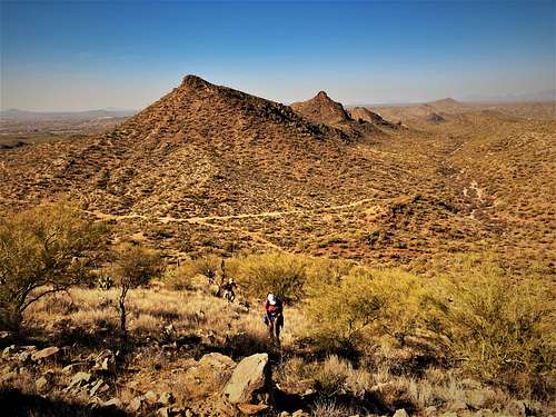
Sophie’s Flat Peak is the highest summit in the Sophie’s Flat hiking area north of Wickenburg, Arizona, just one foot higher than nearby Red Top.
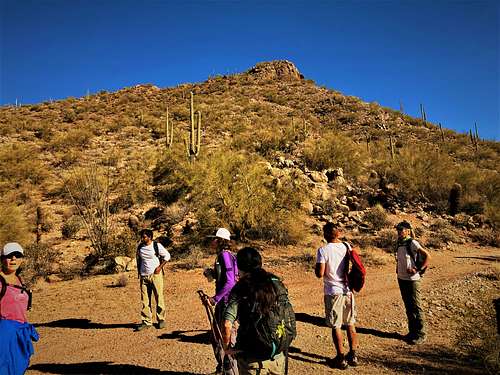
Unlike Red Top, there aren’t any trails to the summit. Relatively simple off-trail hiking is required to reach the summit from a main trail just south of the peak.
The Sophie’s Flat area is becoming more popular as the Phoenix metro area expands further west, with neighborhoods in Surprise, AZ just a 30-minute drive of the trailhead.
Sophie’s Flat Peak is accessed relatively close to the Sophie's Flat Trailhead and can be hiked in a little over 4 1/2 miles round trip. It is also easy to add Pt. 3060 – Sophie’s Flat Hill, which is located just to the east of Sophie's Flat Peak. Adding it requires less than ¾ miles of round-trip hiking and another 345’ - all easy off-trail hiking.
Because Sophie’s Flat Peak is at a relatively low elevation, it is best to hike here during the winter months – November through March to avoid the heat. Because there is an off-trail section, make sure the weather remains cool, because once it heats up, rattlesnakes may be present.
Getting There
From the Phoenix metro area, getting to the Sophie’s Flat Trail is easy. If coming from downtown Phoenix, take US 60 for about 50 miles to Wickenburg. From north Phoenix take the Carefree Highway (74) for from the I-17 and turn right on US 60 to Wickenburg. Once in Wickenburg, turn right on El Recreo Drive, which merges into Constellation Drive and turns to dirt after a couple miles. Once on the dirt, continue up Constellation for a little less than a mile, at which point there is a sign to Sophie’s Flat Trailhead which is to the right on Blue Tank Road less than 1 ½ miles from the turn off.
Route
There is one primary approach to Sophie’s Flat Peak from the trailhead. Start walking up Blue Tank Road from the trailhead for a little under half a mile. You’ll see a small structure for the cattle and take a right onto a smaller road. Continue on that road for about a mile, and then take a left on a road that runs just south of Sophie’s Flat Peak. After about four-tenths of a mile, the road crests at about 2,835’. Sophie’s Flat Peak stands right above just about 355’ higher. The easiest option on the ascent is just to go straight up. It is kind of loose at spots, but no scrambling is required until maybe the top, but even then, it can be avoided. Descending is another matter. Going up such a steep slope is manageable but coming down is dangerous. However, if you just walk down from the summit along the summit ridge for a quarter mile, it is an easier descent down to the road.
As noted above, this is about a 4 ½ mile hike gaining 770’ round trip, and Sophie’s Flat Hill can easily be added. In addition, Sophie’s Flat Peak can be hiked along with Red Top. In fact, on January 8, 2022, we did a grand loop starting up Red Top Plateau 3,064’, then to Red Top 3,190’, then Sophie’s Flat Peak, and then Sophie’s Flat Hill 3,060’, covering about 2,300’ of gain in about 9 ¼ miles.
It should be stated that none of these summits is officially named by USGS, although Red Top is more commonly named by various websites as the area has gained popularity in recent years. I came up with the name Sophie's Flat Peak, as well as Red Top Plateau and Sophie's Flat Hill.
Red Tape
There is no red tape of note. The trailhead is managed by the BLM. Leave no trace.
External Links
https://www.blm.gov/visit/sophies-flat-trailhead