
South West Face of Rincón
**please note: the text that follows has some questions about routes and difficulties - any help with filling in the details would be appreciated**
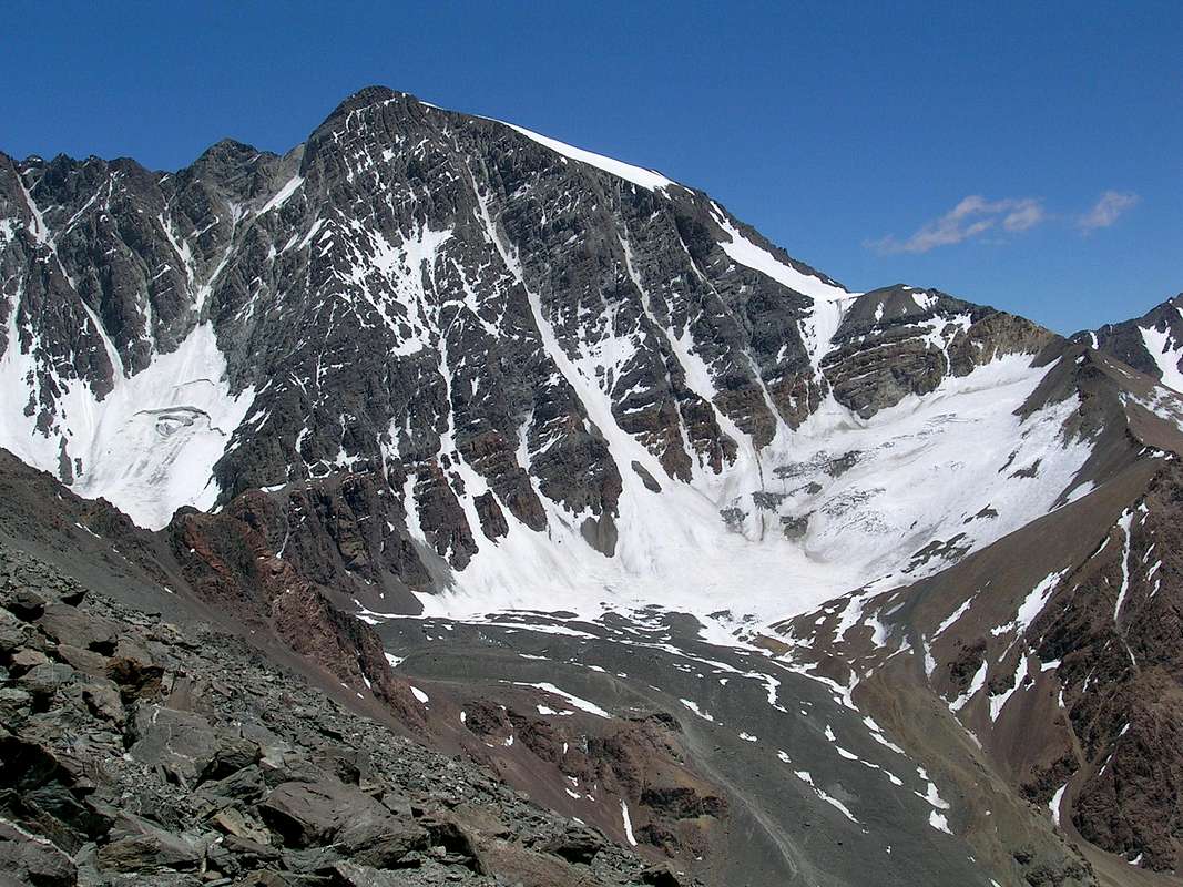
The main face of Rincón. The camp at El Salto de Agua (or just ´El Salto´) can just be made out as a couple of white dots on a small bluff above the moraine, bottom centre. Due to altitude issues among our party, we were, unfortunately, unable to summit. Further, due to a poor winter, conditions this season were poor, lots of penitentes up to halfway up most mixed routes.
The normal route to Rincón (PD??) takes off across the moraine below the snowy bowl at centre, up the easiest brown scree slope at centre right to follow the low ridgeline at far right up to the skyline knob and first glacier, top right. A short snow slope on the small steep rocky rise leads to the second, high glacier which can be seen leading right up to the summit, top centre. Despite the profusion of penitentes around Rincón this season, the normal route looked pretty clear.
Alejandro Geras´ "Mountains of Light" lists the following routes on the main face: Supercanaleta (D), which can be seen as the main couloir leading from the snow bowl direct to the summit; Espolón Sur-Este (D+) leading across from from the right hand limb of the seracced glacier at left and up the direct-facing buttress to the summit; Pilar Este (D??) leading from the base of the couloir left of Supercanaleta and thence up the buttress just left of Supercanaleta all the way to the top; Pared Sur (ED), a rock route leading direct up the Espolón Sur buttress from the bottom (just out of view in this photo). Mauricio Fernandez also suggested we climb a route called Reloj del Reina (AD??) but I´m not sure which one this is - if anyone can identify it, I´d appreciate it!!
Taken from the normal route to Cerro Franke from Las Veguitas (December 2007).


Comments
Post a Comment