
-
 7785 Hits
-
 85.12% Score
-
 20 Votes
|
|
Mountain/Rock |
|---|---|
|
|
47.71069°N / 12.24667°E |
|
|
Hiking, Skiing |
|
|
Spring, Summer, Fall, Winter |
|
|
5236 ft / 1596 m |
|
|
Overview
 Summit
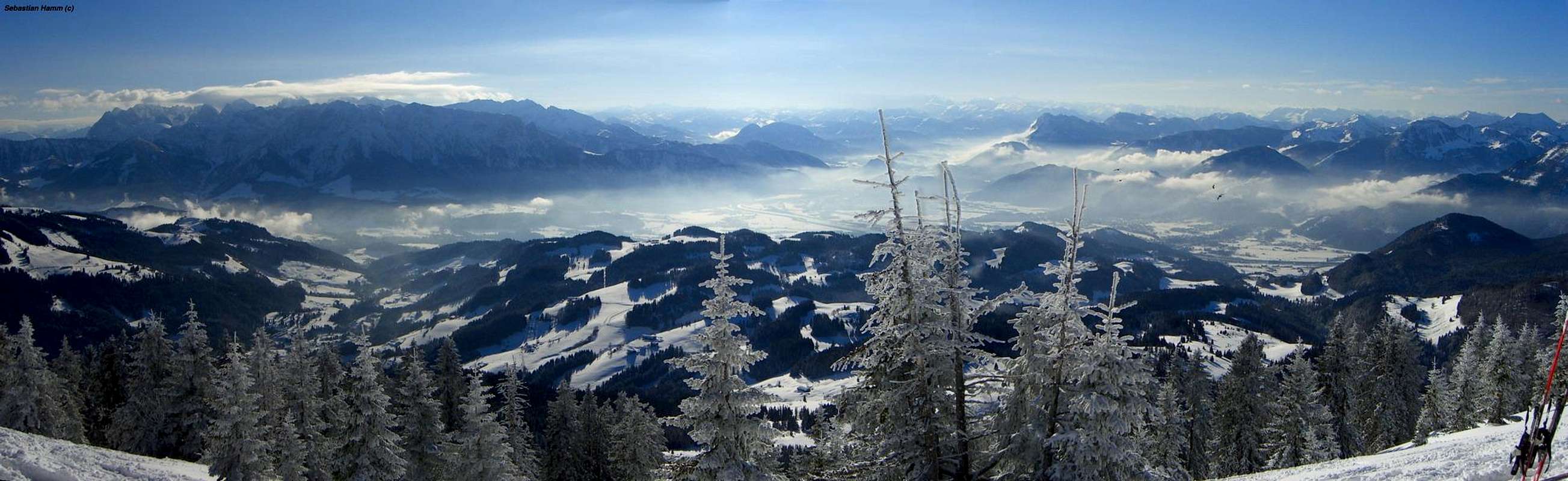
Spitzstein is a small mountain in Germany at the border to Tyrol (Austria). It belongs to the region Chiemgau. Spitzstein is climbed the whole year around. In winter there many people to climb it by ski, because the landscape is very diversified and save of avalanches. The view from summit is awesome. You have a great view to "Zahmer Kaiser", "Wilder Kaiser - Ellamuer Halt", Inn-Valley and the Bavarian-Pre-Alps. The summit is surrounded from a little copse. On the summit is a nice summit-cross and a little chapel. The origin for ascents is SACHRANG. A hut of the Alpenverein is also located at the mountain (Spitzsteinhaus 1.263m).
Getting There
 Spitzstein from Space
FROM NORTH:
From Munich or Salzburg via A8 to exit "105-Frasdorf" (West) or "106-Bernau am Chiemsee" (East). Drive further to Aschau and then you will arrive at Sachrang. The are some parking-possibilities on the streets.
FROM SOUTH:
From innsbruck or Kufstein via A12 to exit "59-Oberaudorf". Continuing on B172 to Niederndorf an after that to the north on B175 to Sachrang.
Nearest Airport:
Munich Airport
Innsbruck Airport
Railroad:
Austrian railroad company "ÖBB"
Bayrische Oberlandbahn
Deutsche Bahn
When To Climb: Weather, Webcam and general informations
WEATHER IN THIS REGION
DANGER OF AVALANCHES TYROL
DANGER OF AVALANCHES BAVARIA
  |
CAMPING IN THIS REGION
Chiemgau Tourismus e.V.
Ludwig-Thoma-Straße 2
D - 83278 Traunstein
Telefon +49 (0) 861 - 58223
Telefax +49 (0) 861 - 64295
E-Mail: info@chiemgau-tourismus.de
Tourism association Kufstein
Unterer Stadtplatz 8
6330 Kufstein
FON +43.5372.62207
FAX +43.5372.61455
SPITZSTEINHAUS
Susi Schneider & Wolfgang Wagner
Tel.: +43 - (0)5373 / 8330
E-Mail: info@spitzsteinhaus.de
Routes to Spitzstein
ASCENTS IN SUMMER:
From Sachrang to Mesner-Alm 1.097 1:15min - Mesner-Alm to Auer-Alm 1.305m 0:45min - Via Spitzsteinhaus towards the summit in 1h. Total: 3h
For descending you can follow the winter-ascent-track to Mitterleiten and Sachrang. 2:15min

ASCENTS IN WINTER:
Follow the path at the creek through the forest. After the forest you reach Mitterleiten on a little bank on the right-handed side. After Mitterleiten ascend through the next forest, sometimes very steep, to a alp. Now you ski towards Steinmoosalm and Spitzsteinhaus. At Spitzstein is a small holy-cross. From the cross you heading towards the right bottom edge of the summit-copse. Now you can search your own way to the top. Normally, the whole ascent is prepared from other ski-mountaineers, so you won´t have any problems with orientation. 2hours. DESCENT: At Spitzsteinhaus you have to choose the alp on the right-hand-side to avoid skiing through the steep forest.