
|
|
Mountain/Rock |
|---|---|
|
|
33.58220°N / 111.5581°W |
|
|
Maricopa |
|
|
Hiking |
|
|
Winter |
|
|
2988 ft / 911 m |
|
|
Overview
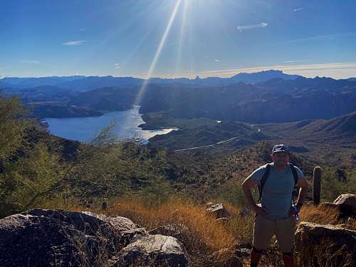
The Stewart Mountains are located in Tonto National Forest in eastern Maricopa County located closest to Mesa and not too far from Scottsdale. They are made up of a series of three peaks in a circle, all close together, and all of them prominent.
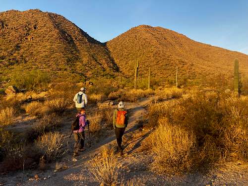
There are no good trails to any of the peaks, and as a result, they aren’t often hiked. However, the off-trail hiking isn’t too rough and the mountains are well worth a visit by any peakbagger looking for an easy way to knock off three summits in a few hours.
Hiking the Stewart Mountains is recommended during winter months. Primarily late November through March. Hiking during other time periods may be too hot, or there’s a risk of running into rattlesnakes. That's why springtime isn't recommended. Other Phoenix-area summits are recommended in springtime, but the lack of trail makes people vulnerable to running into critters.
Getting There
The primary trailhead for the Stewart Mountains in the Butcher Jones OHV staging area off of Bush Highway. There are a couple options from there – approaching from the east or from the north.
If approaching from the north part of the Phoenix Valley, take Shea Blvd through Fountain Hills to the Beeline Highway, and drive to the Bush Highway junction and then 2 1/2 miles south to the parking area. The main paved parking lot is for boats, but there is dirt parking behind it suitable for 2WD vehicles.
If approaching from downtown Phoenix, Chandler, Gilbert, Mesa, or Tempe head to AZ-87 which is called Country Club Drive in town and then becomes the Beeline Highway. Turn at Bush Highway and follow directions above.
There are parts of East Mesa and the southeast valley communities like Apache Junction and Queen Creek, where the best route is via Usery Pass, which goes up Bush Highway from the south.
Route
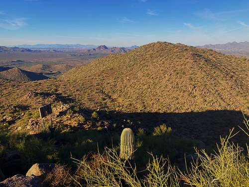
From the north there is a trail going up to 2,600’ towards Peak 2,931’ or North Stewart Mountain. Cross the Bush Highway and go under a fence. Once on the other side, head straight and partly to the right and you’ll run into the road, which becomes a trail. The trail ends at about 300’ below the summit. From the end of the trail, it isn’t too difficult to ascend North Stewart Mountain off-trail.
From the summit, descend to the saddle with it and Stewart Mountain and hike from there. East Stewart Mountain 2,961’ can also be added. The only irritation with this route is that North Stewart Mountain needs to be ascended again on the way back. This adds a little under 330’, which isn’t a big deal if wanting to avoid more significant off-trail hiking. A loop can be accomplished in 4.5-4.75 miles with a gain of over 2,200’ if re-ascending North Stewart Mountain, and about 1,900’ if taking the gully.
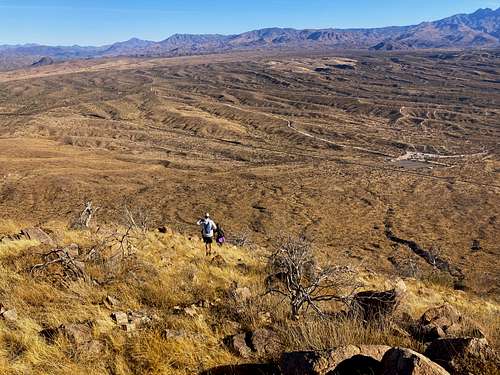
The other alternative is hiking up the obvious gully in between East Stewart Mountain and North Stewart Mountain. This is difficult, but manageable. There are large boulders. Alternatively, one can go on the side of the gully to achieve the same result. If going up this way, it is recommended that one descend via the trail coming down North Stewart Mountain.
Red Tape
There is no red tape. The parking area and the mountains are in Tonto National Forest.