
|
|
Mountain/Rock |
|---|---|
|
|
47.95150°N / 121.3°W |
|
|
Snohomish |
|
|
Hiking, Mountaineering |
|
|
Spring, Summer, Fall, Winter |
|
|
5120 ft / 1561 m |
|
|
Overview
Storm Ridge is a seldom summited peak in Snohomish County, Washington, wedged between Wild Sky Wilderness and the Monte Cristo conglomerate of peaks. Storm Ridge is the lowest officially-named summit in the Monte Cristo range, has little prominence, and is often overlooked for more popular and recognizable recreational destinations in the region. Storm Ridge
However, what Storm Ridge lacks in elevation, prominence, and popularity, it more than makes up for with views. Storm Ridge offers great views of peaks such as Kyes Peak, Goblin Mountain, Glacier Peak, Bald Eagle Mountain, West Cady Ridge, Excelsior Mountain, Toil Peak, and Double Toil Peak.
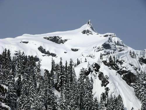 Kyes Peak, As Seen From Storm Ridge
The standard routes to the summit of Storm Ridge are considered non-technical YDS Class 2. However, multiple stream crossings and steep forested slopes are encountered during traverses. Several slopes of the ridge, especially on the west and south sides, are very steep, rocky, and impassable by conventional hiking methods. The most common ascents are via the eastern slopes, or possibly by traveling south from Goblin Mountain along the ridgetop that connects the two peaks.
 Storm Ridge Highpoint As Seen From Quartz Creek Trail...
Getting There
Due to very steep and rugged slopes on many sections of the mountain, the standard approaches for Storm Ridge tend to originate from the Quartz Creek Trail #1050 on its eastern side.DRIVING DIRECTIONS TO QUARTZ CREEK TRAIL #1050:
1) Along Highway 2 a short distance east of Skykomish, turn left (north) onto Forest Service Road #6500 (a.k.a. FS-65, Beckler River Road).
2) Follow FS-65 for 14.4 miles, until an intersection with FS-63.
3) Turn right onto FS-63 and follow for 4.2 miles to the Quartz Creek Trailhead (~2500' elevation). There are three trailheads at the parking area; Quartz Creek Trail begins on the north side of the parking area.
 Standard Summit Route
HIKING DIRECTIONS FROM QUARTZ CREEK TRAIL #1050:
1) Hike north along Quartz Creek Trail for approximately 2.5 miles.
2) Begin hiking off-trail, heading west and crossing Quartz Creek.
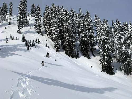
 Crossing Quartz Creek...
3) Steeply ascend through thick forested slopes in a NW direction, crossing several small streams, trying to end up either on a tiny west-east branch-ridge located northeast of Storm Ridge or on the north side of that tiny ridge.
 Ascending Steep Forested Slope...
4) Follow the tiny ridge, or open gully north of the ridge, west for a short distance to a north-south ridge that connects Storm Ridge (to the south) to Goblin Mountain (to the north).
 Heading To Storm Ridge From Tiny Branch-Ridge...
5) Once on the ridgetop, follow it south to the highpoint of Storm Ridge.
 Looking South Towards Storm Ridge Highpoint...
Red Tape
A Northwest Forest Pass (i.e. parking permit) is required for parking at/near the Quartz Creek Trailhead.Motorized vehicles and bicycles are prohibited on Quartz Creek Trail.
As the mountain is located within Henry M. Jackson Wilderness, Wilderness Area regulations apply. Contact the Skykomish Ranger Station, for current trail information and regulations.
Maximum group size is 12, including animals.