
Comments
No comments posted yet.
|
|
Trip Report |
|---|---|
|
|
50.59500°N / 3.9093°W |
|
|
Apr 23, 2021 |
|
|
Hiking |
|
|
Spring |
Tor = a hill or rocky peak.
The thought of a week on Dartmoor in the southwest of England – famous for the Arthur Conan Doyle novel featuring Sherlock Holmes, “The Hound of the Baskervilles” - conjured up images of dark, gloomy days with low cloud on windswept moors, so the prospect of a week of good weather in Spring was very encouraging.
Our cottage for the week lay in a quiet valley amidst farmland and woods. On the first evening we had seen various garden birds, Pheasants and two Deer that hopped over the fence into the garden to feed on a bush outside the kitchen window. Above all, it was a quiet and relaxing place.
On our first full day, we decided to walk from the house. After ten minutes we had climbed out of our small valley to gain phone coverage to check the weather forecast – still good!
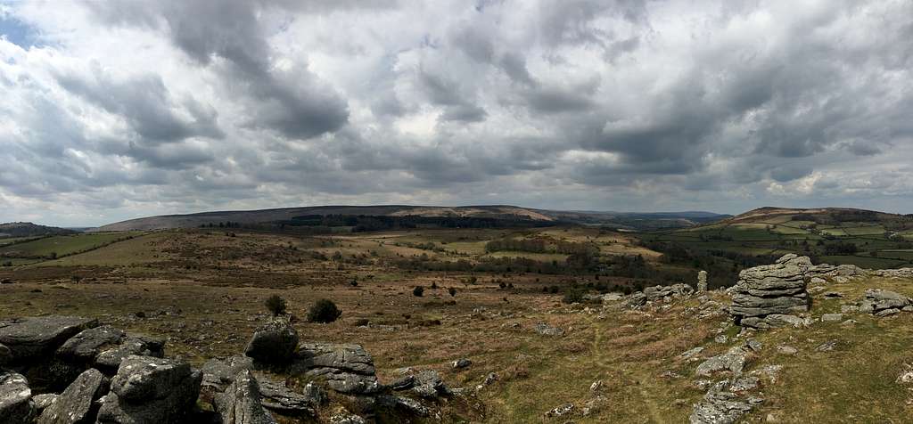
We got off the road and headed north to a small rocky top shown on the map as Huccaby Tor. The moors were golden in the sunshine due to weeks of dry weather and contrasted lovely with the cool blue of the sky. A strong breeze ruffled the hair on the wild ponies and deterred us from lingering too long to admire the views.
Suddenly, Marie stopped. “Look!” She pointed to the path in front of her.
A small Adder lay on the path, sunning himself. My approach sent him slithering into the safety of the longer grass before I could get a picture.
“This is a good start to the week.” I proclaimed. “We’ll probably see a lot of snakes around.” That was the only one we saw!
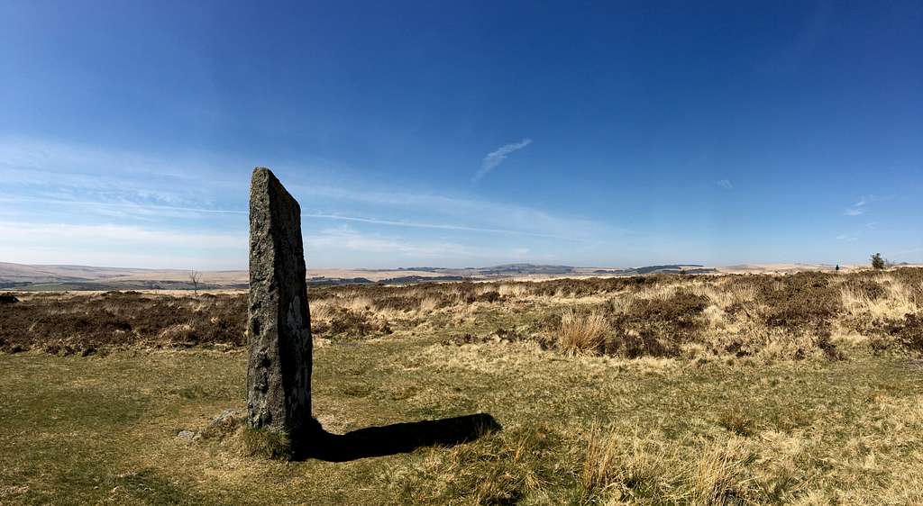
We could see our first Standing stone from a way off as we approached. It was the first ancient standing stone we had actually stood next to and although it was small in stature, it still had something in common with the enormous stones of Stonehenge, which we had driven past the previous day.
We carried on up to Laughter Tor and had a great view northward of Bellever Tor, seemingly rising from the forest across the valley.
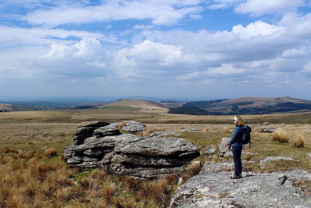
It didn’t take too long to cross the mile of moorland between the Tors and I scrambled up the granite rock to stand on top of Bellever Tor whilst the wind tried to knock me off!
We descended northwards again and once off the Tor, the wind eased up. By now it was getting warmer and we followed the unofficial path over Lakehead Hill to see the numerous stone circles, only impressive due to their age rather than size!
We sat on a tree stump near the old quarry road for lunch before descending to the road at Postbridge to see its medieval Clapper bridge. After checking out the visitor centre to establish when the Army firing ranges were open, we headed back south towards the hamlet of Bellever.
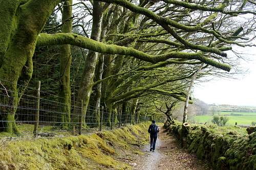
An easy walk on open land took us past the buildings and into a track in the forest. We admired the lichen hanging from the trees like long beards – somewhere I remember being told that good growth signifies clean air.
At Laughter Hole house we turned eastwards and emerged from the forest to cross the East Dart river on some steppingstones. By now, we were off the moor and crossing farmland. At Babeny, we headed south again, crossed another Clapper bridge and more steppingstones to bring us into a pleasant sunlit valley. We passed through another farm and onto the road above our cottage, soon we were back inside enjoying a cup of coffee.
A fine walk in lovely sunshine and with very little wet ground.
Another day of sunshine, clear skies and a strong breeze. The unusually cool weather seemed to be keeping people off the moors and we were surprised to have them more or less to ourselves.
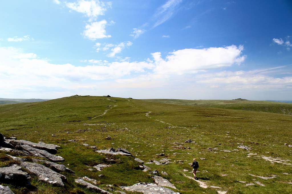
We headed north from Postbridge and soon left civilization behind. This area was more of a wilderness than the land around Bellever although it was relatively flat and open. In the sunshine, it was easy to see the route ahead even though, Sittaford Tor looked to be further away than I had realised.
That said, we soon ate up the ground and watched two distant walkers take a path up to its top.
“Is that our path?” Marie asked.
I checked the map, “I don’t think so. We’ll miss the stone circles if we go up there.”
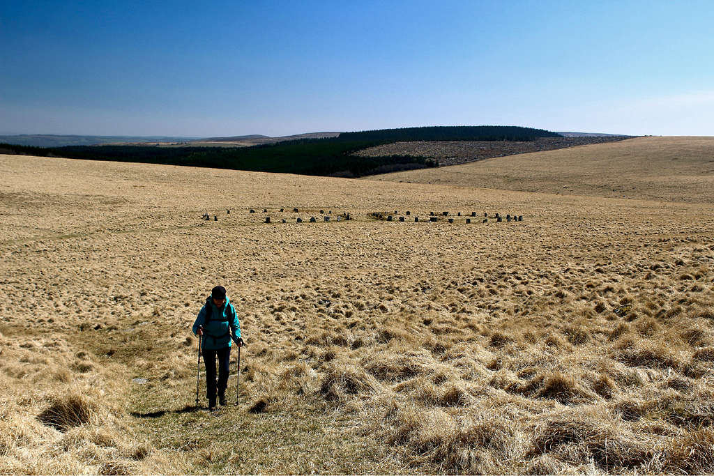
The map showed the “Grey Wethers” stone circles to be further on and we were making for them. We continue north and crested a small, grassy rise to see the stones in front of us. Again, they were quite small but were more impressive than I had thought they would be.
I spent some time taking photos, Marie had walked to the long dry-stone wall behind the circles and was looking further north, to the moors beyond.
“This is fab!: She said. “I had no idea it would be so lonely.”
Although it was only 11.50am we decided that the wall might be our only protection from the strong south wind, so we sat on the north side of the wall for lunch.
Then, it was west, up the Tor to the top. The wind battered us, making it difficult to stand up but once over the rocks and onto the west side, all was calm. We sat in the sun and admired the fantastic, empty views.
Further westwards, we could see vague paths across the moor where only a few were marked on the map, strange square constructions, which turned out to be buildings on the boundaries of the Army firing ranges and the occasional walkers moving through the sea of golden grass.
Whilst we were at the Tor, a few people passed us, a man told of us about a new stone circle discovered after a fire on the moors in 2008 – we went to visit it and three runners appeared and charged off in a south westerly direction, soon being lost from sight.
We followed a path until it vanished, then I took a compass bearing to bring us to a wall heading back south. We were tempted to head west to Winneys Down – a top marked on the map – but decided against it as we were unsure how long it might take us. Actually, we were moving a lot quicker than we had thought we would and had plenty of time.
We headed south west to a crossing point on the East Dart river near some waterfalls and then down to Braddon lake to rejoin the footpath back to Postbridge.
Another lovely, sunny day and a glimpse into the northern wilderness areas of Dartmoor.
Princetown is known for two things. The first is the infamous HM Prison, Dartmoor, built in 1806 to house French prisoners of war and still in use as a prison today. We had parked our car behind the Dartmoor visitor centre, formerly the Duchy Hotel, which brings me to the second point. It was in the Duchy Hotel that Arthur Conan Doyle was staying when he wrote his Sherlock Holmes novel “The Hound of the Baskervilles”.
Conan Doyle was inspired to use the land to the south of the town as a basis for his description of the moors and his “Grimpen Mire” is reputed to be based on the bogs near Fox Tor.
We headed south from the town on the rough bridleway – following another hike from the “Visit Dartmoor” website – past South Hessary Tor. After a quick scramble on the rocks and some time spent admiring a newborn wild pony foal, we carried on southwards to stop at the “Nuns Cross”, a stone monument.
Here, we left the path to follow the line of boundary stones to the two large Eylesbarrow cairns at the top of the hill. The day was cloudier than previous days and we decided to have an early lunch here rather than risk getting wet later.
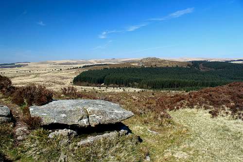
After lunch we descended to the old tin mine ruins and carried straight on to the top of Higher Hightor Tor. Having taken in the views, we descended to the south west. This area is not as wild as the land north of Postbridge. The tracks are wide, there are the occasional farms and there are more people around. For some reason, the views are not as good although, this part of the walk was probably the most attractive part due to the diversity of Standing stones, rows and circles. No one is really sure what the purpose of these ancient stones are. Possibly for religious festivals, possibly as meeting places in the empty moors or maybe just as markers for the ancients to find their way across the featureless moors.
We descended to the ruins of Ditsworthy Warren house and then followed a farm track north to a ford crossing the Sheepstor Brook and headed back east.
At the campsite here, we heard our first Cuckoo of the year, always something to take note of. We returned to the ruins of the Eylesbarrow tin mines for a tea break and then followed the original track back north to the town.
It was nice to see this area but not as inspiring as our previous routes.
For our last day, we had decided to explore the area around the village of Widdecombe-in-the-moor on the eastern side of Dartmoor. We had lots of suggestions for routes from several sources and in the end, we decided to make up our own route based on these.
Leaving the car in the village at 9.35am, we headed west up a road and steeply onto Hamel Down, a long, whale-back of a ridge. We picked up the Two Moors way path and headed north.
This area reminded us of the Black Mountains in Wales, complete with wild ponies. Looking east across the valley, we could see the Tors we planned to visit that afternoon, so long as the weather held. The promised day of full sun had deteriorated to one of sun and cloud but it looked a bit ominous to us.
We passed Hameldown Beacon and various Barrows (ancient burial mounds) before we reached Hameldown Tor. From here we descended to the Grimspound, the remains of a Bronze-age settlement with an enormous enclosure wall. It looked grey and felt cold on the day and I couldn’t imagine why anyone would choose to live there when the valleys looked so much more attractive.
We descended eastwards here to the Natsworthy manor and continued on to the Hayne Down to see the “Bowerman’s nose”. This is a rock formation said to be the remains of a hunter who upset the local witches in times past. The witches lured him to the Down and turned him to stone! We chose this spot for our lunch.
After lunch we headed south to Hound Tor then on again to Holwell Lawn to cross Bekka Brook on a new Clapper bridge. We bypassed Holwell Tor and headed up to Haytor Rocks as the weather got cloudier. I had visited Haytor before to do some rock climbs but after 20 years I couldn’t remember which ones we had done and nothing on the rock looked familiar!
We quickly crossed the moor to get to Saddle Tor. Due to the close proximity of the road, we met more people than we had seen all week here. We crossed the road and went up to Rippon Tor then, descended northwards to Hemsworthy gate and walked up to Top Tor. (We had originally planned to visit Pil Tor but decided to skip it as the weather was worsening).
Westwards and down towards Widdecombe-in-the-moor on firstly the moor and then the road. We arrived at the car at 4.45pm after around 20 km (about 12 miles) just as it began to rain. We were driving back to our cottage as the heavens opened!
We loved the area north of Postbridge, around the Army firing ranges and it was good to see some of the other highlights but there is a lot left for us to explore.
The weather has spoilt us for the future though – we will expect clear blue skies and sunshine every time now!
Just over six weeks later we were back in Dartmoor and again, experiencing good weather. However, that seemed to be changing and we knew a storm was approaching from the east. Strange, as the poorer weather nearly always comes from the Atlantic in the west.
We drove to the Meldon reservoir in the northwest corner of the national park and set off towards the Okehampton firing range. We had previously entered the range from the southeast but this was an area of the park we hadn’t visited before – mainly due to the restrictions in place whilst the range was being used by the British Army.
We climbed up from the reservoir and onto the green, rounded Longstone Hill. We could see cloud approaching but for the time being we were still in the sunshine although, there was quite a brisk, cool wind.
From here we continued east across the moors following a compass bearing and a vague trail up the west flank of Yes Tor.
Many years ago, I had been an avid fan of the British progressive rock group called Yes. In 1978, they released an album called “Tormato”, inspired by a place called Yes Tor and they explained that from the top of Yes Tor….”you can see forever!” At the time, it sounded like an inspiring place and I had thought I would like to visit that someday, without being sure exactly where it was.
Time has passed and although I still go back and listen to the music, I had always remembered about Yes Tor and when I saw it on the map, I was instantly drawn to it.
Reaching the top of Yes Tor in windy sunshine, I was a little disappointed. The view was indeed far reaching as we looked north across the farmlands of Devon and turning towards the southeast, I fancied I could see Hangingstone Hill on the distant horizon. The problem was on top of the Tor itself. The Army’s warning flagpole, guard rail and metal building left by the military removed any feeling of mysticism that my memory of the music had evoked.
We continued southwards across the hillside to the pile of rocks that signified the summit of High Willhays, at 621m, the highest point of Dartmoor and 2 metres higher than Yes Tor!
After the obligatory photographs, we continued towards the southwest and down into the valley, aiming for a point on the West Okement river, marked as “Sandy Ford.” Although we were not following a path, I hoped that there would be a way to cross the river at this point.
As we neared the water, it was clear that this was a point for driving animals across but had no steppingstones. We didn’t fancy getting wet feet, so we explored up and down the riverside until we found a place we could hop across on rocks and keep our feet dry.
The ground here was really rough and we struggled up the hillside on the west side of the river, to find a place to stop on Kitty Tor, once again using the military building (metal container) to shelter from the wind which had become cooler as the cloud had now moved in.
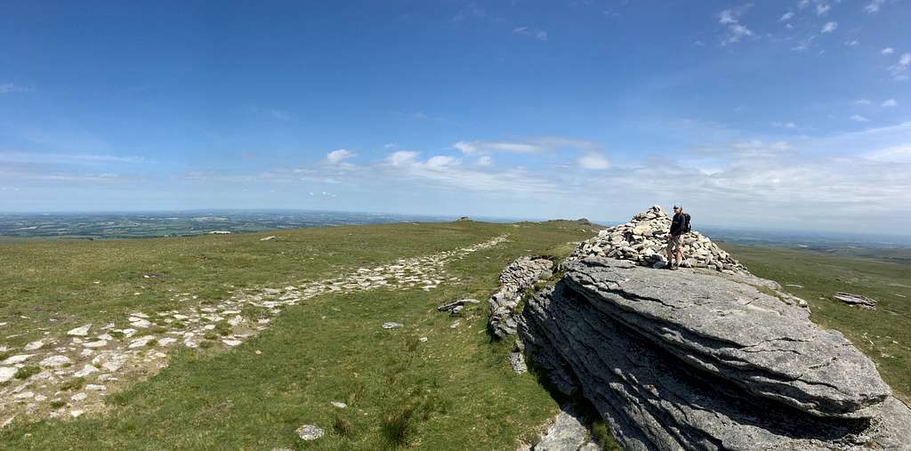
After lunch, we found a feint track down towards a wash boarded dirt track created for the military vehicles, then headed south to climb Great links Tor. When we arrived at the crags that form the summit, it was so windy that we decided to make do with the lower situated trig point, rather than scramble to the highest point of the rocks and risk being blown off!
Back on the track we headed north in calmer conditions until we passed over Sourton Tors and within sight of the Meldon reservoir again.
A good day in the wild, northwestern region of Dartmoor and for me, a nostalgic visit to the inspiration for some music from my youth!