-
 1688 Hits
-
 0% Score
-
 0 Votes
|
|
Trip Report |
|---|---|
|
|
Nov 6, 2015 |
|
|
Mountaineering |
|
|
Fall |
Add Heading Here
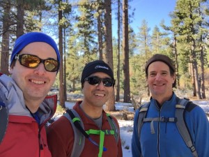
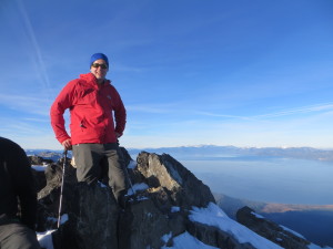
See link at http://www.technologyhiker.com/?p=656Drought stricken Sierra had its first significant snowfall last week. What better time for a quick one night trip to climb one of Northern California’s iconic peaks, 9735’Mount Tallac. Tallac towers overs Lake Tahoe, Fallen Leaf Lake, & the Desolation Wilderness. Two friends and I climbed Tallac’s Southeast Chutes and descended via the Mt Tallac trail for some snow covered, world class views. The ~8 mile & 3000+’ elevation gain route made for an outstanding day.
 The drive to Mt Tallac was an enjoyable one. We battled Bay Area Thursday night traffic as we left a little later. After a meal at Redrum Burgers in Davis, we drove to Lover’s Leap Campground off 50 in Strawberry. There were a few other cars/vans in the parking lot, but I think we were the only ones of slept outside. It got down into the teens at night. We took a quick hike to view the Lover’s Leap climbing area (an adventure for another time) and drove to South Lake Tahoe. We warmed up with a hearty breakfast at Bert’s right off of 50 in South Lake Tahoe. Fueled up, we were ready to go.
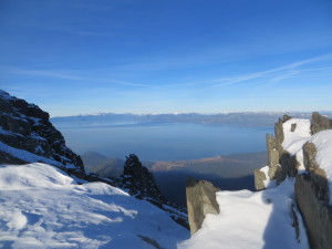
 We ascended the more direct Mt Tallac trailhead and trail. The trail followed a ridge above Fallen Leaf Lake with Tahoe and the Casinos in the distant background. About 2 miles into the trail, we left the trail for the SE chutes. There snow was deep enough to obscure the rocks and willows but not to create a smooth path. We left our fair share of postholes on the mountain. Our progress was slow but steady across a wash and subsequent ridges as we approached a massive rock. During breaks, we could just look behind us and see Mt Freel, Fallen Leaf Lake, and Lake Tahoe in the background. We exited the couloir on the North side and were soon on the summit plateau.
 After a little bit of route finding, we stumbled across compacted snow along a trail. It felt good to follow the already snow compacted steps of others. We made our final push to the summit, snapped a few pictures, and descended quickly. We were running out of daylight on our climb. We followed another bootpath down, but the trail started descending toward the Lake Aloha basin, so we cut across cross country. Fortunately, we found the semblance of a trail after our detour and are happy to see a signpost confirming we were on
 the right path. As we descended, the sunset alpenglow was outstanding. Darkness fell after we reentered the woods, and we finished the final segment to the car via headlamp and phone light.
The trip had a little bit of everything including varied conditions with snow, ice, and some trail, interesting climbing up the chute, a narrow summit ridge, a cross county route finding challenge, and a triumphant return to our car in the dark. The snow clad Sierra Nevada and Tahoe vistas made this climb one of a kind. I highly recommend it for anyone – especially after a first snow.

