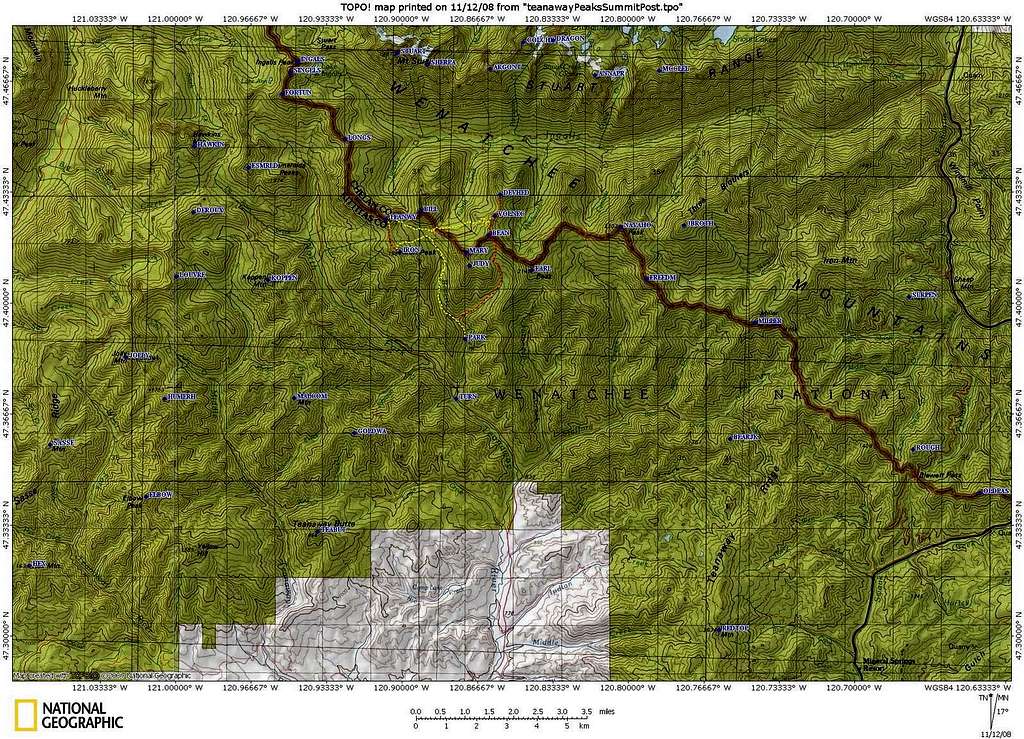
Teanaway Area Topo Map

Teanaway Area Topo Map
This topo map shows the Teanaway area and most of its officially and unofficially named summits. See other sections of the Teanaway page to correlate the map waypoints with summit names. The yellow and red tracks are from a Bean, Volcanic Neck, Devil's Head, Teanaway Peak (Genes) and Iron Peak five summit day on July 6, 2008. This page will be a good place for posting Teanaway multi-summit trip reports.


Comments
Post a Comment