


-
 1499 Hits
-
 80.49% Score
-
 12 Votes
|
|
Route |
|---|---|
|
|
45.61833°N / 7.40842°E |
|
|
Hiking, Mountaineering |
|
|
Summer, Fall |
|
|
A long day |
|
|
I |
|
|
Note
|
La montagna chiama i suoi figli, ed essi rispondono fedelmente al suo appello… Osvaldo Cardellina, Diario alpinistico, 1964-65 Page texts: @ OsvaldoCardellina "Osva", passed away on May 2, 2022. Page owners: Christian Cardellina e Osvaldo Cardellina. Any updates from September 12, 2022: Antonio Giani, page administrator, friend and climbing companion. Testi della pagina: @ OsvaldoCardellina "Osva", scomparso il 2 maggio 2022. Proprietari pagina: Christian Cardellina e Osvaldo Cardellina. Eventuali aggiornamenti dal 12 settembre 2022: Antonio Giani, amministratore della pagina, amico e compagno di salite. |
Money Overview
Pictures of this page are by Emilio Bertona aka emilius, Antonio Giani & Osw
This crossing surely is not part of the larger "Classic" of the Gran Paradiso.
They are ancient ridges, scorched by the sun and transformed by the winds, where even find shelter ibex and chamois that border from neighboring Gran Paradiso National Park. Beyond the Torrent Urtier, beyond which it is indicated the forbidden limit. Towards the majestic peaks of the Gran Paradiso. You do not think to come here to find solid rock and wonderful climbings, Because you have the wrong address. These airlines ridges facing Tersiva, Emilius, Rouèses and Peak Garin in the North will suggest great walks on the sky, Which is reflected in the many lakes That surround the base. Follow an ancient footprint and, if you tend the ear, brings you even the sound of the hunting horns from the limits of the old Gressoney Baron Hunting Reserve Egon Beck Peckoz, that these extreme lapped margins. Until the Glacier Tessonet or Doreire. While in the South, if you sharpen your sight, you still see the old miners in the bowels of Mount Creya and the caravans that carried the ore, passing on Côte Piemont, towards Piedmont and Po Valley bypassing the Colli di Acque Rosse, Scaletta, Bocchetta of the Rancio and'Arietta. But if you do not have that Spirit and your ears are plugged and eyes closed, you'd better not come here. You arrive on a planet that does not belong to you ...
Questa traversata certamente non rientra nelle grandi "Classiche" del Gruppo del Gran Paradiso.
Sono creste antiche, arse dal sole e trasformate dai venti, dove trovano ancora riparo stambecchi e camosci che sconfinano dall'attiguo Parco Nazionale del Gran Paradiso. Al di là del Torrent Urtier, oltre il quale vien segnalato il limite proibito. Fino alle maestose Vette del Gran Paradiso. Non pensate di venir qui a trovare roccia compatta e splendide arrampicate, perchè avete sbagliato indirizzo. Queste aeree creste di fronte a Tersiva, Emilius, Rouèses e Pic Garin a Settentrione vi propinano grandi passeggiate sul cielo, che si specchia nei numerosi laghetti che le cingono alla base. Seguite un'orma antica e, se tendete l'orecchio, vi porta ancora il suono del corno di caccia dai limiti della vecchia Riserva di Caccia del Barone di Gressoney Egon Beck Peckoz, che questi estremi margini lambiva. Insino al Ghiacciaio del Tessonet o di Doreire. Mentre a Meridione, s'aguzzate la vista, vedete ancora i vecchi Minatori nelle viscere del Monte Creya e le carovane che portavano il minerale, transitando sulle Côte Piemont, in Piemonte e Pianura Padana scavalcando i Colli d'Acque Rosse, Scaletta, Bocchetta del Rancio e dell'Arietta. Ma se non avete sto Spirito e le vostre orecchie son tappate e gli occhi chiusi, è meglio che qui non veniate. Arrivate in pianeta che non v'appartiene ...
Why Money?
That does not mean, as you might think, money but comes from the Mediterranean voice Moneth and that it remained even in the Gaelic language and transformed into the Irish Moin, meaning "mountain pasture in the coterie", as stated by the Scholar of place names Jules Brocherel in the "Rivista Mensile C.A.I." 1937/8 into page 87. So we find many Money in Aosta Valley, where for example in the Apostles Chain in the Gran Paradiso Group are under Punte Patrì with Alp of Money and Glacier de Money, flanked by Col de Coupé Money, Money Crest also with Campanile (Steeple) of Money. With this we must not think that there is some money everywhere ...
Perché Money?
Che non significa, come si potrebbe pensare, denaro bensì proviene dalla voce mediterranea Moneth rimasta anche nel linguaggio gaelico e trasformata in quello irlandese Moin che significa "alpeggio in consorteria", come afferma lo Studioso di toponomastica Jules Brocherel nella "Rivista Mensile C.A.I." 1937/8 a pagina 87.
Così rinveniamo molti Money in Valle di Aosta dove, ad esmpio nella Catena degli Apostoli nel Gruppo del Gran Paradiso troviamo sotto le Punte Patrì l'Alpe di Money ed il Glacier de Money, affiancati dal Col Coupé de Money, dalla Cresta di Money con pur il Campanile di Money. Con ciò non bisogna pensare che vi sian soldi dappertutto ...
First Ascents
- First on the summit: Unknown.
- In winter: Unknown.
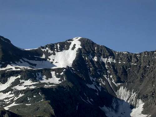
- South-southwest Crest (integrally): Osvaldo Cardellina and Emilio Bertona; September 08th, 2002, in ascent from Taveronna Alpage.
- Northern Face: Osvaldo Cardellina, lone; July 03th, 1996, in ascent from Gimillan Hamlet, Grauson Vieux Alps and Money Lake.
Getting There
BY CAR:
- From Torino, Milano, etc: Motorway A5. Exit in Aosta Ovest. Drive to the near Aymavilles. Follow in the direction of Valle di Cogne.
- From Switzerland: through the Grand St. Bernard Tunnel or the homonym Pass). Drive to Aosta, then follow Courmayeur direction on SS.26. Just after Sarre, turn to the left, in the direction of Valle di Cogne.
- From France: through Mont Blanc Tunnel or Petit St. Bernard Pass). It isn't necessary to enter in Motorway A5, you can drive through SS.26 Aosta direction. Before arriving at the Village of Sarre, follow the sign and turn right towards Valle di Cogne.
BY PLANE:
- Aeroporto "Corrado Gex" Saint Christophe (Aosta).
Specific Itinerary Roads
![]()
![]()
A) - West Crest through Monte Creya: from Cogne center (1.534m) reach through the Regional Road the small Village of Champlong/Saint-Pierre (1.596m). From this last take the path towards Northwest n° 7A and reach Facette Pasture (1.662m). Leaving left the path with a long crossing to the West-northwest is directed to the small Village of Montroz (1.681/1.702m) always with the trail n° 5. Continuing instead to the North dominating the Vallon of Torrent Liconi and reaching the largest concentration which is the remains of the homes of miners Colonna (2.386/90m; now restored Museum) well known for the extraction of the valuable Cogne magnetite or loadstone (E/F; 1h'40/2h'10).
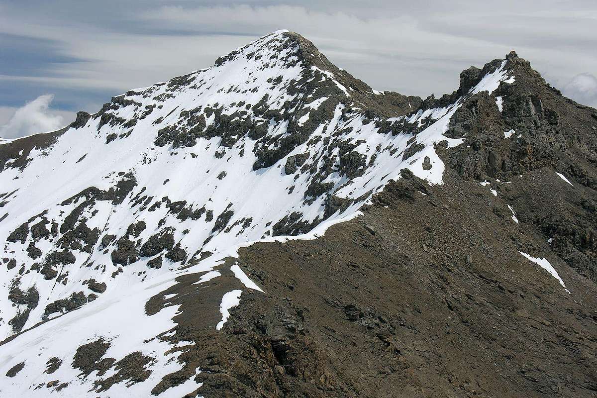
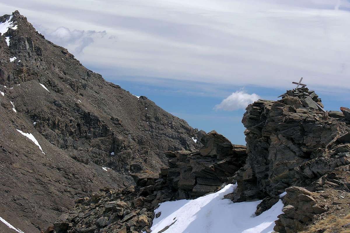
From Colonna Mines continue with trail n° 5 to the Northeast climbing to the overlying Ironmines of Liconi (2.495m), just below the Mont Salet or Montsalet (2.764m) from these down to the bottom of the deep valley of the same name and Liconi reaching the torrent crossing for twice. Returning to the left (West) and continue towards the North, again on a comfortable path and passed three bends, reaching the easy South-southwest Crest that connects to the Mont Salet (2.764m). With this easy always with a small path n° 5 on South-southwest Crest to reach the Summit of Mont Creya (3.015m) (E/F; 1h'00/1h'15 from Colonna Mines Village; 3h'00/3h'15 in total by Champlong/Saint-Pierre). From this quickly and easily, by following the tracks and bypassing in the midst of crumbling and rotten rocks a few short sections on the left (North) near the small and unsignificant rocky altitude 3.022 meters, towards the Testa or Tête (Head) of Money (3.130m) via short, easy West-northwest Crest (EE/F+; 0h'40; 4'00/4h'15 altogether).
A) - Cresta Ovest dal Creya: da Cogne raggiungere tramite la Regionale il Villaggetto di Champlong/Saint-Pierre (1.596 m), appena prima della Frazione di Lillaz (1.631 m). Da qui prendere in direzione Nordovest il sentiero n° 7A che raggiunge l'Alpe Facette (1.662 m). Lasciando sulla sinistra il sentiero che con una lunga traversata verso Ovest-nordovest si indirizza al Villaggio di Montroz sempre con il sentiero n° 5, continuare invece verso Nord dominando dall'alto il Vallone del Torrente Liconi e raggiungendo il grande agglomerato costituente i resti delle abitazioni dei minatori di Colonna (2.386/90 m; Museo) ben conosciuto in passato per l'estrazione della pregiata magnetite di Cogne (E/F; 1h'40/2h'10).
Da Colonna continuare con il sentiero n° 5 verso Nordest salendo alle soprastanti Miniere di Liconi (2.495 m), subito al di sotto del Mont Salet o Montsalet (2.764 m). Da queste scendere sul fondo del Vallone di Liconi raggiungendo il torrente omonimo ed attraversandolo per due volte. Ritornati a sinistra (Ovest) continuare verso Settentrione e, sempre su comodo sentiero e superati tre tornanti, raggiungere la Cresta Sud-sudovest collegantesi al Mont Salet. Tramite questa facilmente raggiungere la facile Cima del Monte Creya (3.015 m) (1h'00/1h'15 da Colonna; 3h'00/3h'15 in totale dal Villaggetto di Champlong/Saint-Pierre). Da questa in breve tempo e facilmente, seguendo delle tracce ed aggirando qualche breve tratto sulla sinistra (Nord) nei pressi della modesta quota 3.022 metri, alla Testa di Money (3.130 m) tramite la Cresta Ovest-nordovest (EE/F+; 0h'40).
![]()
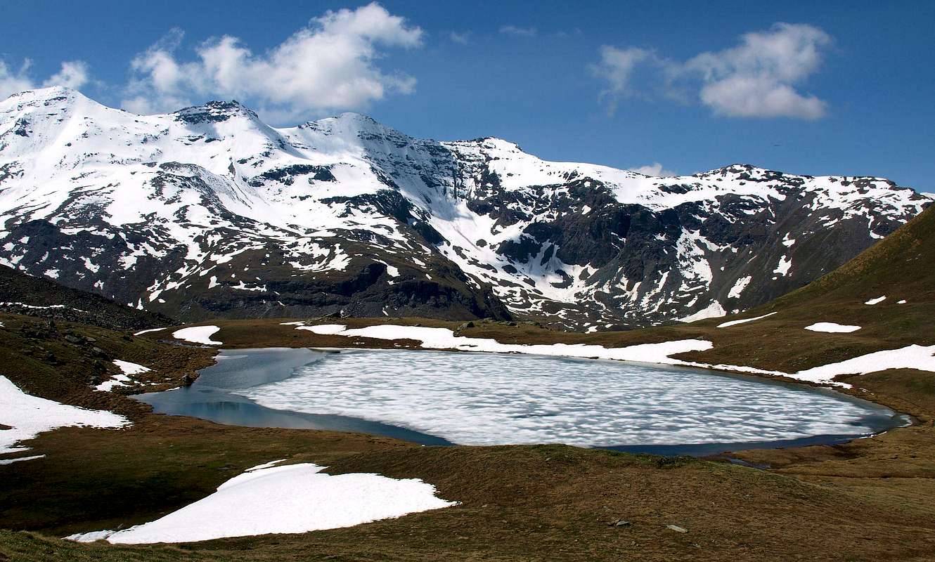
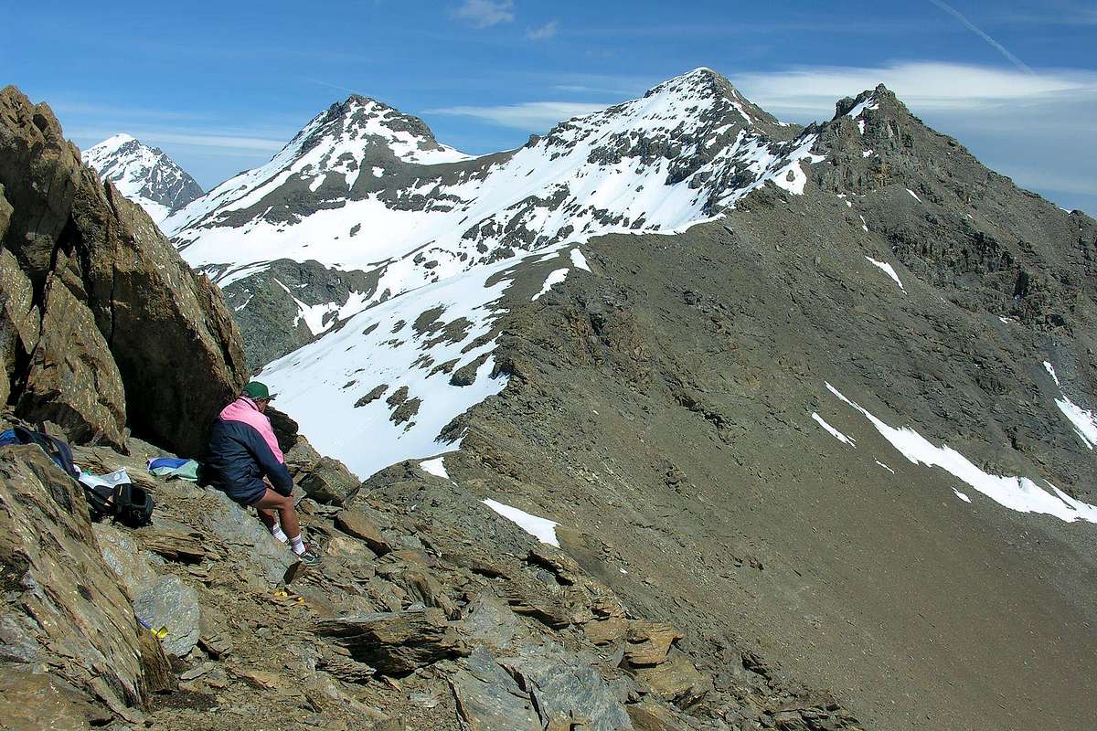
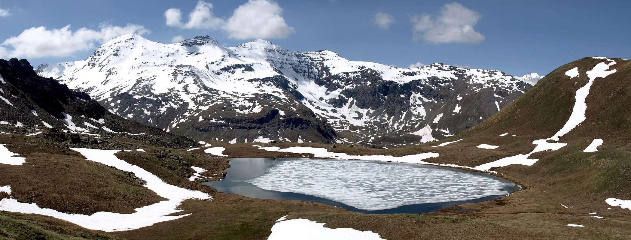
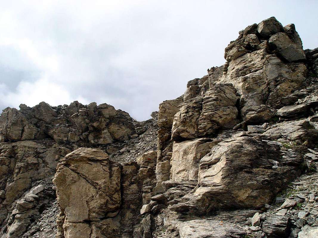
B) - Through the South-southwest Crest: this small rocky pyramid has a steep slope Northern much above the Money Lake (2.550m) with a wall of crushed rocks alternating with steep snowfields high over 400 meters. After a steep morainic "flow" slips up to the same dividend in two parts this difficult slope. Around the Southern Slope of this small chain it is even more "unfriendly" than the Northern. Formed by steep ribs of burned and crushed rock, interspersed with grassy and detrital gullies, down over the Pastures of Gueula, Seutse or Suches and Taveronna (2.369m) connected to each other by a farm road dating from the lower middle Urtier Valley towards the Northwest. All routes, except to the Pas d'Invergneux initial and the final from Colonna Mines at Mount Creya, are definitely inadvisable and more suitable for Hunters chamois than for Hikers. But between these reliefs there was a South-sudovet Cresta that, starting from the altitude around 2.620 meters just to the Northwest above Alpe Taveronna, directly reaches the Testa di Money, separating the Farcoz Vallon from that of Liconi (West). The same rises linearly presenting some small rocky sheets, fun to climb even though the rock is not very solid, before the Vertex. Probably the same has already been visited by route under crest to the East, while the integral via (steps from I°+ to II+) was carried out in September 2002.
From the Alps of Taveronna, reached with Lillaz route through the farm road, concomitant path n° 10A, towards Alpe Goilles Damon (1.869m) and the little Chapel of Crest (2.020m; wooden fountain). So with the same under the Côte Piemont and route n° 10 to the junction at the Tsavanis Pastures with waterfall (2.293m). Giving up on the right (East) the continuation to the Refuge "Sogno di Berdzé or Dream of Shepherd", instead continuing with the branch of West-northwest and trail n° 10C, reaching after those of Gueula Dèsott and Damon and Seutse, the Taveronna Pastures. From this continue for a short distance on the trail n° 5B with a small track in the fields, then climb steeply towards the North reaching the base of the "crestone", it goes up on the ridge encountering progressively more difficult passages (especially immediately before the Summit), or just below the East through rocks definitely easier but somewhat rotten and broken (EEA/F+/PD-; 1h'30/2h'00 from "crestone" base; 4h'00/5h'00 by Lillaz).
B) - Tramite la Cresta Sud-sudovest: questa piccola piramide rocciosa presenta un Versante Settentrionale molto dirupato soprastante il Lago di Money (2.550 m) con una parete di rocce frantumate alternate a ripidi nevai alta oltre 400 metri). Dopodiché una ripida colata morenica scivola sin al medesimo dividendo in due parti questo ostico pendio. Tutto il Versante Meridionale di questa piccola catena si presenta ancora più "inospitale" di quello Settentrionale. Formato da ripidi costoloni di roccia arsa e frantumata, alternati ad erbosi e detritici canaloni, scende sopra gli Alpeggi di Gueula, Seutse o Suches e Taveronna (2.369 m) collegati tra di loro da una strada poderale risalente dal medio-basso Vallone dell'Urtier verso Nordovest. Tutti i percorsi, tranne quello iniziale verso il Pas d'Invergneux ed il finale dalle Miniere di Colonna al Monte Creya, sono decisamente sconsigliabili e maggiormente indicati a Cacciatori di camosci piuttosto che agli Escursionisti. Tra questi rilievi però s'evidenzia una Cresta Sud-sudovet che, iniziando dall'altitudine 2.620 metri circa appena a Nordovest al di sopra dell'Alpe Taveronna, raggiunge direttamente la Cima della Testa di Money, separando il Vallone di Farcoz da quello di Liconi (Ovest). La stessa sale in modo lineare presentando alcuni muretti rocciosi, divertenti da arrampicarsi anche se la roccia non risulta molto solida, prima della Sommità. Probabilmente la medesima é già stata visitata con percorso sottocresta ad Oriente, mentre quello integrale (passaggi dal I°+ al II°+) é stato effettuato nel Settembre 2002. Dall'Alpe di Taveronna, raggiunta con itinerario da Lillaz tramite la poderale, concomitante al sentiero n° 10A, verso l'Alpe Goilles Damon (1.869 m) e la Cappelletta del Crest (2.020 m; fontana in legno). Quindi con la medesima sotto la Côte Piemont e sentiero n° 10 fino al bivio presso l'Alpe Tsavanis (2.293 m). Abbandonando sulla destra (Est) la continuazione verso il Rifugio "Sogno di Berdzé o del Pastore", proseguire invece con il ramo di Ovest-nordovest e sentiero n° 10C raggiungendo, dopo quelle di Gueula Dèsott e Damon e Seutse, l'Alpe di Taveronna. Da questa continuare per breve tratto con il sentiero n° 5B con una piccola traccia nei prati, poi salire decisamente verso Settentrione raggiungendo la base del "crestone", che si risale sul filo di cresta incontrando progressivamente passaggi più impegnativi (soprattutto immediatamente prima della Vetta), od appena sotto ad Est tramite rocce sicuramente più facili ma alquanto rotte e marce (EEA/F+/PD-; 1h'30/2h'00 dalla base del "crestone"; 4h'00/5h'00 da Lillaz).
![]()
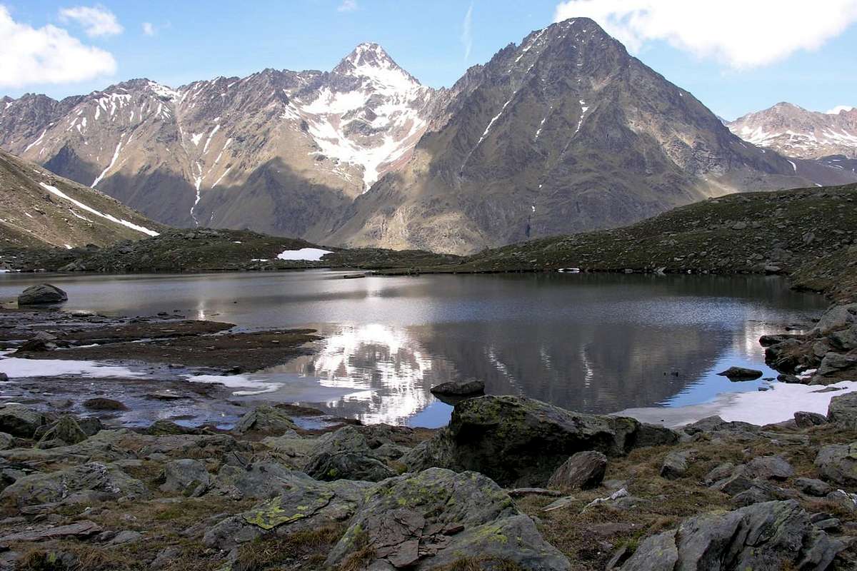
C) - Through the Eastern Ridge from Penne Blanche: also you can reach the Tête de Money along the long opposite ridge or Eastern. In this case it is almost mandatory from Pas d' Invergneux or des Hevergnes (2.902m) in succession bypassing the Testa Vallonet, the two Penne Blanche (East 3.248m, West 3.205m) and Pointe Coupée (3.211m), as all other paths on both the South slope that of the North they are dangerous and therefore inadvisable. This ridge, already reached by North at the two Penne Blanche, Pointe Coupée and the same Testa of Money, has a sinuous long but safe, where it is only necessary to choose the path of steps (I°/I°+, II°- whether on the ridge) and the routes on the slopes are boring and dangerous. also on the South, excluding "Crestone" South-southwest, already faced downhill from Giovanni Bobba and Co. in 1886 with crossing North / South through the Eastern Penne Blanche. You come to Pas des Invergneux from south continuing with the same way of the previous itinerary up to the bridge of 2.360 meters near the junction to the Alps Pianas and Invergneux with trail n° 10D (or crossing from the shelter with the n° 10F towards the Ponton). Otherwise from the North starting from Gimillan Hamlet with the trail n° 8/TVC to the Valley of Grauson and the Doreire Lakes. From the hill not remains that is to follow the long ridge going up in the final part on brief Crest East-southeast from Col of Money (3.105m) easily reaches the Summit (EEA/F+/PD-; 0h'30 from Col di Money; 2h'30/3'00 from Pas d'Invergneux).
C) - Cresta Est dal Penne Blanche: inoltre é possibile raggiungere la Tête de Money percorrendo la lunga cresta opposta ovvero Orientale. In questo caso risulta quasi obbligatorio partire dal Passo d'Invergneux o des Hevergnes (2.902 m) scavalcando in successione la Testa di Vallonet, i due Penne Blanche (Est 3.248 m, Ovest 3.205 m)e la Pointe Coupèe (3.211 m), poichè tutti gli altri percorsi sia sul Versante Meridionale che su quello Settentrionale sono pericolosi e quindi sconsigliabili. Questa cresta, già raggiunta da Nord in corrispondenza dei due Penne Blanche, della Pointe Coupée e della stessa Testa di Money, presenta un andamento sinuoso lungo ma sicuro, dove é soltanto necessario scegliere i passaggi del percorso (I°/I°+, II°- se sul filo di cresta) mentre le vie sui versanti risultano faticose e pericolose. anche su quello Meridionale, escluso il Crestone Sud-sudovest, già affrontato in discesa da Giovanni Bobba e Compagni nel 1886 con traversata Nord/Sud del Penne Blanche Est. Si raggiunge il Pas des Invergneux da Sud continuando con la stessa via del precedente fino al ponte del bivio 2.360 metri e l'Alpi Pianas ed Invergneux con sentiero n° 10D (oppur in traversata dal rifugio con il n° 10F verso il Ponton). Altrimenti da Nord partendo da Gimillan col sentiero n° 8/TVC pel Vallone di Grauson e Laghi Doreire. Dal colle non rimane che seguire la lunga cresta salendo infine la breve Cresta Est-sudest che dal Col di Money (3.105 m) facilmente raggiunge la Vetta (EEA/F+/PD-; 0h'30 dal Col di Money; 2h'30/3'00 dal Pas d'Invergneux).
![]()
D) - Traverses through Northern Slopes: even from the North you can reach the ridge and then cross in either direction, but, in our opinion, the only valid and appropriate solution is to climb Mount Creya (3.015m) with two possibilities: 1) - by Gimillan reach through the trail n° 8/TVC Pila Pasture (2.021m) in the first part of the Valley of Grauson and passing the narrow passage of Ecloseur (1.903m). From this leave the same, taking on Cresta Northwest. Having overcome the altitudes 2.275, 2.672, 2.755, 2.943, 2.968 meters remaining on the ridge or some outflanking the left (North) and follow a characteristic series of mounds of stone and piled cairn quite easily arrive on Summit and then continue with the itinerary A) - (EEA/F+; 3h'10/3h'40 from alp; 4h'45/5h'15 by Gimillan). 2) - From Alpe Pila continue for a short time to Alpe Creuzet (2.244 m) to the junction 2.296 meters and from this through the route n° 8C reach Lake Money (2.550m); or continue to the next of Grauson Vieux (2.273m; Source Pré Vaudan) and via a connection path to resume earlier on. From the lake to move towards the Southern shore and take a path not numbered alternating tracks up towards Southwest on the grassy-rocky slope reaching the height of 2.968 meters on Northwest Crest. Then to Summit with subsequent traverse (EE/F; 2h'40/3h'10 from alps; 4h'15/4h'45 Gimillan).
D) - Dai Versanti Settentrionali: anche dai Versanti Nord é possibile raggiungere il filo di cresta per poi attraversare nell'una o nell'altra direzione, ma, a nostro avviso, l'unica soluzione valida ed opportuna risulta quella di salire il Monte Creya (3.015 m) con due diverse possibilità: 1) - da Gimillan raggiungere con il sentiero n° 8/TVC l'Alpe Pila (2.021 m) nella prima parte del Vallone di Grauson e passando la strettoia dell'Ecloseur (1.903 m). Da questa abbandonare il medesimo portandosi progressivamente sulla Cresta Nordovest. Superate le minuscole asperità rocciose 2.275, 2.672, 2.755, 2.943, 2.968 metri restando sul filo di cresta o con qualche aggiramento sulla sinistra (Nord) e ,seguendo una caratteristica serie di ometti e tumuli in pietra accatastati, abbastanza facilmente si raggiunge la Cima per poi continuare con l'itinerario A) - (EEA/F+; 2h'30/3h'00 dall'Alpe Pila; 4h'00/4h'15 da Gimillan, con altri 0h'40 aggiuntivi per la traversata alla Testa di Money). 2) - Dall'Alpe Pila continuare ancora per breve tempo fino all'Alpe Créuzet (2.244 m) insino al bivio 2.296 metri e da questo tramite il sentiero n° 8C raggiungere il Lago di Money (2.550 m); oppure proseguire sino alla successiva di Grauson Vieux (2.273 m; Sorgente Pré Vaudan nella prateria antestante) e tramite un sentierino di collegamento riprendere la via precedente. Dal lago indirizzarsi verso la sponda Meridionale e prendere un altro sentierino non numerato alternato a tracce che, risalendo verso Sudovest il pendio erboso-roccioso, raggiunge la quota 2.968 metri sulla Cresta Nordovest, donde alla Vetta e susseguente attraversata alla Testa di Money con la Cresta Ovest-nordovest (EE/F; 2h'40/3h'10 dalle Alpi di Créuzet e Grauson Vieux; 4h'15/4h'45 da Gimillan).
![]()
These routes can be considered EEA/ from F/F+ to PD (Experts Hikers and Mountaineers); BSA in winter (even by Ski).
Gli itinerari sono da classificarsi in EEA/ da F/F+ a PD (Escursionisti Esperti od Alpinisti) BSA in inverno (anche in Scialpinismo).
EQUIPMENT
High Hiking gear, in winter as for Ski-Mountaineering.
Da Alto Escursionismo, in inverno da Scialpinismo.
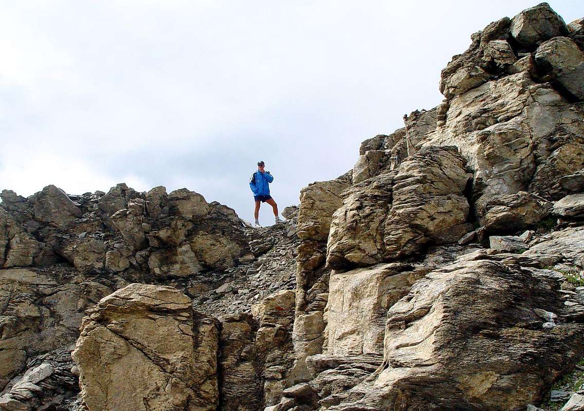
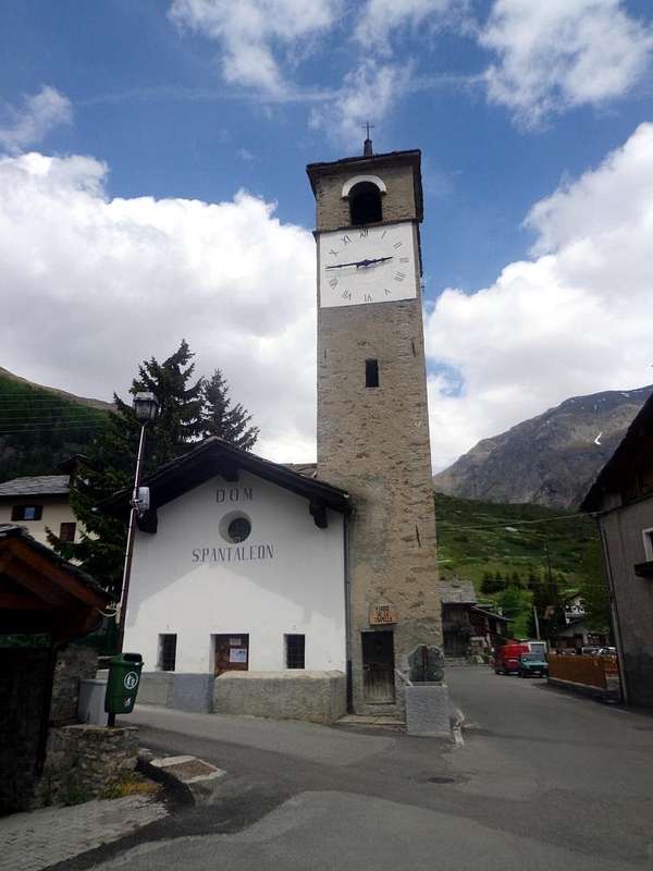
- After Aymavilles Municipality, the RR.47 crosses the Hamlets of Vieyes, Epinel, Crétaz and after about 25 Km. arrives at Cogne (1.534m) Commune and Resort. Follow the road signs, with East direction, for Gimillan and Lillaz. a) - Arrived at a round-about, recently built in proximity of the St. Anthony Chapel, leaving East the main road towards Lillaz go left along the scenic route leading to the Village of Montroz and the Hamlet of Gimillan or Dzèmi(e)llan (1.787m), 3 Km. after Cogne. Usually no parking problem, either in the center of the village in the parking lot at the church as the road next to the Dzèmillan Torrent, as well highlights the two pictures.
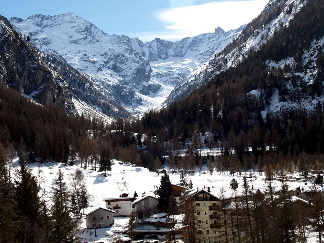
b) - Or from rotunda, leaving before in North after Northwest the road towards Montroz and Gimillan Villages, continue towards East along and just above the Urtier's Torrent, passing near Moline, Champlong small Villages (1.539m, 1.596m), reach Lillaz Hamlet (1.631m) at entrance on Urtier Valley, 7,500 Km. after Cogne Municipality.
Approaches & Routes Description
A) - West Crest through Monte Creya: from Cogne center (1.534m) reach through the Regional Road the small Village of Champlong/Saint-Pierre (1.596m). From this last take the path towards Northwest n° 7A and reach Facette Pasture (1.662m). Leaving left the path with a long crossing to the West-northwest is directed to the small Village of Montroz (1.681/1.702m) always with the trail n° 5. Continuing instead to the North dominating the Vallon of Torrent Liconi and reaching the largest concentration which is the remains of the homes of miners Colonna (2.386/90m; now restored Museum) well known for the extraction of the valuable Cogne magnetite or loadstone (E/F; 1h'40/2h'10).
From Colonna Mines continue with trail n° 5 to the Northeast climbing to the overlying Ironmines of Liconi (2.495m), just below the Mont Salet or Montsalet (2.764m) from these down to the bottom of the deep valley of the same name and Liconi reaching the torrent crossing for twice. Returning to the left (West) and continue towards the North, again on a comfortable path and passed three bends, reaching the easy South-southwest Crest that connects to the Mont Salet (2.764m). With this easy always with a small path n° 5 on South-southwest Crest to reach the Summit of Mont Creya (3.015m) (E/F; 1h'00/1h'15 from Colonna Mines Village; 3h'00/3h'15 in total by Champlong/Saint-Pierre). From this quickly and easily, by following the tracks and bypassing in the midst of crumbling and rotten rocks a few short sections on the left (North) near the small and unsignificant rocky altitude 3.022 meters, towards the Testa or Tête (Head) of Money (3.130m) via short, easy West-northwest Crest (EE/F+; 0h'40; 4'00/4h'15 altogether).
A) - Cresta Ovest dal Creya: da Cogne raggiungere tramite la Regionale il Villaggetto di Champlong/Saint-Pierre (1.596 m), appena prima della Frazione di Lillaz (1.631 m). Da qui prendere in direzione Nordovest il sentiero n° 7A che raggiunge l'Alpe Facette (1.662 m). Lasciando sulla sinistra il sentiero che con una lunga traversata verso Ovest-nordovest si indirizza al Villaggio di Montroz sempre con il sentiero n° 5, continuare invece verso Nord dominando dall'alto il Vallone del Torrente Liconi e raggiungendo il grande agglomerato costituente i resti delle abitazioni dei minatori di Colonna (2.386/90 m; Museo) ben conosciuto in passato per l'estrazione della pregiata magnetite di Cogne (E/F; 1h'40/2h'10).
Da Colonna continuare con il sentiero n° 5 verso Nordest salendo alle soprastanti Miniere di Liconi (2.495 m), subito al di sotto del Mont Salet o Montsalet (2.764 m). Da queste scendere sul fondo del Vallone di Liconi raggiungendo il torrente omonimo ed attraversandolo per due volte. Ritornati a sinistra (Ovest) continuare verso Settentrione e, sempre su comodo sentiero e superati tre tornanti, raggiungere la Cresta Sud-sudovest collegantesi al Mont Salet. Tramite questa facilmente raggiungere la facile Cima del Monte Creya (3.015 m) (1h'00/1h'15 da Colonna; 3h'00/3h'15 in totale dal Villaggetto di Champlong/Saint-Pierre). Da questa in breve tempo e facilmente, seguendo delle tracce ed aggirando qualche breve tratto sulla sinistra (Nord) nei pressi della modesta quota 3.022 metri, alla Testa di Money (3.130 m) tramite la Cresta Ovest-nordovest (EE/F+; 0h'40).
B) - Through the South-southwest Crest: this small rocky pyramid has a steep slope Northern much above the Money Lake (2.550m) with a wall of crushed rocks alternating with steep snowfields high over 400 meters. After a steep morainic "flow" slips up to the same dividend in two parts this difficult slope. Around the Southern Slope of this small chain it is even more "unfriendly" than the Northern. Formed by steep ribs of burned and crushed rock, interspersed with grassy and detrital gullies, down over the Pastures of Gueula, Seutse or Suches and Taveronna (2.369m) connected to each other by a farm road dating from the lower middle Urtier Valley towards the Northwest. All routes, except to the Pas d'Invergneux initial and the final from Colonna Mines at Mount Creya, are definitely inadvisable and more suitable for Hunters chamois than for Hikers. But between these reliefs there was a South-sudovet Cresta that, starting from the altitude around 2.620 meters just to the Northwest above Alpe Taveronna, directly reaches the Testa di Money, separating the Farcoz Vallon from that of Liconi (West). The same rises linearly presenting some small rocky sheets, fun to climb even though the rock is not very solid, before the Vertex. Probably the same has already been visited by route under crest to the East, while the integral via (steps from I°+ to II+) was carried out in September 2002.
From the Alps of Taveronna, reached with Lillaz route through the farm road, concomitant path n° 10A, towards Alpe Goilles Damon (1.869m) and the little Chapel of Crest (2.020m; wooden fountain). So with the same under the Côte Piemont and route n° 10 to the junction at the Tsavanis Pastures with waterfall (2.293m). Giving up on the right (East) the continuation to the Refuge "Sogno di Berdzé or Dream of Shepherd", instead continuing with the branch of West-northwest and trail n° 10C, reaching after those of Gueula Dèsott and Damon and Seutse, the Taveronna Pastures. From this continue for a short distance on the trail n° 5B with a small track in the fields, then climb steeply towards the North reaching the base of the "crestone", it goes up on the ridge encountering progressively more difficult passages (especially immediately before the Summit), or just below the East through rocks definitely easier but somewhat rotten and broken (EEA/F+/PD-; 1h'30/2h'00 from "crestone" base; 4h'00/5h'00 by Lillaz).
B) - Tramite la Cresta Sud-sudovest: questa piccola piramide rocciosa presenta un Versante Settentrionale molto dirupato soprastante il Lago di Money (2.550 m) con una parete di rocce frantumate alternate a ripidi nevai alta oltre 400 metri). Dopodiché una ripida colata morenica scivola sin al medesimo dividendo in due parti questo ostico pendio. Tutto il Versante Meridionale di questa piccola catena si presenta ancora più "inospitale" di quello Settentrionale. Formato da ripidi costoloni di roccia arsa e frantumata, alternati ad erbosi e detritici canaloni, scende sopra gli Alpeggi di Gueula, Seutse o Suches e Taveronna (2.369 m) collegati tra di loro da una strada poderale risalente dal medio-basso Vallone dell'Urtier verso Nordovest. Tutti i percorsi, tranne quello iniziale verso il Pas d'Invergneux ed il finale dalle Miniere di Colonna al Monte Creya, sono decisamente sconsigliabili e maggiormente indicati a Cacciatori di camosci piuttosto che agli Escursionisti. Tra questi rilievi però s'evidenzia una Cresta Sud-sudovet che, iniziando dall'altitudine 2.620 metri circa appena a Nordovest al di sopra dell'Alpe Taveronna, raggiunge direttamente la Cima della Testa di Money, separando il Vallone di Farcoz da quello di Liconi (Ovest). La stessa sale in modo lineare presentando alcuni muretti rocciosi, divertenti da arrampicarsi anche se la roccia non risulta molto solida, prima della Sommità. Probabilmente la medesima é già stata visitata con percorso sottocresta ad Oriente, mentre quello integrale (passaggi dal I°+ al II°+) é stato effettuato nel Settembre 2002. Dall'Alpe di Taveronna, raggiunta con itinerario da Lillaz tramite la poderale, concomitante al sentiero n° 10A, verso l'Alpe Goilles Damon (1.869 m) e la Cappelletta del Crest (2.020 m; fontana in legno). Quindi con la medesima sotto la Côte Piemont e sentiero n° 10 fino al bivio presso l'Alpe Tsavanis (2.293 m). Abbandonando sulla destra (Est) la continuazione verso il Rifugio "Sogno di Berdzé o del Pastore", proseguire invece con il ramo di Ovest-nordovest e sentiero n° 10C raggiungendo, dopo quelle di Gueula Dèsott e Damon e Seutse, l'Alpe di Taveronna. Da questa continuare per breve tratto con il sentiero n° 5B con una piccola traccia nei prati, poi salire decisamente verso Settentrione raggiungendo la base del "crestone", che si risale sul filo di cresta incontrando progressivamente passaggi più impegnativi (soprattutto immediatamente prima della Vetta), od appena sotto ad Est tramite rocce sicuramente più facili ma alquanto rotte e marce (EEA/F+/PD-; 1h'30/2h'00 dalla base del "crestone"; 4h'00/5h'00 da Lillaz).
C) - Through the Eastern Ridge from Penne Blanche: also you can reach the Tête de Money along the long opposite ridge or Eastern. In this case it is almost mandatory from Pas d' Invergneux or des Hevergnes (2.902m) in succession bypassing the Testa Vallonet, the two Penne Blanche (East 3.248m, West 3.205m) and Pointe Coupée (3.211m), as all other paths on both the South slope that of the North they are dangerous and therefore inadvisable. This ridge, already reached by North at the two Penne Blanche, Pointe Coupée and the same Testa of Money, has a sinuous long but safe, where it is only necessary to choose the path of steps (I°/I°+, II°- whether on the ridge) and the routes on the slopes are boring and dangerous. also on the South, excluding "Crestone" South-southwest, already faced downhill from Giovanni Bobba and Co. in 1886 with crossing North / South through the Eastern Penne Blanche. You come to Pas des Invergneux from south continuing with the same way of the previous itinerary up to the bridge of 2.360 meters near the junction to the Alps Pianas and Invergneux with trail n° 10D (or crossing from the shelter with the n° 10F towards the Ponton). Otherwise from the North starting from Gimillan Hamlet with the trail n° 8/TVC to the Valley of Grauson and the Doreire Lakes. From the hill not remains that is to follow the long ridge going up in the final part on brief Crest East-southeast from Col of Money (3.105m) easily reaches the Summit (EEA/F+/PD-; 0h'30 from Col di Money; 2h'30/3'00 from Pas d'Invergneux).
C) - Cresta Est dal Penne Blanche: inoltre é possibile raggiungere la Tête de Money percorrendo la lunga cresta opposta ovvero Orientale. In questo caso risulta quasi obbligatorio partire dal Passo d'Invergneux o des Hevergnes (2.902 m) scavalcando in successione la Testa di Vallonet, i due Penne Blanche (Est 3.248 m, Ovest 3.205 m)e la Pointe Coupèe (3.211 m), poichè tutti gli altri percorsi sia sul Versante Meridionale che su quello Settentrionale sono pericolosi e quindi sconsigliabili. Questa cresta, già raggiunta da Nord in corrispondenza dei due Penne Blanche, della Pointe Coupée e della stessa Testa di Money, presenta un andamento sinuoso lungo ma sicuro, dove é soltanto necessario scegliere i passaggi del percorso (I°/I°+, II°- se sul filo di cresta) mentre le vie sui versanti risultano faticose e pericolose. anche su quello Meridionale, escluso il Crestone Sud-sudovest, già affrontato in discesa da Giovanni Bobba e Compagni nel 1886 con traversata Nord/Sud del Penne Blanche Est. Si raggiunge il Pas des Invergneux da Sud continuando con la stessa via del precedente fino al ponte del bivio 2.360 metri e l'Alpi Pianas ed Invergneux con sentiero n° 10D (oppur in traversata dal rifugio con il n° 10F verso il Ponton). Altrimenti da Nord partendo da Gimillan col sentiero n° 8/TVC pel Vallone di Grauson e Laghi Doreire. Dal colle non rimane che seguire la lunga cresta salendo infine la breve Cresta Est-sudest che dal Col di Money (3.105 m) facilmente raggiunge la Vetta (EEA/F+/PD-; 0h'30 dal Col di Money; 2h'30/3'00 dal Pas d'Invergneux).

D) - Traverses through Northern Slopes: even from the North you can reach the ridge and then cross in either direction, but, in our opinion, the only valid and appropriate solution is to climb Mount Creya (3.015m) with two possibilities: 1) - by Gimillan reach through the trail n° 8/TVC Pila Pasture (2.021m) in the first part of the Valley of Grauson and passing the narrow passage of Ecloseur (1.903m). From this leave the same, taking on Cresta Northwest. Having overcome the altitudes 2.275, 2.672, 2.755, 2.943, 2.968 meters remaining on the ridge or some outflanking the left (North) and follow a characteristic series of mounds of stone and piled cairn quite easily arrive on Summit and then continue with the itinerary A) - (EEA/F+; 3h'10/3h'40 from alp; 4h'45/5h'15 by Gimillan). 2) - From Alpe Pila continue for a short time to Alpe Creuzet (2.244 m) to the junction 2.296 meters and from this through the route n° 8C reach Lake Money (2.550m); or continue to the next of Grauson Vieux (2.273m; Source Pré Vaudan) and via a connection path to resume earlier on. From the lake to move towards the Southern shore and take a path not numbered alternating tracks up towards Southwest on the grassy-rocky slope reaching the height of 2.968 meters on Northwest Crest. Then to Summit with subsequent traverse (EE/F; 2h'40/3h'10 from alps; 4h'15/4h'45 Gimillan).
D) - Dai Versanti Settentrionali: anche dai Versanti Nord é possibile raggiungere il filo di cresta per poi attraversare nell'una o nell'altra direzione, ma, a nostro avviso, l'unica soluzione valida ed opportuna risulta quella di salire il Monte Creya (3.015 m) con due diverse possibilità: 1) - da Gimillan raggiungere con il sentiero n° 8/TVC l'Alpe Pila (2.021 m) nella prima parte del Vallone di Grauson e passando la strettoia dell'Ecloseur (1.903 m). Da questa abbandonare il medesimo portandosi progressivamente sulla Cresta Nordovest. Superate le minuscole asperità rocciose 2.275, 2.672, 2.755, 2.943, 2.968 metri restando sul filo di cresta o con qualche aggiramento sulla sinistra (Nord) e ,seguendo una caratteristica serie di ometti e tumuli in pietra accatastati, abbastanza facilmente si raggiunge la Cima per poi continuare con l'itinerario A) - (EEA/F+; 2h'30/3h'00 dall'Alpe Pila; 4h'00/4h'15 da Gimillan, con altri 0h'40 aggiuntivi per la traversata alla Testa di Money). 2) - Dall'Alpe Pila continuare ancora per breve tempo fino all'Alpe Créuzet (2.244 m) insino al bivio 2.296 metri e da questo tramite il sentiero n° 8C raggiungere il Lago di Money (2.550 m); oppure proseguire sino alla successiva di Grauson Vieux (2.273 m; Sorgente Pré Vaudan nella prateria antestante) e tramite un sentierino di collegamento riprendere la via precedente. Dal lago indirizzarsi verso la sponda Meridionale e prendere un altro sentierino non numerato alternato a tracce che, risalendo verso Sudovest il pendio erboso-roccioso, raggiunge la quota 2.968 metri sulla Cresta Nordovest, donde alla Vetta e susseguente attraversata alla Testa di Money con la Cresta Ovest-nordovest (EE/F; 2h'40/3h'10 dalle Alpi di Créuzet e Grauson Vieux; 4h'15/4h'45 da Gimillan).

Difficulties & Equipment
DIFFICULTIESThese routes can be considered EEA/ from F/F+ to PD (Experts Hikers and Mountaineers); BSA in winter (even by Ski).
Gli itinerari sono da classificarsi in EEA/ da F/F+ a PD (Escursionisti Esperti od Alpinisti) BSA in inverno (anche in Scialpinismo).
 |
 |
 |
EQUIPMENT
High Hiking gear, in winter as for Ski-Mountaineering.
Da Alto Escursionismo, in inverno da Scialpinismo.
Campings
Remember that free camping is forbidden (except for emergency reasons, over 2.500m, from darkness until dawn).Mountain Condition
- Meteo: you can find all the needed informations at the official site of the Valle d'Aosta Region:
- Valle d'Aosta Meteo
Important Information
- REGIONE AUTONOMA VALLE D'AOSTA the official site.
- FONDAZIONE MONTAGNA SICURA Villa Cameron, località Villard de la Palud n° 1 Courmayeur (AO) Tel: 39 0165 897602 - Fax: 39 0165 897647.
- A.I.NE.VA. (Associazione Interregionale Neve e Valanghe).
Useful numbers
- Protezione Civile Valdostana località Aeroporto n° 7/A Saint Christophe (Ao) Tel. 0165-238222.
- Bollettino Meteo (weather info) Tel. 0165-44113.
- Unità Operativa di Soccorso Sanitario Tel. 118.