Welcome to SP!  -   
 
 New features are here! - Read More... 
Areas & Ranges·Mountains & Rocks·Routes·Images·Articles·Trip Reports·Gear·Other·People·Plans & Partners·What's New·Forum

The approximate line of the...

 
[ Sizes: Orig | Med | Small | Thumb ]
The approximate line of the...
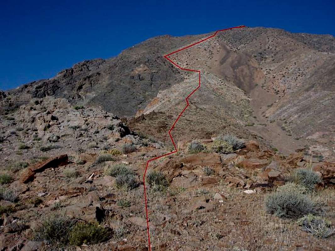
The approximate line of the route along the mid-portion of the southeast ridge. The route-finding is a breeze, but I thought I'd show you the line anyway. The upper part of the route in the photo is the steepest part of the ridge. The summit is still a ways beyond the highest point visible in the photo.


Comments

[ Post a Comment ]
Viewing: 1-2 of 2

KathyWThanks

Voted 10/10

I'll take this picture along when I do Pyramid Peak. I really like when people draw the route out on a photo.
Posted Nov 30, 2005 11:49 am

cp0915Re: Thanks

cp0915

Hasn't voted

I do too. You're welcome.
Posted Nov 30, 2005 12:34 pm

Viewing: 1-2 of 2

Sign in to post!

Don't have an account? Register now.


Rate This Image
Current Score: 87.84

Log In To Vote
 Southeast Ridge (Route)


You are at
the First
Image

Viewing
#1 of 3
GALLERY
A typical view along the...
NEXT »

 cp0915's Image Gallery

Nicole and Rainbow Wall from...
« PREV

Viewing
#53 of 388
GALLERY
Windy Peak from near the...
NEXT »


 Pyramid Peak (Death Valley) (Mountain/Rock)


Image Data

cp0915Submitted by cp0915
on Nov 8, 2005 5:54 pm

Image ID: 135454
Hits: 1503 

Lat/Lon: 36.39200°N / 116.611°W


"All composite things pass away. Strive for your own salvation with diligence."   --Gautama   

© 2006-2012 SummitPost.org. All Rights Reserved.