|
|
Mountain/Rock |
|---|---|
|
|
41.05800°N / 107.7041°W |
|
|
Carbon |
|
|
Hiking, Mountaineering, Canyoneering |
|
|
Spring, Summer, Fall |
|
|
6930 ft / 2112 m |
|
|
Overview
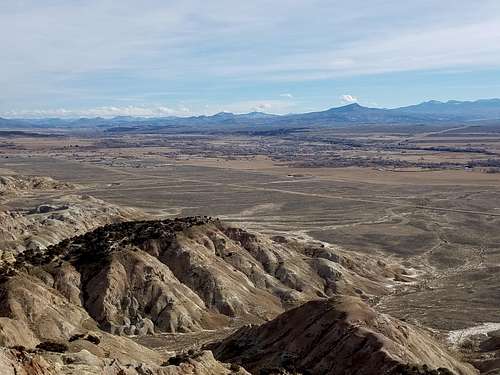
The Bluffs is an isolated mountain tucked away in an almost unknown part of South Central Wyoming. The peak has some nice views, but few people will ever go there since it's such an out of the way location. This is the most interesting mountain in the vicinity and the views from the summit area really good, especially of Battle Mountain and the Elkhead Mountains.
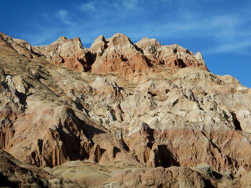
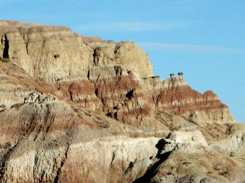
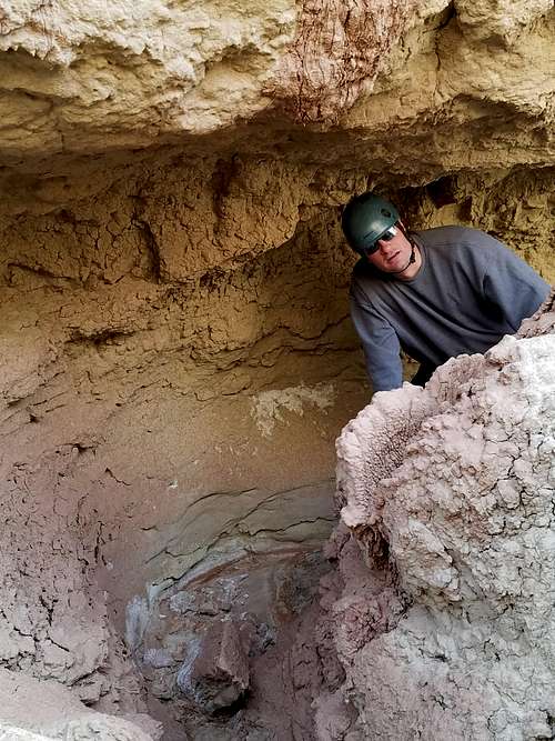
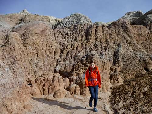
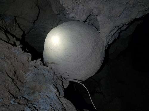
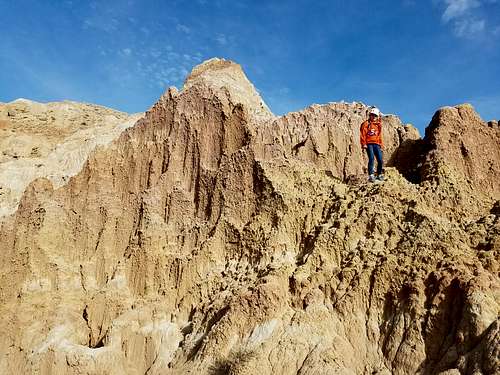
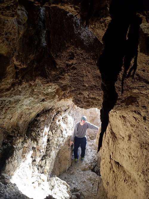
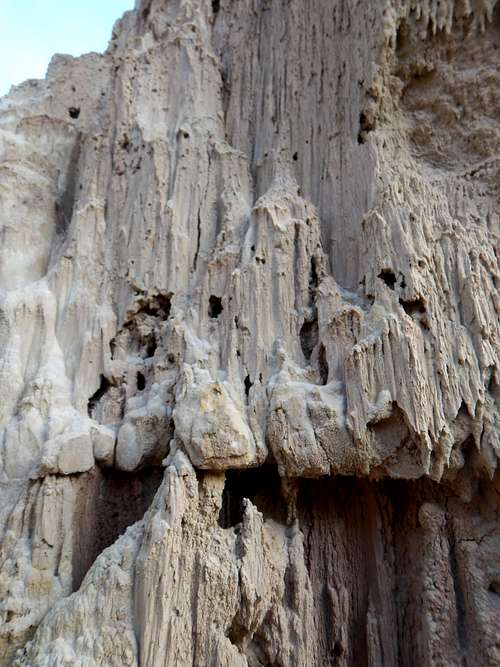
The mountain known as The Bluffs has a spectacular south face that resembles parts of Utah and Badlands National Park. The south side of the mountain is very colorful. As an added bonus, the south face holds the most unusual slot canyon that I have ever seen. Our kids named the slot canyon Candyland because of the beautiful colors. The slot also goes underground in several locations!
The mountain is just northeast of Baggs Wyoming. Baggs Wyoming is a tiny town with a colorful history. The town was named for Maggie Baggs, who although female was known as one of the meanest and most feared "cowboys" in the west. One of the ranch hands named two nearby hills "Maggie's Nipples" and when Maggie found out about it, she drug him behind a horse through town.
Baggs was also one of the hangouts of Butch Cassidy and the Wild Bunch and was a town known for harboring outlaws.
The area was also considered a "warring grounds" for Shoshone, Sioux, Utes, Arapaho, and Cheyenne tribes. By 1841, a large band of Sioux attacked a group of trappers gathered there.
Today things have quieted down and Baggs is a quiet ranching town with occasional boom and bust cycles from the oil industry. Few people will head out there to hike, but just in case you ever do, The Bluffs is a great destination.
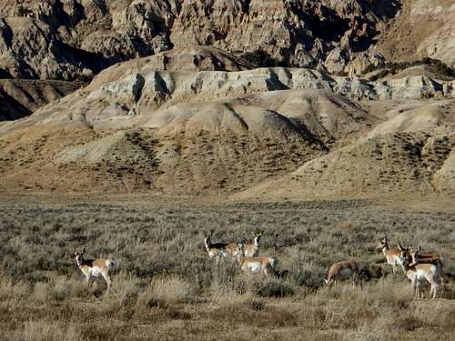
Don't expect to encounter any other people out here, though you may encounter deer, antelope, and in the cold season, elk. There are a lot of mountain lions in the vicinity as well, but you have to get lucky to sight one.
Getting There
Since few people will ever use this page, directions will be brief.
Baggs is the main access point and town in the area and the only place to get fuel or basic supplies.
To get to the recommended trailhead, drive north from Baggs on State Highway 789 to just out of town. Turn west (left) onto CR 700, also known as Poison Butte Road or Government Road. Drive west along the road past a gas natural gas facility. When you get close to The Bluffs, turn right and follow the road to it or near its end. The last part of the road is rough, but it's a short walk if you can't make it all the way.
Routes Overview
Although the highest point of The Bluffs is most easily climbed from the north, the south side is much more interesting and is the recommended route. From the trailhead you can make your way northwest up the spurs and around the west side of the big drainage before circling around to the summit. There are deer and antelope trails in places and the last part is really steep.
For a very interesting descent route, descend the Candyland Slot Canyon directly. The slot canyon goes through several tunnels. You will need a headlamp for the last optional tunnel and possibly for the tunnel near the middle of the slot canyon. There are several steep downclimbs where a short rope and/or a partner is useful. Near the lower end of the slot canyon, the drainage drops off a 12-15 foot drop. This is most easily passed on the left/east side of the drainage. Bring a helmet if you want to descend the Candyland Slot.
Red Tape
There is no red tape, so please take care of the area.
When to Climb
Mid-Spring through Fall is reasonable, or anytime the roads are dry. Mid Summer can be quite warm and winters are very cold. You could ski or snowshoe to the summit, but the access road is closed for much of the winter.
Watch for rattlesnakes in the warm season. Ticks could be a problem in late Spring and early Summer. Also use caution during hunting season.
Camping
There are no camping restrictions on the public land in this area, so feel free to camp anywhere. Bring your own water though and please leave a clean campsite.
Mountain Conditions
CLICK HERE FOR THE BLUFFS WEATHER FORECAST
Below is the National Weather Service Climate Summary of Dixon/Baggs, on the Wyoming/Colorado border. The data is from 1922-2001. This is the closest long term weather station, but be aware that higher elevations will be a little wetter and colder. Dixon/Baggs is at 6370 feet elevation, so expect the temperatures on The Bluffs to be about two degrees colder than in Dixon, except for on cold winter nights.
| MONTH | AVE HIGH | AVE LOW | REC HIGH | REC LOW | AVE PREC (in) |
| JAN | 32 | 3 | 55 | -55 | 0.89 |
| FEB | 36 | 8 | 61 | -47 | 0.72 |
| MAR | 43 | 16 | 75 | -31 | 0.96 |
| APR | 56 | 27 | 84 | -9 | 1.14 |
| MAY | 67 | 34 | 93 | 9 | 1.18 |
| JUN | 76 | 41 | 96 | 20 | 0.94 |
| JUL | 83 | 47 | 99 | 30 | 1.07 |
| AUG | 81 | 45 | 100 | 26 | 1.12 |
| SEP | 72 | 36 | 92 | 1 | 1.04 |
| OCT | 61 | 27 | 82 | -9 | 1.23 |
| NOV | 44 | 16 | 77 | -26 | 0.80 |
| DEC | 35 | 3 | 62 | -39 | 1.02 |

