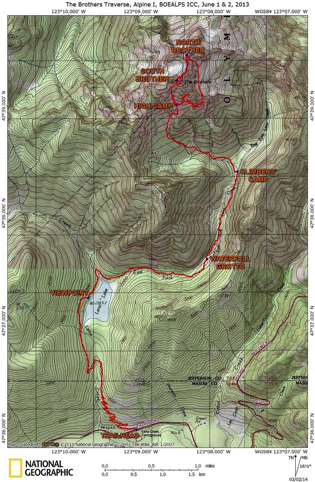
The Brothers Traverse Route
Here's the route and map I created of our Brothers Traverse climb. The route data was generated from my Garmin eTrex 10 and the map was created by National Geographic's Topo! mapping program.
That little hook in the loop was from our route finding on the first day. That's probably the easiest way into the Great Basin, but because of the fog the first day we could not be sure. Also, that "hook" route will depend on snow levels because it requires there being a tongue of snow to descend otherwise you could get cliff-ed out going that way.


