Toggle navigation
Mountains
Routes
Images
Trip Reports
Forum
What's New
People
Areas & Ranges
Articles
Trailheads
Canyons
Huts & Campgrounds
Albums
Logistical Centers
Fact Sheets
Lists
Custom Objects
Gear
Plans & Partners
WELCOME TO SUMMITPOST
SIGN IN
REGISTER
Mount Remus
Additional Parents
North Ridge Traverse
Image
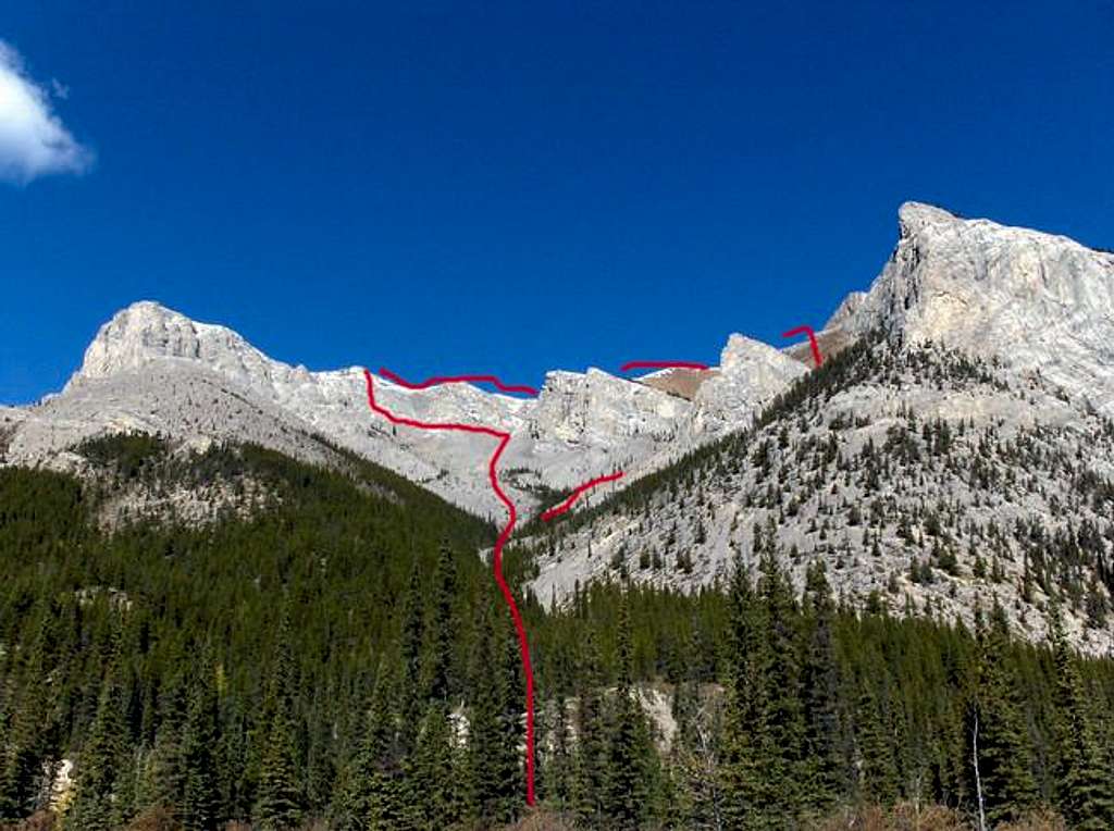
The marked ascent-descent...
View High-Resolution Image
The marked ascent-descent...
The marked ascent-descent route as seen from the trail, Mount Remus, Elbow-Sheep Wildland Provincial Park, September, 2005
« PREV
NEXT »
Dow Williams
on
Sep 25, 2005 11:20 am
Comments & voting
Other parents
Lat/Lon:
50.79440°N / 114.9709°W
Image Type(s):
Rock Climbing
Image ID:
127922
2259 Hits
80.49
% Score
12
Votes
Log in to vote
Comments
No comments posted yet.
to post!
Don't have an account?
Mount Remus
(Mountain/Rock)
« PREV
Viewing
#4 of 21
GALLERY
NEXT »
Dow Williams's Image Gallery
« PREV
Viewing
#1063 of 13422
GALLERY
NEXT »
North Ridge Traverse
(Route)
Loading....
×
You need to login in order to vote!
User Name
Password
Remember me
Forgot your password?
Log me out when I close my browser.
Keep me logged in all the time.
sign in as a user
Don't have an account?
Register now for FREE
Rating available
Suggested routes for you
People who climb the same things as you
Comments Available
Create Albums
Register Here


