Toggle navigation
Mountains
Routes
Images
Trip Reports
Forum
What's New
People
Areas & Ranges
Articles
Trailheads
Canyons
Huts & Campgrounds
Albums
Logistical Centers
Fact Sheets
Lists
Custom Objects
Gear
Plans & Partners
WELCOME TO SUMMITPOST
SIGN IN
REGISTER
The red line is approximately...
View High-Resolution Image
The red line is approximately...
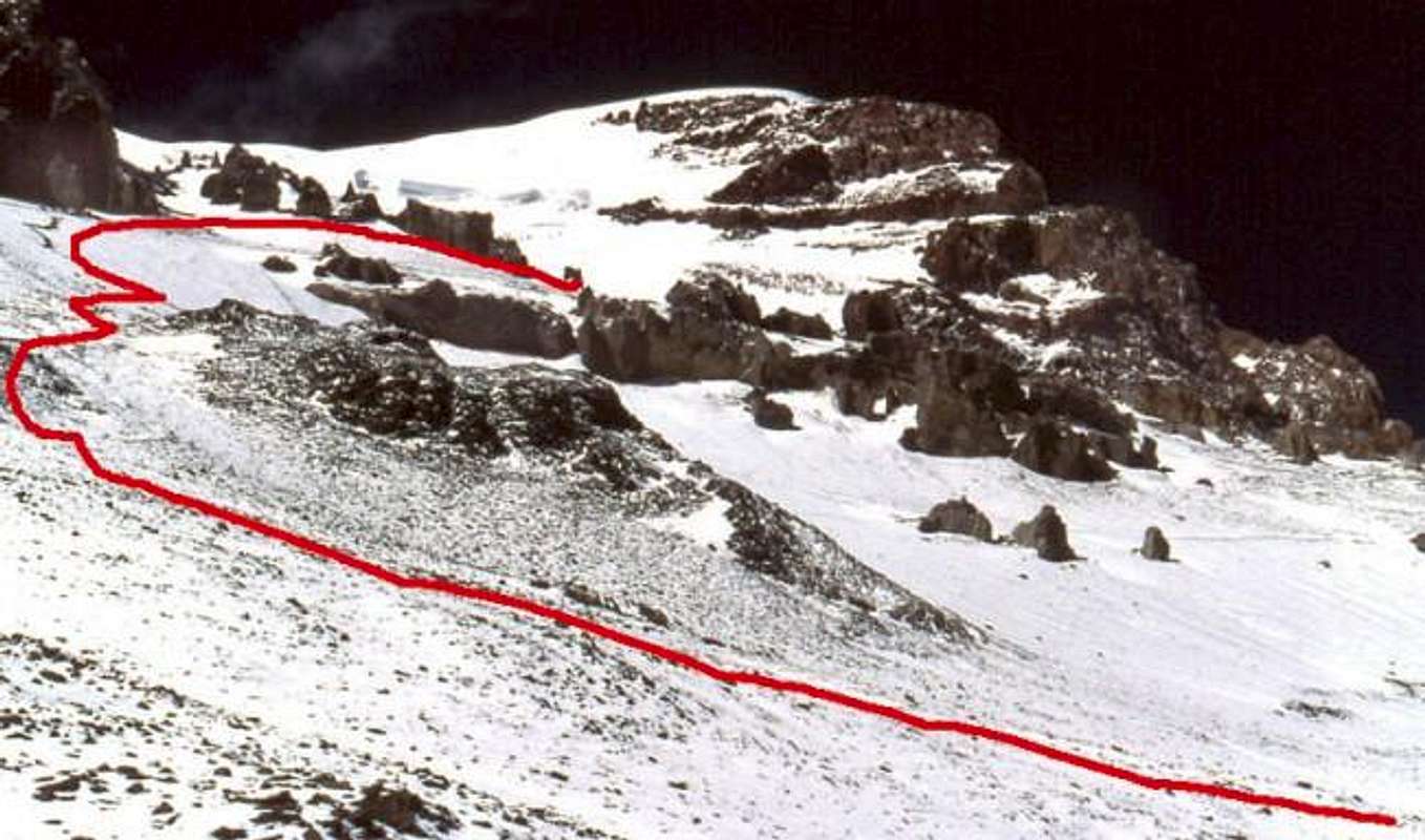
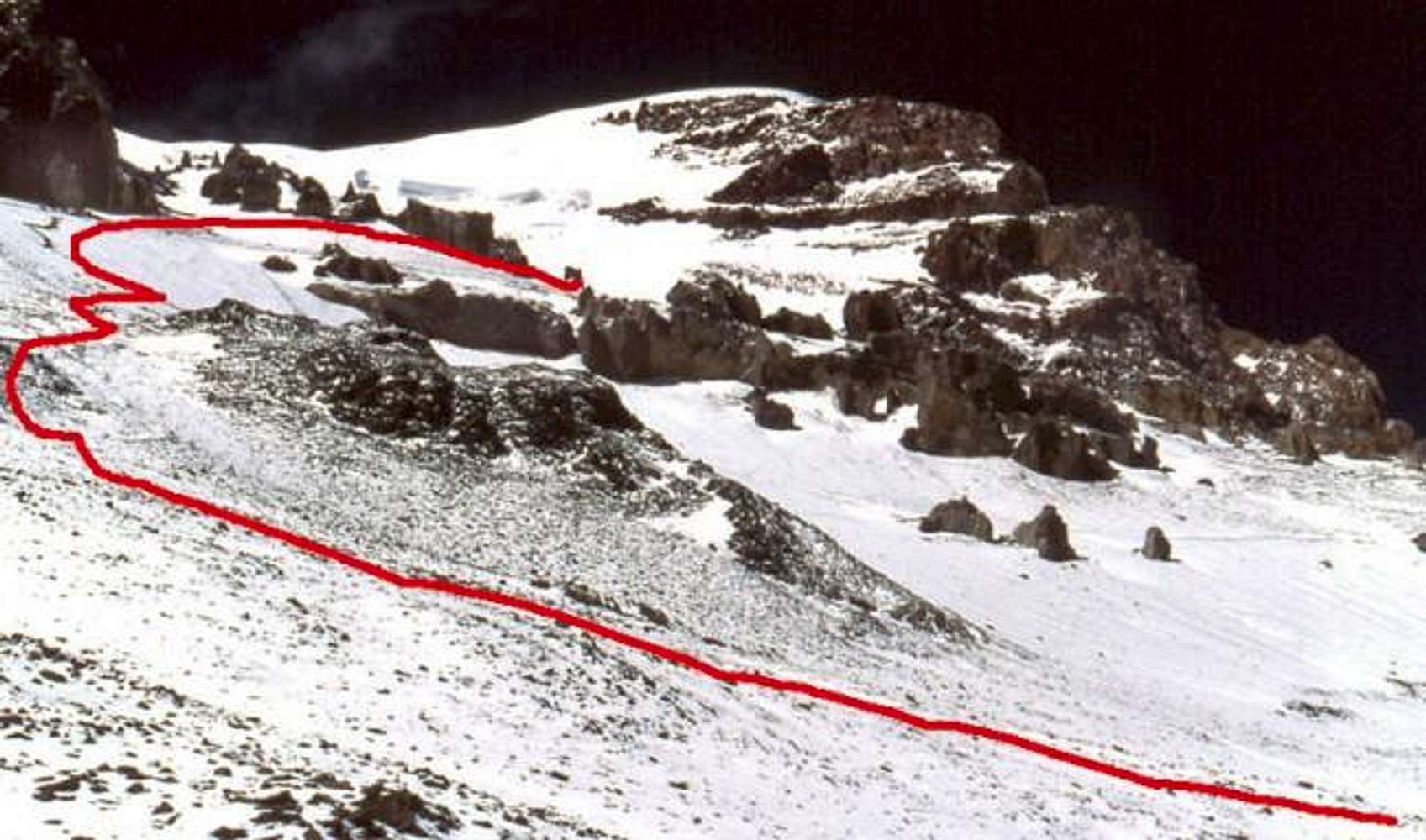
The red line is approximately the route of the last 1000 feet to camp 2. The Polish Glacier is seen above. December 15th 2001. William Marler
« PREV
NEXT »
William Marler
on
Apr 23, 2002 9:38 am
Comments & voting
Other parents
Lat/Lon:
32.65°S / 70°W
Image ID:
6769
9793 Hits
76.43
% Score
7
Votes
Log in to vote
Comments
No comments posted yet.
to post!
Don't have an account?
Aconcagua
(Mountain/Rock)
You are at
the First
Image
Viewing
#1 of 1
GALLERY
You are at
the Last
Image
William Marler's Image Gallery
« PREV
Viewing
#569 of 1277
GALLERY
NEXT »
Aconcagua
(Mountain/Rock)
Loading....
Polish Traverse
(Route)
Loading....
Aconcagua 2001, when things go wrong
(Trip Report)
Loading....
×
You need to login in order to vote!
User Name
Password
Remember me
Forgot your password?
Log me out when I close my browser.
Keep me logged in all the time.
sign in as a user
Don't have an account?
Register now for FREE
Rating available
Suggested routes for you
People who climb the same things as you
Comments Available
Create Albums
Register Here


