
Viewing: 1-1 of 1

ElliottDavis - Nov 15, 2011 2:30 pm - Hasn't voted
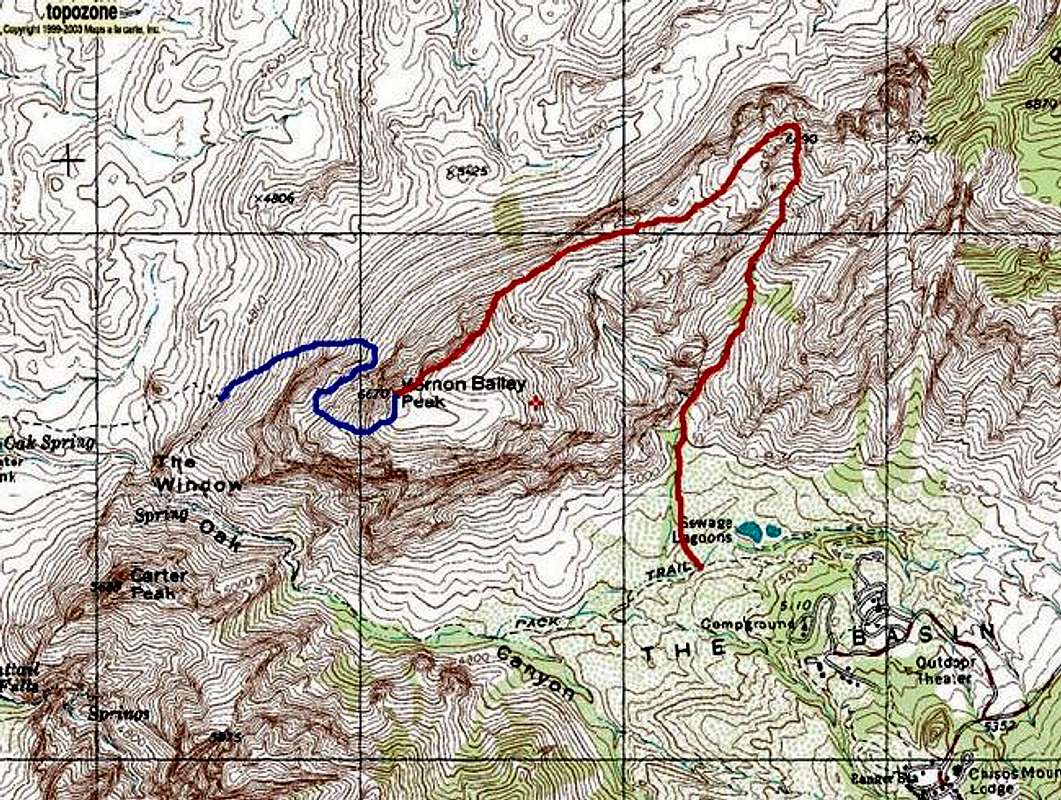
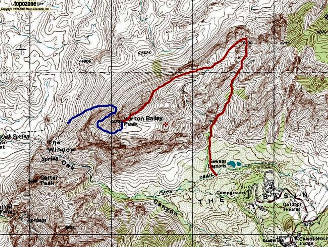
NW face of Vernon BaileyI climbed Vernon Bailey on 11/13/11 and descended the blue line route you drew on your map. It was fun! Caveat: my definition of fun includes a lot of route-finding, scrambling through steep gullies and getting shredded by the vegetation. =) Whatever you may think of how pleasant it is, the route does go through, and I don't think I did anything harder than class 3. My ascent route matches yours until the prominent rock towers at 5800-ish, to the left of your red line. Then I went NW, bending around to SW, up the talus field to the saddle behind the towers. From there it's pretty straightforward, WSW down into a hanging valley, W up to the NE end of the summit horseshoe and along the ridge to the true summit.
Viewing: 1-1 of 1


Comments
Post a Comment