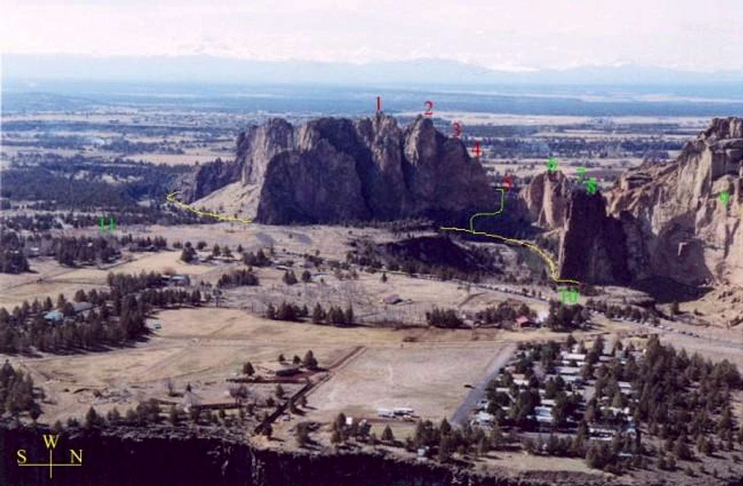
The Smith Rock Group as seen from the top of
Brogan Spire (looking roughly SW) in the
Marsupials. A flip-side of this photo (looking at
Marsupials from Smith Rock Group) is
here. A clouded over, faint outline of the Cascade Volcanos can be seen in the far background. Other features in the photo include: (1) Smith Summit (highest point) and Vulture Ridge extending to its left; (2) Platform (the flat highpoint in the front) and Arrowpoint (the sharp point just behind the Platform); (3) top of the Wherever I May Roam route; (4) top of the
Sky Ridge route; (5)
Asterisk Pass; (6) The Christian Brothers; (7) (obscured by Ship Rock) The Dihedrals; (8) Ship Rock; (9) Picnic Lunch Wall; (10) main Smith parking area; and (11) Smith Rock State Park campground. The yellow line shows the (easy but longer) river-side approach trail to the west side of the Smith Rock Group; the green line shows the 4th/5th class scramble shortcut to the west side of Smith Rock Group via
Asterisk Pass.


